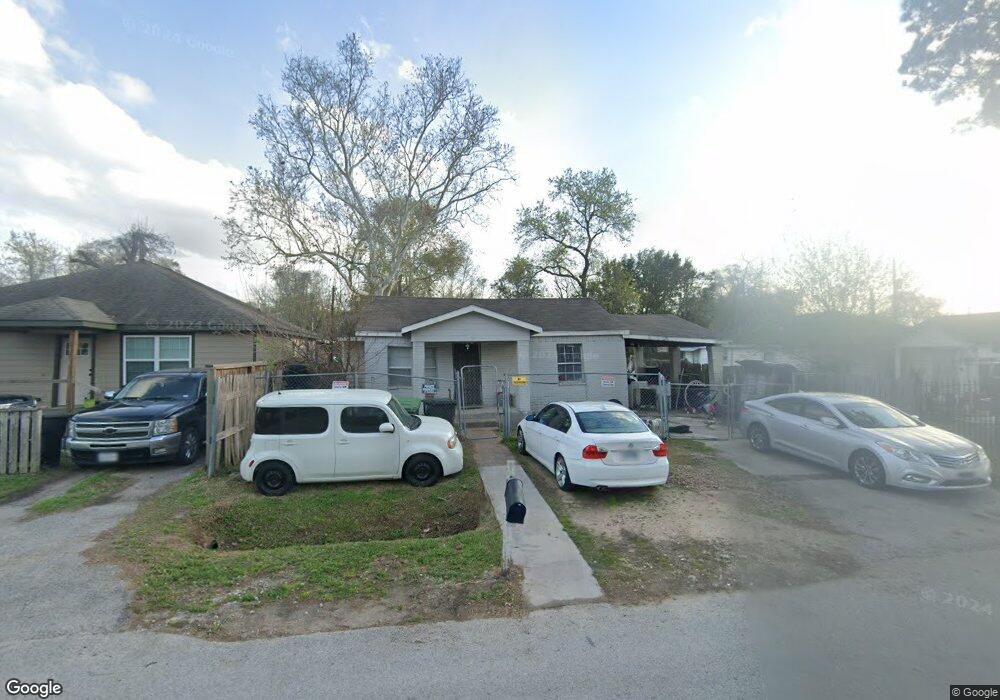
1081 Marjorie St Houston, TX 77088
Acres Homes NeighborhoodEstimated Value: $174,000 - $270,000
4
Beds
2
Baths
1,380
Sq Ft
$165/Sq Ft
Est. Value
About This Home
This home is located at 1081 Marjorie St, Houston, TX 77088 and is currently estimated at $227,273, approximately $164 per square foot. 1081 Marjorie St is a home located in Harris County with nearby schools including Osborne Elementary School, Williams Middle, and Booker T Washington Sr High.
Ownership History
Date
Name
Owned For
Owner Type
Purchase Details
Closed on
May 8, 2012
Sold by
Flores Ricky A
Bought by
Perez Nelson R and Arevalo Alexander Flores
Current Estimated Value
Purchase Details
Closed on
Nov 15, 2010
Sold by
Perez Maria Alicia and Flores Ricky Arevalo
Bought by
Flores Ricky Arevalo
Purchase Details
Closed on
Jan 13, 2010
Sold by
Bank Of America National Association
Bought by
Perez Maria Alicia
Purchase Details
Closed on
Mar 3, 2009
Sold by
Newson Gladys
Bought by
Bank Of America National Association
Create a Home Valuation Report for This Property
The Home Valuation Report is an in-depth analysis detailing your home's value as well as a comparison with similar homes in the area
Home Values in the Area
Average Home Value in this Area
Purchase History
| Date | Buyer | Sale Price | Title Company |
|---|---|---|---|
| Perez Nelson R | -- | None Available | |
| Flores Ricky Arevalo | -- | None Available | |
| Perez Maria Alicia | -- | None Available | |
| Bank Of America National Association | $75,856 | None Available |
Source: Public Records
Tax History Compared to Growth
Tax History
| Year | Tax Paid | Tax Assessment Tax Assessment Total Assessment is a certain percentage of the fair market value that is determined by local assessors to be the total taxable value of land and additions on the property. | Land | Improvement |
|---|---|---|---|---|
| 2025 | $3,114 | $201,102 | $73,016 | $128,086 |
| 2024 | $3,114 | $189,113 | $73,016 | $116,097 |
| 2023 | $3,114 | $158,049 | $73,016 | $85,033 |
| 2022 | $2,482 | $163,877 | $56,988 | $106,889 |
| 2021 | $2,389 | $143,392 | $37,398 | $105,994 |
| 2020 | $2,256 | $130,302 | $32,056 | $98,246 |
| 2019 | $2,143 | $128,352 | $28,494 | $99,858 |
| 2018 | $1,945 | $111,207 | $16,028 | $95,179 |
| 2017 | $1,770 | $70,000 | $10,685 | $59,315 |
| 2016 | $1,947 | $77,849 | $10,685 | $67,164 |
| 2015 | -- | $70,000 | $10,685 | $59,315 |
| 2014 | -- | $70,000 | $10,685 | $59,315 |
Source: Public Records
Map
Nearby Homes
- 1093 Junell St
- 7217 Wheatley St
- 7805 Wheatley St
- 1053 Marjorie St
- 1052 Marjorie St
- 1050 Marjorie St
- 8609 Wheatley St
- 7817 Maxroy St
- 0 St Clair Unit 40573378
- 0 Prairie View Dr
- 7818 Hanfro Ln Unit A/B
- 8114 Double Unit C/D
- 8114 Double Unit A/B
- 1030 Reverend b j Lewis Dr
- 1038 Wall St
- 8114 Wheatley St
- 0 S Victory Dr Unit 48484102
- 1207 S Victory Dr
- 0 S Victory Dr
- 8307 Double
- 1083 Marjorie St
- 1079 Marjorie St
- 1087 Marjorie St
- 1090 Junell St
- 1086 Junell St
- 1077 Marjorie St
- 1092 Junell St
- 1078 Marjorie St
- 1084 Marjorie St
- 1074 Marjorie St
- 1086 Marjorie St
- 1086 Marjorie St Unit A
- 1075 Marjorie St
- 1072 Marjorie St
- 1090 Marjorie St
- 1071 Marjorie St
- 1066 Marjorie St
- 1087 Junell St
- 1073 South Ln
- 1067 Marjorie St