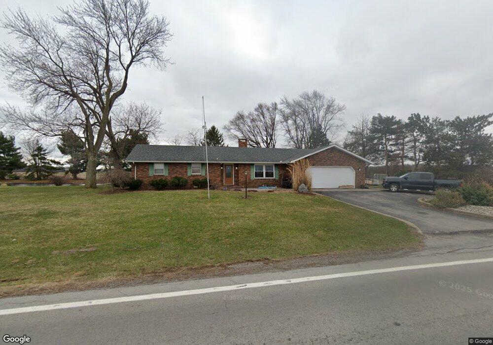
1081 State Route 613 Leipsic, OH 45856
Estimated Value: $266,603 - $295,000
3
Beds
2
Baths
2,072
Sq Ft
$136/Sq Ft
Est. Value
About This Home
This home is located at 1081 State Route 613, Leipsic, OH 45856 and is currently estimated at $282,401, approximately $136 per square foot. 1081 State Route 613 is a home located in Putnam County with nearby schools including Leipsic Elementary School and Leipsic High School.
Ownership History
Date
Name
Owned For
Owner Type
Purchase Details
Closed on
Sep 11, 2008
Sold by
Morgan Mark A and Morgan Jane L
Bought by
Vancalster Gerald J and Van Calster Karen S
Current Estimated Value
Home Financials for this Owner
Home Financials are based on the most recent Mortgage that was taken out on this home.
Original Mortgage
$118,000
Interest Rate
6.57%
Mortgage Type
Future Advance Clause Open End Mortgage
Create a Home Valuation Report for This Property
The Home Valuation Report is an in-depth analysis detailing your home's value as well as a comparison with similar homes in the area
Home Values in the Area
Average Home Value in this Area
Purchase History
| Date | Buyer | Sale Price | Title Company |
|---|---|---|---|
| Vancalster Gerald J | $168,000 | Attorney |
Source: Public Records
Mortgage History
| Date | Status | Borrower | Loan Amount |
|---|---|---|---|
| Closed | Vancalster Gerald J | $118,000 |
Source: Public Records
Tax History Compared to Growth
Tax History
| Year | Tax Paid | Tax Assessment Tax Assessment Total Assessment is a certain percentage of the fair market value that is determined by local assessors to be the total taxable value of land and additions on the property. | Land | Improvement |
|---|---|---|---|---|
| 2024 | $2,083 | $68,160 | $7,680 | $60,480 |
| 2023 | $2,149 | $55,240 | $5,790 | $49,450 |
| 2022 | $2,140 | $55,241 | $5,789 | $49,452 |
| 2021 | $2,151 | $55,240 | $5,790 | $49,450 |
| 2020 | $2,141 | $46,380 | $4,960 | $41,420 |
| 2019 | $1,942 | $53,130 | $5,790 | $47,340 |
| 2018 | $1,914 | $53,130 | $5,790 | $47,340 |
| 2017 | $1,625 | $53,130 | $5,790 | $47,340 |
| 2016 | $1,625 | $46,380 | $4,960 | $41,420 |
| 2015 | $1,598 | $46,380 | $4,960 | $41,420 |
| 2014 | $1,558 | $46,380 | $4,960 | $41,420 |
| 2013 | $1,637 | $46,380 | $4,960 | $41,420 |
Source: Public Records
Map
Nearby Homes
- 358 State Route 613
- 4674 Township Road 117
- 3699 State Route 613
- 223 Cherry St
- 107 S High St
- 0 Joshua Rd Unit 6126475
- 207 N Todd St
- 4516 W US Route 224
- 513 E Liberty St
- 634 Ohio St
- 504 E Main St
- 5330 State Route 186
- 4134 County Road 203
- 111 E Sugar St
- 25 W Main St
- 712 State St
- 713 State St
- 711 State St
- 709 State St
- 707 State St
- 5801 County Road 16
- 5801 County Road 16
- 5801 County Road 16
- 5801 County Road 16 County Rd
- 6966 Road 1
- 7010 Road 1
- 1280 State Route 613
- 169 State Route 613
- 169 Ohio 613
- 7074 Road 1
- 296 State Route 613
- 296 State Route 613
- 5355 County Road 16
- 411 County Road 96
- 1509 State Route 613
- 6250 Rd 1
- 5225 County Road 16
- 5233 Township Road 115
- 1697 State Route 613
- 3877 Road 1