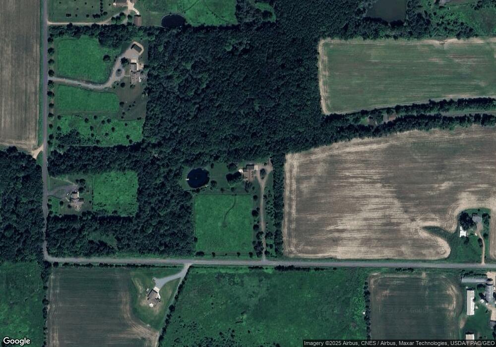
10810 Brush Rd Marshfield, WI 54449
Estimated Value: $579,000 - $793,768
Studio
--
Bath
--
Sq Ft
18.15
Acres
About This Home
This home is located at 10810 Brush Rd, Marshfield, WI 54449 and is currently estimated at $691,589. 10810 Brush Rd is a home with nearby schools including Marshfield High School.
Ownership History
Date
Name
Owned For
Owner Type
Purchase Details
Closed on
Jan 14, 2010
Sold by
Mackay Christopher and Mackay Rae Ann
Bought by
Fritsche Thomas R and Fritsche Mary Jo
Current Estimated Value
Home Financials for this Owner
Home Financials are based on the most recent Mortgage that was taken out on this home.
Original Mortgage
$417,000
Outstanding Balance
$270,311
Interest Rate
4.78%
Mortgage Type
New Conventional
Estimated Equity
$421,278
Purchase Details
Closed on
Nov 14, 2005
Sold by
Knuth Ronald C
Bought by
Mackay Christopher and Mackay Rae Ann
Home Financials for this Owner
Home Financials are based on the most recent Mortgage that was taken out on this home.
Original Mortgage
$60,000
Interest Rate
6.04%
Mortgage Type
Future Advance Clause Open End Mortgage
Purchase Details
Closed on
May 24, 2005
Sold by
Knuth Ronald C
Bought by
Trudeau Construction Inc
Create a Home Valuation Report for This Property
The Home Valuation Report is an in-depth analysis detailing your home's value as well as a comparison with similar homes in the area
Purchase History
| Date | Buyer | Sale Price | Title Company |
|---|---|---|---|
| Fritsche Thomas R | $555,000 | None Available | |
| Fritsche Thomas R | $555,000 | -- | |
| Mackay Christopher | $660,000 | Badger Title Llc | |
| Trudeau Construction Inc | $14,200 | Badger Title Llc |
Source: Public Records
Mortgage History
| Date | Status | Borrower | Loan Amount |
|---|---|---|---|
| Open | Fritsche Thomas R | $417,000 | |
| Previous Owner | Mackay Christopher | $60,000 |
Source: Public Records
Tax History Compared to Growth
Tax History
| Year | Tax Paid | Tax Assessment Tax Assessment Total Assessment is a certain percentage of the fair market value that is determined by local assessors to be the total taxable value of land and additions on the property. | Land | Improvement |
|---|---|---|---|---|
| 2024 | $8,371 | $493,000 | $76,000 | $417,000 |
| 2023 | $7,315 | $493,000 | $76,000 | $417,000 |
| 2022 | $8,431 | $493,000 | $76,000 | $417,000 |
| 2021 | $8,113 | $493,000 | $76,000 | $417,000 |
| 2020 | $7,877 | $493,000 | $76,000 | $417,000 |
| 2019 | $7,967 | $493,000 | $76,000 | $417,000 |
| 2018 | $8,118 | $493,000 | $76,000 | $417,000 |
| 2017 | $8,158 | $493,000 | $76,000 | $417,000 |
| 2016 | $8,158 | $493,000 | $76,000 | $417,000 |
| 2015 | $8,198 | $493,000 | $76,000 | $417,000 |
Source: Public Records
Map
Nearby Homes
- 10880 County Road H
- 200890 Robin Rd
- 404 S Cypress Ave
- 1808 W Andrea St
- 1801 W Andrea St
- 404 S Birch Ave
- 1709 W Andrea St
- 1200 W State St
- 33.69 MOL 26th Rd
- 1006 N Columbus Ave
- 1607 S Lincoln Ave
- 1105 Onstad Dr
- 718 S Drake Ave
- 612 W 11th St
- 1832 Pheasant Run Dr Unit 2B
- lot 18 Lorene Dr
- Lot 17 Lorene Dr
- Lot 2 Lorene Dr
- Lot 19 Lorene Dr
- Lot 16 Lorene Dr
- 13 Acres MOL Brush Rd
- 19.5 A MOL Brush Rd
- 11763 Robin Rd
- 11778 Falcon Rd
- 11728 Falcon Rd
- 10712 Brush Rd
- 11812 Falcon Rd
- 11881 Prairie Hill Trail
- 000 Prairie Hill Trail
- 11693 Robin Rd
- 11885 Prairie Hill Trail
- 11693 Robinson Rd
- 11811 Robin Rd
- 11829 Prairie Hill Trail
- 11742 Robin Rd
- 11687 Robin Rd
- 10847 County Road Y
- 10827 County Road Y
- 10751 County Road Y
- 11866 Falcon Rd
