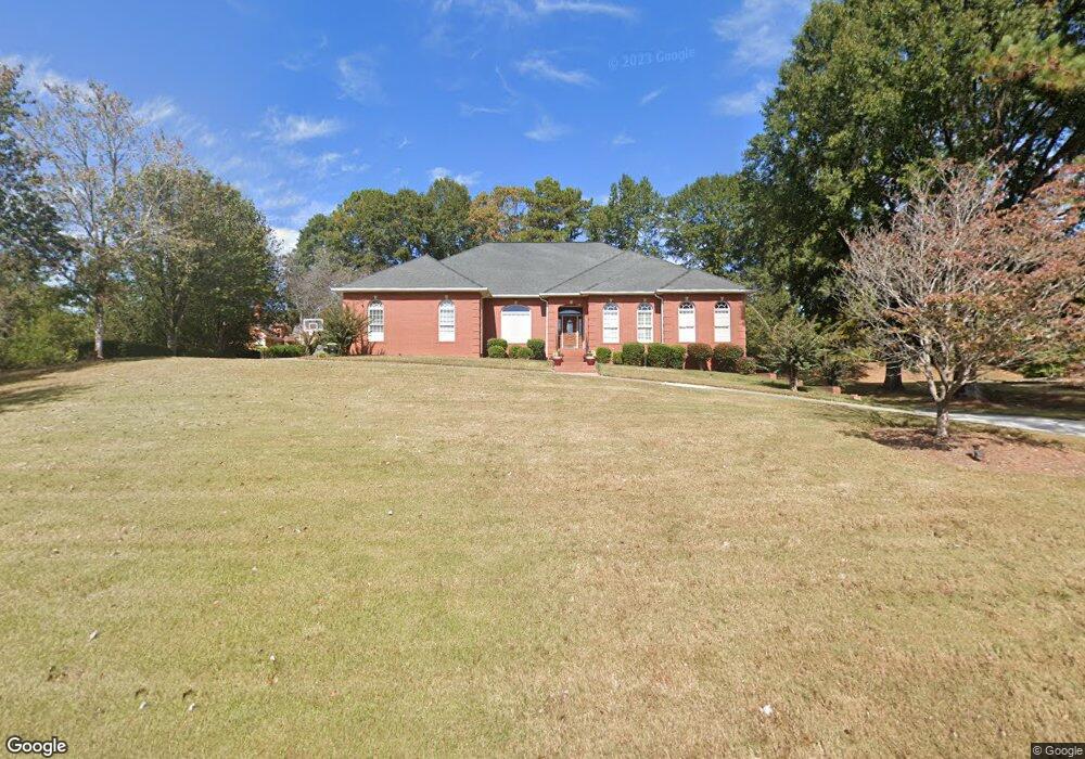
1082 Jimson Cir SE Unit 212 Conyers, GA 30013
Estimated Value: $495,000 - $608,000
5
Beds
5
Baths
5,557
Sq Ft
$97/Sq Ft
Est. Value
About This Home
This home is located at 1082 Jimson Cir SE Unit 212, Conyers, GA 30013 and is currently estimated at $538,884, approximately $96 per square foot. 1082 Jimson Cir SE Unit 212 is a home located in Rockdale County with nearby schools including Flat Shoals Elementary School, Memorial Middle School, and Rockdale County High School.
Ownership History
Date
Name
Owned For
Owner Type
Purchase Details
Closed on
Nov 14, 2023
Sold by
Pinkston Roderick
Bought by
Garner Danielle and Garrett Gary
Current Estimated Value
Home Financials for this Owner
Home Financials are based on the most recent Mortgage that was taken out on this home.
Original Mortgage
$410,062
Outstanding Balance
$403,085
Interest Rate
7.63%
Mortgage Type
New Conventional
Estimated Equity
$135,799
Purchase Details
Closed on
Jan 12, 2018
Sold by
Pinkston Roderick
Bought by
Pinkston Roderick and Pinkston Chantelle E
Home Financials for this Owner
Home Financials are based on the most recent Mortgage that was taken out on this home.
Original Mortgage
$348,570
Interest Rate
4.12%
Mortgage Type
FHA
Purchase Details
Closed on
Jul 18, 2012
Sold by
Scruggs Kathy
Bought by
Scruggs Kathy and Scruggs Patricia
Purchase Details
Closed on
Nov 14, 2005
Sold by
Perkins Clinton
Bought by
Perkins Maymie B
Create a Home Valuation Report for This Property
The Home Valuation Report is an in-depth analysis detailing your home's value as well as a comparison with similar homes in the area
Home Values in the Area
Average Home Value in this Area
Purchase History
| Date | Buyer | Sale Price | Title Company |
|---|---|---|---|
| Garner Danielle | $545,000 | -- | |
| Pinkston Roderick | $355,000 | -- | |
| Pinkston Roderick | $355,000 | -- | |
| Scruggs Kathy | -- | -- | |
| Scruggs Kathy | $249,800 | -- | |
| Perkins Maymie B | -- | -- |
Source: Public Records
Mortgage History
| Date | Status | Borrower | Loan Amount |
|---|---|---|---|
| Open | Garner Danielle | $410,062 | |
| Previous Owner | Pinkston Roderick | $348,570 |
Source: Public Records
Tax History Compared to Growth
Tax History
| Year | Tax Paid | Tax Assessment Tax Assessment Total Assessment is a certain percentage of the fair market value that is determined by local assessors to be the total taxable value of land and additions on the property. | Land | Improvement |
|---|---|---|---|---|
| 2024 | $8,585 | $243,200 | $39,400 | $203,800 |
| 2023 | $5,597 | $227,120 | $35,240 | $191,880 |
| 2022 | $5,387 | $218,960 | $35,240 | $183,720 |
| 2021 | $4,596 | $175,760 | $25,200 | $150,560 |
| 2020 | $6,793 | $158,520 | $24,560 | $133,960 |
| 2019 | $6,411 | $142,600 | $15,000 | $127,600 |
| 2018 | $3,555 | $144,720 | $15,000 | $129,720 |
| 2017 | $2,680 | $115,360 | $15,000 | $100,360 |
| 2016 | $2,027 | $101,200 | $15,880 | $85,320 |
| 2015 | $2,025 | $101,160 | $15,880 | $85,280 |
| 2014 | $1,684 | $98,680 | $13,400 | $85,280 |
| 2013 | -- | $112,720 | $21,600 | $91,120 |
Source: Public Records
Map
Nearby Homes
- 1180 Azalea Cir SE
- 2259 Old Salem Rd SE
- 2165 Old Salem Rd SE
- 1135 Vineyard Dr SE
- 2474 Harvest Dr SE
- 2405 Old Salem Rd SE Unit 1
- 1242 Saxony Dr SE
- 2235 Kings Forest Dr SE
- 1408 Aramore Dr SE
- 2225 Kings Forest Dr SE
- 2215 Kings Forest Dr SE
- 2193 Kings Forest Dr SE
- 2561 Old Salem Cir SE
- 1613 Brentwood Crossing SE Unit 3
- 1260 Sweet Shrub Ln SE
- 2197 Boxwood Cir
- 2239 Mission Ridge Dr SE
- 1082 Jimson Cir SE
- 1100 Thorn Apple Ct SE Unit 39
- 1100 Thorn Apple Ct SE
- 1092 Jimson Cir SE
- 1111 Ardeena Way SE
- 1102 Thorn Apple Ct SE Unit 8
- 0 Thorn Apple Ct SE Unit 8281990
- 0 Thorn Apple Ct SE Unit 8225581
- 0 Thorn Apple Ct SE
- 1113 Jimson Cir SE
- 1103 Jimson Cir SE
- 0 Ardeena Way SE Unit 7262016
- 1121 Ardeena Way SE
- 1102 Jimson Cir SE Unit 8
- 1101 Thorn Apple Ct SE
- 1104 Thorn Apple Ct SE
- 1123 Jimson Cir SE Unit 8
- 1110 Ardeena Way SE Unit 10
- 1110 Ardeena Way SE
- 1093 Jimson Cir SE