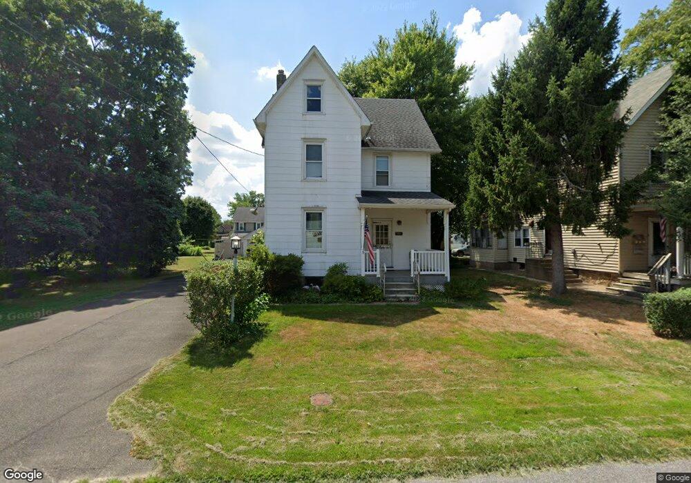
1082 Poquessing Ave Bensalem, PA 19020
Estimated Value: $327,000 - $377,653
3
Beds
2
Baths
1,721
Sq Ft
$208/Sq Ft
Est. Value
About This Home
This home is located at 1082 Poquessing Ave, Bensalem, PA 19020 and is currently estimated at $357,163, approximately $207 per square foot. 1082 Poquessing Ave is a home located in Bucks County with nearby schools including Robert K. Shafer Middle School, School Lane Charter School, and St Charles Borromeo School.
Ownership History
Date
Name
Owned For
Owner Type
Purchase Details
Closed on
Feb 4, 2010
Sold by
Mccarty James J
Bought by
Amend Robert G
Current Estimated Value
Home Financials for this Owner
Home Financials are based on the most recent Mortgage that was taken out on this home.
Original Mortgage
$108,000
Outstanding Balance
$71,763
Interest Rate
5.11%
Mortgage Type
New Conventional
Estimated Equity
$285,400
Purchase Details
Closed on
Sep 25, 1947
Bought by
Mccarty Leo N
Create a Home Valuation Report for This Property
The Home Valuation Report is an in-depth analysis detailing your home's value as well as a comparison with similar homes in the area
Home Values in the Area
Average Home Value in this Area
Purchase History
| Date | Buyer | Sale Price | Title Company |
|---|---|---|---|
| Amend Robert G | $135,000 | None Available | |
| Mccarty Leo N | -- | -- |
Source: Public Records
Mortgage History
| Date | Status | Borrower | Loan Amount |
|---|---|---|---|
| Open | Amend Robert G | $108,000 |
Source: Public Records
Tax History Compared to Growth
Tax History
| Year | Tax Paid | Tax Assessment Tax Assessment Total Assessment is a certain percentage of the fair market value that is determined by local assessors to be the total taxable value of land and additions on the property. | Land | Improvement |
|---|---|---|---|---|
| 2025 | $3,318 | $15,200 | $2,360 | $12,840 |
| 2024 | $3,318 | $15,200 | $2,360 | $12,840 |
| 2023 | $3,225 | $15,200 | $2,360 | $12,840 |
| 2022 | $3,206 | $15,200 | $2,360 | $12,840 |
| 2021 | $3,206 | $15,200 | $2,360 | $12,840 |
| 2020 | $3,174 | $15,200 | $2,360 | $12,840 |
| 2019 | $3,103 | $15,200 | $2,360 | $12,840 |
| 2018 | $3,031 | $15,200 | $2,360 | $12,840 |
| 2017 | $3,012 | $15,200 | $2,360 | $12,840 |
| 2016 | $3,012 | $15,200 | $2,360 | $12,840 |
| 2015 | -- | $15,200 | $2,360 | $12,840 |
| 2014 | -- | $15,200 | $2,360 | $12,840 |
Source: Public Records
Map
Nearby Homes
- 1080 Buttonwood Ave
- 1126 Evelyn Ave
- 1039 Clinton Ave
- 1202 Clinton Ave
- 4161 Orchard Ln
- 1103 Colonial Ave
- 827 Mitchell Ave
- 1236 Whittier Ave
- 124 Meadow Ln
- 227 Dimarco Dr
- 102 Village Ln
- 4374 Deerpath Ln
- 4471 Ernie Davis Cir
- 3727 Pitt Place
- 3750 00 Clarendon Unit 221
- 3726 Clarendon Ave
- 3627 N Hereford Ln
- 3720 Clarendon Ave
- 3750 Clarendon Ave Unit 3
- 3623 N Hereford Ln
- 1088 Poquessing Ave
- 1068 Poquessing Ave
- 1085 Elwood Ave
- 1097 Elwood Ave
- 1056 Poquessing Ave
- 1102 Poquessing Ave
- 1071 Elwood Ave
- 1089 Poquessing Ave
- 1083 Poquessing Ave
- 1067 Poquessing Ave
- 1044 Baxter Ave
- 1046 Poquessing Ave
- 1063 Elwood Ave
- 1114 Poquessing Ave
- 1129 Elwood Ave
- 1042 Poquessing Ave
- 1049 Elwood Ave
- 1124 Poquessing Ave
- 1096 Elwood Ave