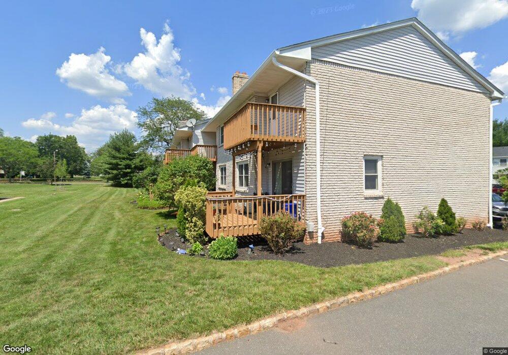
1082 Robin Rd Hillsborough, NJ 08844
Estimated Value: $367,480 - $433,000
--
Bed
--
Bath
1,464
Sq Ft
$276/Sq Ft
Est. Value
About This Home
This home is located at 1082 Robin Rd, Hillsborough, NJ 08844 and is currently estimated at $403,870, approximately $275 per square foot. 1082 Robin Rd is a home located in Somerset County with nearby schools including Hillsborough High School and Brighthorizons at Hillsborough.
Ownership History
Date
Name
Owned For
Owner Type
Purchase Details
Closed on
Aug 21, 2015
Sold by
Rizvi Gulnaz
Bought by
Rizvi Ali and Rizvi Aziz
Current Estimated Value
Home Financials for this Owner
Home Financials are based on the most recent Mortgage that was taken out on this home.
Original Mortgage
$152,525
Outstanding Balance
$122,061
Interest Rate
4.07%
Mortgage Type
New Conventional
Estimated Equity
$283,153
Purchase Details
Closed on
Aug 2, 2010
Sold by
Rizvi Nawab Hussain and Rizvi Zakia Sultana
Bought by
Rizvi Gulnaz
Purchase Details
Closed on
Dec 12, 1996
Sold by
Gaydos Eugene
Bought by
Rizvi Nawab and Rizvi Sakia
Home Financials for this Owner
Home Financials are based on the most recent Mortgage that was taken out on this home.
Original Mortgage
$79,000
Interest Rate
7.75%
Create a Home Valuation Report for This Property
The Home Valuation Report is an in-depth analysis detailing your home's value as well as a comparison with similar homes in the area
Home Values in the Area
Average Home Value in this Area
Purchase History
Date | Buyer | Sale Price | Title Company |
---|---|---|---|
Rizvi Ali | $170,000 | Regional Title Agency Llc | |
Rizvi Gulnaz | -- | None Available | |
Rizvi Nawab | $86,000 | -- |
Source: Public Records
Mortgage History
Date | Status | Borrower | Loan Amount |
---|---|---|---|
Open | Rizvi Ali | $152,525 | |
Previous Owner | Rizvi Nawab | $79,000 |
Source: Public Records
Tax History Compared to Growth
Tax History
Year | Tax Paid | Tax Assessment Tax Assessment Total Assessment is a certain percentage of the fair market value that is determined by local assessors to be the total taxable value of land and additions on the property. | Land | Improvement |
---|---|---|---|---|
2024 | $6,669 | $311,200 | $160,000 | $151,200 |
2023 | $5,779 | $268,400 | $150,000 | $118,400 |
2022 | $5,379 | $240,900 | $125,000 | $115,900 |
2021 | $5,358 | $228,200 | $110,000 | $118,200 |
2020 | $5,457 | $228,900 | $110,000 | $118,900 |
2019 | $5,298 | $220,400 | $100,000 | $120,400 |
2018 | $5,264 | $217,600 | $95,000 | $122,600 |
2017 | $4,598 | $190,400 | $70,000 | $120,400 |
2016 | $4,321 | $179,000 | $70,000 | $109,000 |
2015 | $4,403 | $184,700 | $70,000 | $114,700 |
2014 | $4,327 | $185,400 | $70,000 | $115,400 |
Source: Public Records
Map
Nearby Homes
- 1068 Robin Rd
- 899 Robin Rd
- 722 Robin Rd
- 69 Farm Rd
- 504 Farm Rd
- 530 Andria Ave Unit 295
- 521 Andria Ave Unit 202
- 515 Andria Ave Unit 190
- 605 E Brookside Ln
- 34 Deanna Dr Unit 96
- 16 Deanna Dr Unit 23
- 12 Cranbrook Ave
- 18 Deanna Dr Unit 43
- 351 Doctors Way
- 23 Hughey Ln
- 44 Baker Cir
- 78 Valley Rd
- 6 Cumberland Rd
- 3 Cumberland Rd
- 74 Haverford Ct
- 1082 Robin Rd
- 1080 Robin Rd
- 1084 Robin Rd
- 1086 Robin Rd
- 1088 Robin Rd
- 1072 Robin Rd
- 1070 Robin Rd Unit 106
- 1090 Robin Rd
- 1092 Robin Rd
- 1094 Robin Rd Unit 208
- 1066 Robin Rd
- 1064 Robin Rd
- 1028 Robin Rd
- 1026 Robin Rd
- 1020 Robin Rd
- 1024 Robin Rd Unit 306
- 1030 Robin Rd
- 1022 Robin Rd
- 1062 Robin Rd
- 1032 Robin Rd