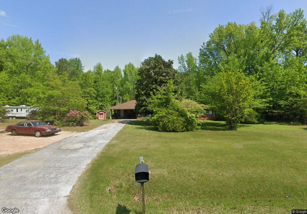
1082 School Rd Griffin, GA 30223
Spalding County NeighborhoodEstimated Value: $248,296 - $288,000
3
Beds
2
Baths
1,676
Sq Ft
$156/Sq Ft
Est. Value
About This Home
This home is located at 1082 School Rd, Griffin, GA 30223 and is currently estimated at $261,074, approximately $155 per square foot. 1082 School Rd is a home located in Spalding County with nearby schools including Beaverbrook Elementary School, Cowan Road Middle School, and Griffin High School.
Ownership History
Date
Name
Owned For
Owner Type
Purchase Details
Closed on
Jun 23, 2016
Sold by
Duncan Billy J
Bought by
Duncan Billy Keith and Duncan Timoty Wade
Current Estimated Value
Purchase Details
Closed on
Jul 17, 2007
Sold by
Shiflett Carolyn W
Bought by
Duncan Billy J
Purchase Details
Closed on
Nov 2, 1971
Sold by
Shiflett Larry
Bought by
Shiflett Larry and Shiflett Carolyn W
Purchase Details
Closed on
Dec 1, 1968
Sold by
Shiflett Newton and Shiflett Lucille V
Bought by
Shiflett Larry
Purchase Details
Closed on
Feb 11, 1950
Bought by
Shiflett Newton and Shiflett Lucille V
Create a Home Valuation Report for This Property
The Home Valuation Report is an in-depth analysis detailing your home's value as well as a comparison with similar homes in the area
Home Values in the Area
Average Home Value in this Area
Purchase History
| Date | Buyer | Sale Price | Title Company |
|---|---|---|---|
| Duncan Billy Keith | -- | -- | |
| Duncan Billy J | $150,000 | -- | |
| Shiflett Larry | -- | -- | |
| Shiflett Larry | -- | -- | |
| Shiflett Newton | -- | -- |
Source: Public Records
Tax History Compared to Growth
Tax History
| Year | Tax Paid | Tax Assessment Tax Assessment Total Assessment is a certain percentage of the fair market value that is determined by local assessors to be the total taxable value of land and additions on the property. | Land | Improvement |
|---|---|---|---|---|
| 2024 | $2,305 | $64,424 | $21,888 | $42,536 |
| 2023 | $2,305 | $61,034 | $21,888 | $39,146 |
| 2022 | $1,741 | $47,868 | $17,784 | $30,084 |
| 2021 | $1,611 | $44,302 | $17,784 | $26,518 |
| 2020 | $1,617 | $44,302 | $17,784 | $26,518 |
| 2019 | $1,649 | $44,302 | $17,784 | $26,518 |
| 2018 | $1,594 | $41,721 | $17,784 | $23,937 |
| 2017 | $1,551 | $41,721 | $17,784 | $23,937 |
| 2016 | $1,579 | $41,721 | $17,784 | $23,937 |
| 2015 | $1,626 | $41,721 | $17,784 | $23,937 |
| 2014 | $1,658 | $41,721 | $17,784 | $23,937 |
Source: Public Records
Map
Nearby Homes
- 1690 Patterson Rd
- 2987 Steele Rd
- 310 Covington Rd
- 300 Covington Rd
- 0 Elder Rd Unit 25075151
- 0 Elder Rd Unit 10619475
- 1120 Patterson Rd
- 1100 Patterson Rd
- 1456 Birdie Rd
- 1060 Patterson Rd
- 466 & 472 Minter Dr
- 175 Mobley Rd
- 1330 Steele Rd
- 725 County Line Church Rd
- 215 Mobley Rd
- 1102 Stiles Crossing
- 1100 Stiles Crossing
- 5061 Old Atlanta Rd
- 105 Anne St
- 220 Galway Ln
- 1120 Malier Rd
- 1120 School Rd
- 1036 School Rd
- 1029 School Rd
- 1024 School Rd
- 1025 School Rd
- 1012 School Rd
- 875 School Rd
- 846 School Rd
- 1845 Patterson Rd
- 1085 Malier Rd
- 1139 Malier Rd
- 1119 Malier Rd
- 1122 School Rd
- 1841 Patterson Rd
- 1841 Patterson Rd Unit 4
- 998 School Rd
- 1081 School Rd
- 1080 Malier Rd
- 1837 Patterson Rd