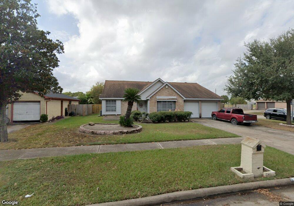
10823 Mackenzie Dr Houston, TX 77086
North Houston NeighborhoodEstimated Value: $218,607 - $254,000
3
Beds
2
Baths
1,659
Sq Ft
$145/Sq Ft
Est. Value
About This Home
This home is located at 10823 Mackenzie Dr, Houston, TX 77086 and is currently estimated at $241,152, approximately $145 per square foot. 10823 Mackenzie Dr is a home located in Harris County with nearby schools including Kujawa EC/Pre-K/K School, Carmichael Elementary School, and Shotwell Middle School.
Ownership History
Date
Name
Owned For
Owner Type
Purchase Details
Closed on
Aug 14, 2014
Sold by
Fannie Mae and Federal National Mortgage Association
Bought by
Granados Santos
Current Estimated Value
Home Financials for this Owner
Home Financials are based on the most recent Mortgage that was taken out on this home.
Original Mortgage
$65,295
Outstanding Balance
$49,880
Interest Rate
4.16%
Mortgage Type
FHA
Estimated Equity
$191,272
Purchase Details
Closed on
Dec 19, 2003
Sold by
Sierra Olivia
Bought by
Federal National Mortgage Association and Fannie Mae
Home Financials for this Owner
Home Financials are based on the most recent Mortgage that was taken out on this home.
Original Mortgage
$103,900
Interest Rate
6.02%
Mortgage Type
Purchase Money Mortgage
Create a Home Valuation Report for This Property
The Home Valuation Report is an in-depth analysis detailing your home's value as well as a comparison with similar homes in the area
Home Values in the Area
Average Home Value in this Area
Purchase History
| Date | Buyer | Sale Price | Title Company |
|---|---|---|---|
| Granados Santos | -- | -- | |
| Granados Santos | -- | -- | |
| Federal National Mortgage Association | $86,022 | None Available | |
| Sierra Olivia | -- | Startex Title Company |
Source: Public Records
Mortgage History
| Date | Status | Borrower | Loan Amount |
|---|---|---|---|
| Open | Granados Santos | $65,295 | |
| Closed | Granados Santos | $65,295 | |
| Previous Owner | Sierra Olivia | $103,900 |
Source: Public Records
Tax History Compared to Growth
Tax History
| Year | Tax Paid | Tax Assessment Tax Assessment Total Assessment is a certain percentage of the fair market value that is determined by local assessors to be the total taxable value of land and additions on the property. | Land | Improvement |
|---|---|---|---|---|
| 2025 | $3,255 | $201,419 | $40,204 | $161,215 |
| 2024 | $3,255 | $204,555 | $40,204 | $164,351 |
| 2023 | $3,255 | $208,643 | $40,204 | $168,439 |
| 2022 | $3,954 | $176,032 | $34,071 | $141,961 |
| 2021 | $3,586 | $147,663 | $34,071 | $113,592 |
| 2020 | $3,785 | $140,216 | $34,071 | $106,145 |
| 2019 | $3,714 | $132,332 | $17,356 | $114,976 |
| 2018 | $1,453 | $126,161 | $17,356 | $108,805 |
| 2017 | $3,204 | $118,389 | $15,585 | $102,804 |
| 2016 | $2,915 | $107,713 | $15,585 | $92,128 |
| 2015 | $783 | $101,824 | $15,585 | $86,239 |
| 2014 | $783 | $77,167 | $15,585 | $61,582 |
Source: Public Records
Map
Nearby Homes
- 10723 Mackenzie Dr
- 10711 Heather Hill Dr
- 10614 Mackenzie Dr
- 7222 Northleaf Dr
- 7227 Greenyard Dr
- 7218 Winding Trace Dr
- 10307 Bammel North Houston Rd
- 7302 Seton Lake Dr
- 7023 Sandswept Ln
- 7307 Silver Star Dr
- 7002 Sandswept Ln
- 5010 Kale Ct
- 11007 Tobasa Ct
- 5103 Dartmoor Ridge Trail
- 6911 Silver Star Dr
- 6722 Winding Trace Dr
- 11006 Crinkleawn Dr
- 6654 Brownie Campbell Rd
- 6822 Dusty Dawn Dr
- 11021 Crenchrus Ct
- 10819 Mackenzie Dr
- 10815 Mackenzie Dr
- 10903 Mackenzie Dr
- 10822 Mackenzie Dr
- 10811 Mackenzie Dr
- 10818 Mackenzie Dr
- 10826 Mackenzie Dr
- 10907 Mackenzie Dr
- 10814 Mackenzie Dr
- 10902 Mackenzie Dr
- 10807 Mackenzie Dr
- 10810 Mackenzie Dr
- 10911 Mackenzie Dr
- 10906 Mackenzie Dr
- 10811 Heather Hill Dr
- 10815 Heather Hill Dr
- 10806 Mackenzie Dr
- 10807 Heather Hill Dr
- 10803 Mackenzie Dr
- 10910 Mackenzie Dr