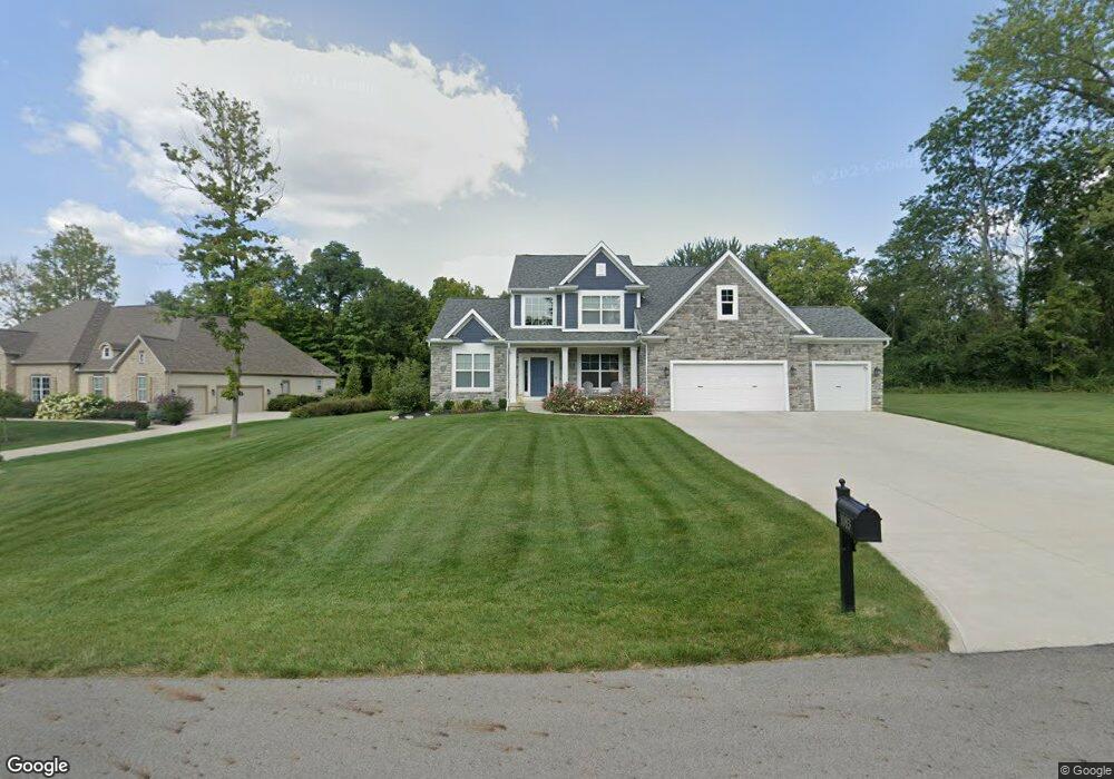
1083 Bluebird Ln Canal Winchester, OH 43110
Bloom NeighborhoodEstimated Value: $444,000 - $838,000
4
Beds
3
Baths
2,570
Sq Ft
$259/Sq Ft
Est. Value
About This Home
This home is located at 1083 Bluebird Ln, Canal Winchester, OH 43110 and is currently estimated at $666,904, approximately $259 per square foot. 1083 Bluebird Ln is a home with nearby schools including Bloom Carroll Primary School, Bloom Carroll Intermediate School, and Bloom-Carroll Middle School.
Ownership History
Date
Name
Owned For
Owner Type
Purchase Details
Closed on
Sep 23, 2019
Sold by
Depappe Patrik D and Depappe Holly L
Bought by
Beal Christopher and Beal Ashlee
Current Estimated Value
Home Financials for this Owner
Home Financials are based on the most recent Mortgage that was taken out on this home.
Original Mortgage
$82,500
Outstanding Balance
$39,251
Interest Rate
6.25%
Mortgage Type
Adjustable Rate Mortgage/ARM
Estimated Equity
$627,653
Purchase Details
Closed on
Oct 23, 2018
Sold by
J M Muggs Ltd
Bought by
Depappe Patrik L and Depappe Holly L
Home Financials for this Owner
Home Financials are based on the most recent Mortgage that was taken out on this home.
Original Mortgage
$88,400
Interest Rate
4.6%
Mortgage Type
Future Advance Clause Open End Mortgage
Create a Home Valuation Report for This Property
The Home Valuation Report is an in-depth analysis detailing your home's value as well as a comparison with similar homes in the area
Home Values in the Area
Average Home Value in this Area
Purchase History
| Date | Buyer | Sale Price | Title Company |
|---|---|---|---|
| Beal Christopher | $110,000 | None Available | |
| Depappe Patrik L | $104,000 | None Available |
Source: Public Records
Mortgage History
| Date | Status | Borrower | Loan Amount |
|---|---|---|---|
| Open | Beal Christopher | $82,500 | |
| Previous Owner | Depappe Patrik L | $88,400 |
Source: Public Records
Tax History Compared to Growth
Tax History
| Year | Tax Paid | Tax Assessment Tax Assessment Total Assessment is a certain percentage of the fair market value that is determined by local assessors to be the total taxable value of land and additions on the property. | Land | Improvement |
|---|---|---|---|---|
| 2024 | $14,553 | $183,290 | $44,990 | $138,300 |
| 2023 | $7,691 | $183,290 | $44,990 | $138,300 |
| 2022 | $7,751 | $183,290 | $44,990 | $138,300 |
| 2021 | $7,860 | $168,940 | $43,210 | $125,730 |
| 2020 | $605 | $43,210 | $43,210 | $0 |
| 2019 | $2,039 | $43,210 | $43,210 | $0 |
| 2018 | $1,198 | $43,210 | $43,210 | $0 |
| 2017 | $1,128 | $25,840 | $25,840 | $0 |
| 2016 | $0 | $25,840 | $25,840 | $0 |
Source: Public Records
Map
Nearby Homes
- 0 Columbus St Unit 225023784
- 73 E North St
- 330 W Columbus St
- 750 Faulkner Dr
- 740 Faulkner Dr
- 11511 Lithopolis Rd NW
- 560 Eastman Ave
- Harmony Plan at The Summit at Wagnalls Run
- Henley Plan at The Summit at Wagnalls Run
- Bellamy Plan at The Summit at Wagnalls Run
- Stamford Plan at The Summit at Wagnalls Run
- Aldridge Plan at The Summit at Wagnalls Run
- Fairton Plan at The Summit at Wagnalls Run
- Juniper Plan at The Summit at Wagnalls Run
- Chatham Plan at The Summit at Wagnalls Run
- Pendleton Plan at The Summit at Wagnalls Run
- 1400 Hansberry Dr
- 1410 Hansberry Dr
- 5225 Lithopolis Winchester Nw Rd
- 720 Faulkner Dr
- 1044 Bluebird Ln
- 910 Bluebird Ln
- 1224 Bluebird Ln
- 1333 Bluebird Ln
- 0 Bluebird St
- 658 Bluebird Ln
- 1384 Bluebird Ln Unit Lot 9
- 450 Hummingbird Ct
- 1207 Bluebird Ln
- 323 Robin Place
- 112 W North St
- 120 W North St
- 84 W Columbus St
- 84 North St
- 84 W North St
- 194 Robin Place
- 0 Columbus St Unit 213029702
- 541 Hummingbird Ct
- 0 Robin Place
- 0 Robin Place Unit Lot 11