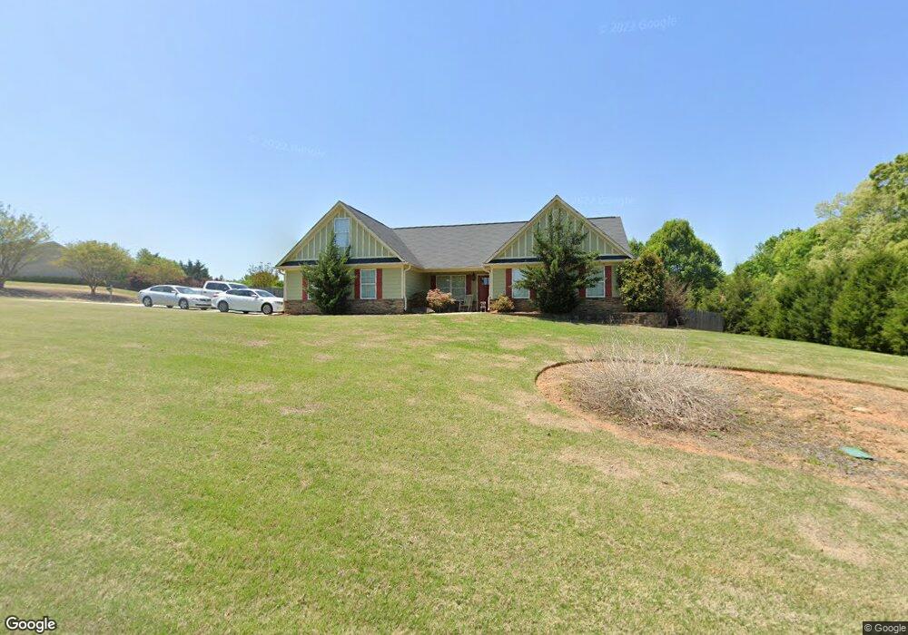
1083 Cassin Ct Winder, GA 30680
Estimated Value: $320,540 - $353,000
--
Bed
--
Bath
1,692
Sq Ft
$201/Sq Ft
Est. Value
About This Home
This home is located at 1083 Cassin Ct, Winder, GA 30680 and is currently estimated at $339,635, approximately $200 per square foot. 1083 Cassin Ct is a home with nearby schools including County Line Elementary School, Russell Middle School, and Winder-Barrow High School.
Ownership History
Date
Name
Owned For
Owner Type
Purchase Details
Closed on
Oct 1, 2013
Sold by
Mullinax Bo J
Bought by
Boggus Kristen Noreen
Current Estimated Value
Purchase Details
Closed on
Nov 21, 2008
Sold by
Mclintack Construction Corp
Bought by
First Piedmont Bank
Purchase Details
Closed on
Nov 3, 2006
Sold by
Rippstar Development
Bought by
Mclintack Construction Corp
Purchase Details
Closed on
Sep 16, 2004
Sold by
Ledbetter
Bought by
Rippstar Development
Create a Home Valuation Report for This Property
The Home Valuation Report is an in-depth analysis detailing your home's value as well as a comparison with similar homes in the area
Home Values in the Area
Average Home Value in this Area
Purchase History
| Date | Buyer | Sale Price | Title Company |
|---|---|---|---|
| Boggus Kristen Noreen | $10,000 | -- | |
| First Piedmont Bank | -- | -- | |
| Mclintack Construction Corp | $52,000 | -- | |
| Rippstar Development | -- | -- |
Source: Public Records
Tax History Compared to Growth
Tax History
| Year | Tax Paid | Tax Assessment Tax Assessment Total Assessment is a certain percentage of the fair market value that is determined by local assessors to be the total taxable value of land and additions on the property. | Land | Improvement |
|---|---|---|---|---|
| 2024 | $2,461 | $98,626 | $15,000 | $83,626 |
| 2023 | $2,817 | $99,026 | $15,000 | $84,026 |
| 2022 | $1,928 | $66,809 | $15,000 | $51,809 |
| 2021 | $2,028 | $66,809 | $15,000 | $51,809 |
| 2020 | $2,027 | $66,809 | $15,000 | $51,809 |
| 2019 | $2,061 | $66,809 | $15,000 | $51,809 |
| 2018 | $1,914 | $62,789 | $15,000 | $47,789 |
| 2017 | $1,729 | $59,382 | $15,000 | $44,382 |
| 2016 | $1,691 | $52,426 | $15,000 | $37,426 |
| 2015 | $1,699 | $52,426 | $15,000 | $37,426 |
| 2014 | $218 | $5,678 | $5,678 | $0 |
| 2013 | -- | $5,678 | $5,678 | $0 |
Source: Public Records
Map
Nearby Homes
- 0 Mulberry Cir Unit 10647438
- The Paisley Plan at Rockwell Farms
- The Rockwell Plan at Rockwell Farms
- The Barnes Plan at Rockwell Farms
- The Reynolds Plan at Rockwell Farms
- The Austin Plan at Rockwell Farms
- The Logan Plan at Rockwell Farms
- The Rose II Plan at Rockwell Farms
- 0 Mulberry Trail Unit 7684364
- 615 Wellington Dr
- 731 Lincoln Dr
- 137 New Cut Rd
- 980 Lake Rockwell Way
- 412 Regan Dr
- 746 Baskins Cir
- 563 Rockwell Church Rd NW
- 432 Mulberry Rd
- 0 Gainesville Hwy Unit 10549985
- 318 Ryan Rd
- 926 Live Oak Ct Unit 2
- Lot 3 Hawk Creek Trail
- 41 Hawk Creek Trail
- 0 Hawk Creek Trail Unit 7255614
- 0 Hawk Creek Trail Unit 7522266
- 0 Hawk Creek Trail Unit 7332924
- 0 Hawk Creek Trail Unit 7117134
- 0 Hawk Creek Trail Unit 8553454
- 0 Hawk Creek Trail Unit 8477084
- 0 Hawk Creek Trail Unit 8394670
- 0 Hawk Creek Trail Unit 8231130
- 0 Hawk Creek Trail Unit 8055682
- 0 Hawk Creek Trail Unit 8389729
- 0 Hawk Creek Trail Unit 8541388
- 0 Hawk Creek Trail Unit 3271459
- 863 Hawk Creek Tr
- 860 Hawk Creek Trail
- 863 Hawk Creek Trail
- 1085 Cassin Ct Unit 4
- 1085 Cassin Ct
- 1084 Cassin Ct