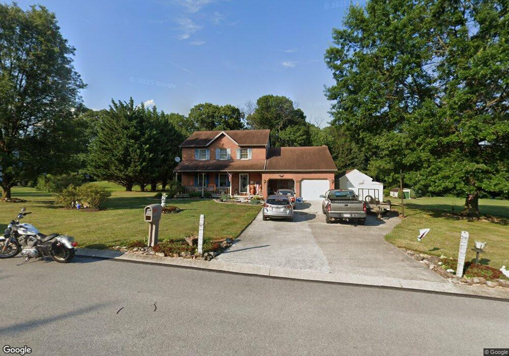
1083 Clinton Ct Spring Grove, PA 17362
Estimated Value: $392,000 - $420,000
3
Beds
3
Baths
2,108
Sq Ft
$192/Sq Ft
Est. Value
About This Home
This home is located at 1083 Clinton Ct, Spring Grove, PA 17362 and is currently estimated at $404,693, approximately $191 per square foot. 1083 Clinton Ct is a home located in York County with nearby schools including Spring Grove Area Middle School, Spring Grove Area High School, and Garbers Mennonite School.
Ownership History
Date
Name
Owned For
Owner Type
Purchase Details
Closed on
Nov 6, 2024
Sold by
Schuchart Jeffrey L
Bought by
Schuchart Jeffrey L and Smith-Schuchart Barbara A
Current Estimated Value
Purchase Details
Closed on
Jan 27, 2010
Sold by
Schuchart Jeffrey L and Schuchart Christy
Bought by
Schuchart Jeffrey L
Home Financials for this Owner
Home Financials are based on the most recent Mortgage that was taken out on this home.
Original Mortgage
$174,200
Interest Rate
5%
Mortgage Type
New Conventional
Purchase Details
Closed on
Sep 15, 1992
Bought by
Schuchart Jeffrey L and Schuchart Christy
Create a Home Valuation Report for This Property
The Home Valuation Report is an in-depth analysis detailing your home's value as well as a comparison with similar homes in the area
Home Values in the Area
Average Home Value in this Area
Purchase History
| Date | Buyer | Sale Price | Title Company |
|---|---|---|---|
| Schuchart Jeffrey L | -- | None Listed On Document | |
| Schuchart Jeffrey L | -- | None Available | |
| Schuchart Jeffrey L | $29,500 | -- |
Source: Public Records
Mortgage History
| Date | Status | Borrower | Loan Amount |
|---|---|---|---|
| Previous Owner | Schuchart Jeffrey L | $174,200 |
Source: Public Records
Tax History Compared to Growth
Tax History
| Year | Tax Paid | Tax Assessment Tax Assessment Total Assessment is a certain percentage of the fair market value that is determined by local assessors to be the total taxable value of land and additions on the property. | Land | Improvement |
|---|---|---|---|---|
| 2025 | $6,795 | $202,220 | $41,490 | $160,730 |
| 2024 | $6,722 | $202,220 | $41,490 | $160,730 |
| 2023 | $6,722 | $202,220 | $41,490 | $160,730 |
| 2022 | $6,722 | $202,220 | $41,490 | $160,730 |
| 2021 | $6,434 | $202,220 | $41,490 | $160,730 |
| 2020 | $6,434 | $202,220 | $41,490 | $160,730 |
| 2019 | $6,297 | $202,220 | $41,490 | $160,730 |
| 2018 | $6,214 | $202,220 | $41,490 | $160,730 |
| 2017 | $6,021 | $202,220 | $41,490 | $160,730 |
| 2016 | -- | $202,220 | $41,490 | $160,730 |
| 2015 | $4,130 | $202,220 | $41,490 | $160,730 |
| 2014 | $4,130 | $202,220 | $41,490 | $160,730 |
Source: Public Records
Map
Nearby Homes
- 1063 Porters Rd
- 6428 York Rd
- 1844 Liberty Rd
- 5931 York Rd
- 1323 Moulstown Rd N
- 6475 Pamadeva Rd
- 1233 Glatco Lodge Rd
- 5497 Stambaugh Rd
- 1709 Jefferson Rd
- 1495 Jefferson Rd
- Lot # 2 Midhill Rd
- Lot # 1 Midhill Rd
- Lot# 3 Midhill Rd
- 0 Moulstown Rd N Unit PAYK2082362
- 7877 Gnatstown Rd
- 799 Laurel Woods Ln
- 7962 Woodland Dr
- 1120 Hoff Rd
- 6306 Liam Dr
- 6309 Liam Dr
- 1077 Clinton Ct
- 1091 Clinton Ct
- 1084 Clinton Ct
- 1072 Porters Rd
- 1076 Clinton Ct
- 1071 Clinton Ct
- 1090 Clinton Ct
- 1099 Clinton Ct
- 1066 Porters Rd
- 6305 Shutt Rd
- 1070 Clinton Ct
- 6350 Shutt Rd
- 6332 Straw Acres Rd
- 1087 Porters Rd
- 6328 Straw Acres Rd
- 1093 Porters Rd
- 6300 Straw Acres Rd
- 6336 Straw Acres Rd
- 6324 Straw Acres Rd
- 6304 Straw Acres Rd