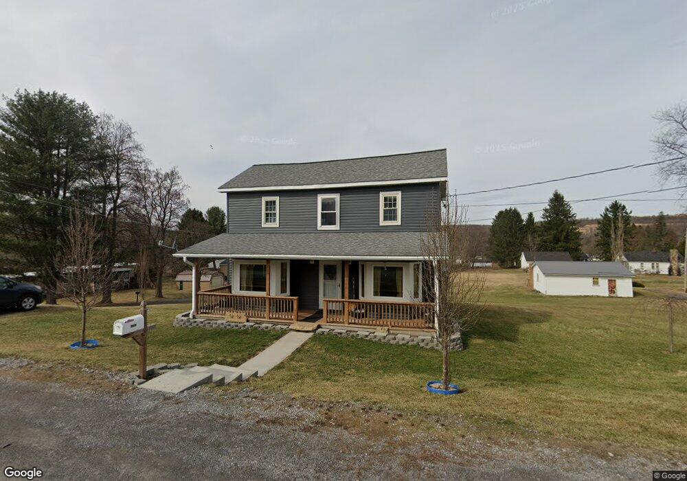
1083 Market St Coalport, PA 16627
Estimated Value: $63,000 - $81,000
--
Bed
--
Bath
--
Sq Ft
0.5
Acres
About This Home
This home is located at 1083 Market St, Coalport, PA 16627 and is currently estimated at $72,623. 1083 Market St is a home located in Clearfield County with nearby schools including Glendale Elementary School and Glendale Junior/Senior High School.
Ownership History
Date
Name
Owned For
Owner Type
Purchase Details
Closed on
Apr 11, 2019
Sold by
Brumbaugh Tracy
Bought by
Shomo Glenn E
Current Estimated Value
Purchase Details
Closed on
Dec 8, 2015
Sold by
Williams Daniel
Bought by
Brink James R
Purchase Details
Closed on
Jul 15, 2005
Sold by
Heil Eugene G
Bought by
Williams George W
Home Financials for this Owner
Home Financials are based on the most recent Mortgage that was taken out on this home.
Original Mortgage
$21,525
Interest Rate
5.67%
Mortgage Type
Purchase Money Mortgage
Create a Home Valuation Report for This Property
The Home Valuation Report is an in-depth analysis detailing your home's value as well as a comparison with similar homes in the area
Home Values in the Area
Average Home Value in this Area
Purchase History
| Date | Buyer | Sale Price | Title Company |
|---|---|---|---|
| Shomo Glenn E | $1,900 | None Available | |
| Brink James R | -- | None Available | |
| Williams George W | $26,000 | None Available |
Source: Public Records
Mortgage History
| Date | Status | Borrower | Loan Amount |
|---|---|---|---|
| Previous Owner | Williams George W | $21,525 |
Source: Public Records
Tax History Compared to Growth
Tax History
| Year | Tax Paid | Tax Assessment Tax Assessment Total Assessment is a certain percentage of the fair market value that is determined by local assessors to be the total taxable value of land and additions on the property. | Land | Improvement |
|---|---|---|---|---|
| 2025 | $571 | $7,250 | $2,500 | $4,750 |
| 2024 | $91 | $3,625 | $1,250 | $2,375 |
| 2023 | $526 | $3,625 | $1,250 | $2,375 |
| 2022 | $511 | $3,625 | $1,250 | $2,375 |
| 2021 | $526 | $3,625 | $1,250 | $2,375 |
| 2020 | $526 | $3,625 | $1,250 | $2,375 |
| 2019 | $513 | $3,625 | $1,250 | $2,375 |
| 2018 | $446 | $3,625 | $1,250 | $2,375 |
| 2017 | $459 | $3,625 | $1,250 | $2,375 |
| 2016 | -- | $3,625 | $1,250 | $2,375 |
| 2015 | -- | $3,625 | $1,250 | $2,375 |
| 2014 | -- | $3,625 | $1,250 | $2,375 |
Source: Public Records
Map
Nearby Homes
- 1460 Main St
- 123 Liberty St
- 103 1st Ave
- 0 Heverly Blvd
- 53 Hill St
- 5480 St Lawrence Rd
- 31 Acres Along Saint Lawrence Rd
- 49 Beers Ln
- 773 Church Hill Rd
- 5331 Glen Hope Blvd
- 1683 Beaver Valley Rd
- 1675 Beaver Valley Rd
- 275 Frye Rd
- 128 N Crescent Dr
- 124 Hayes Rd
- 122 Scenic Cir
- 284 N Locust Ln
- 237 N Locust Ln
- 5962 Glen Hope Blvd
- 245 N North Locust Ln