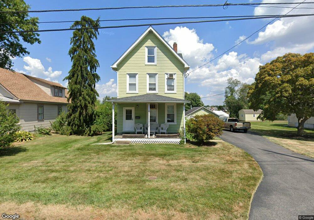
1083 Poquessing Ave Bensalem, PA 19020
Estimated Value: $356,000 - $450,000
3
Beds
2
Baths
2,088
Sq Ft
$200/Sq Ft
Est. Value
About This Home
This home is located at 1083 Poquessing Ave, Bensalem, PA 19020 and is currently estimated at $417,818, approximately $200 per square foot. 1083 Poquessing Ave is a home located in Bucks County with nearby schools including Robert K. Shafer Middle School, School Lane Charter School, and St Charles Borromeo School.
Ownership History
Date
Name
Owned For
Owner Type
Purchase Details
Closed on
Nov 20, 2008
Sold by
Wichterman Dennis and Wichterman David
Bought by
Fala Edward C and Rosney Mcdevitt Eileen I
Current Estimated Value
Home Financials for this Owner
Home Financials are based on the most recent Mortgage that was taken out on this home.
Original Mortgage
$184,000
Outstanding Balance
$120,961
Interest Rate
6.11%
Mortgage Type
Purchase Money Mortgage
Estimated Equity
$296,857
Purchase Details
Closed on
Aug 29, 2008
Sold by
Wichterman Dennis
Bought by
Wichterman Dennis
Purchase Details
Closed on
Mar 29, 2008
Sold by
Wichterman David and Wichterman Richard
Bought by
Wichterman Dennis
Create a Home Valuation Report for This Property
The Home Valuation Report is an in-depth analysis detailing your home's value as well as a comparison with similar homes in the area
Home Values in the Area
Average Home Value in this Area
Purchase History
| Date | Buyer | Sale Price | Title Company |
|---|---|---|---|
| Fala Edward C | $230,000 | None Available | |
| Wichterman Dennis | -- | None Available | |
| Wichterman Dennis | -- | None Available |
Source: Public Records
Mortgage History
| Date | Status | Borrower | Loan Amount |
|---|---|---|---|
| Open | Fala Edward C | $184,000 |
Source: Public Records
Tax History Compared to Growth
Tax History
| Year | Tax Paid | Tax Assessment Tax Assessment Total Assessment is a certain percentage of the fair market value that is determined by local assessors to be the total taxable value of land and additions on the property. | Land | Improvement |
|---|---|---|---|---|
| 2025 | $3,667 | $16,800 | $4,360 | $12,440 |
| 2024 | $3,667 | $16,800 | $4,360 | $12,440 |
| 2023 | $3,564 | $16,800 | $4,360 | $12,440 |
| 2022 | $3,543 | $16,800 | $4,360 | $12,440 |
| 2021 | $3,543 | $16,800 | $4,360 | $12,440 |
| 2020 | $3,508 | $16,800 | $4,360 | $12,440 |
| 2019 | $3,429 | $16,800 | $4,360 | $12,440 |
| 2018 | $3,350 | $16,800 | $4,360 | $12,440 |
| 2017 | $3,329 | $16,800 | $4,360 | $12,440 |
| 2016 | $3,329 | $16,800 | $4,360 | $12,440 |
| 2015 | -- | $16,800 | $4,360 | $12,440 |
| 2014 | -- | $16,800 | $4,360 | $12,440 |
Source: Public Records
Map
Nearby Homes
- 1080 Buttonwood Ave
- 1126 Evelyn Ave
- 1039 Clinton Ave
- 1236 Whittier Ave
- 4161 Orchard Ln
- 1202 Clinton Ave
- 1103 Colonial Ave
- 827 Mitchell Ave
- 124 Meadow Ln
- 102 Village Ln
- 4374 Deerpath Ln
- 4471 Ernie Davis Cir
- 3727 Pitt Place
- 3750 00 Clarendon Unit 221
- 3627 N Hereford Ln
- 3726 Clarendon Ave
- 3623 N Hereford Ln
- 3720 Clarendon Ave
- 4208 Greenmount Rd
- 3750 Clarendon Ave Unit 3
- 1089 Poquessing Ave
- 1067 Poquessing Ave
- 1082 Poquessing Ave
- 1102 Belfast Ave
- 1088 Poquessing Ave
- 1068 Poquessing Ave
- 1056 Poquessing Ave
- 1110 Emerson Ln
- 1102 Poquessing Ave
- 1046 Poquessing Ave
- 1086 Emerson Ln
- 1115 Poquessing Ave
- 1094 Emerson Ln
- 1114 Poquessing Ave
- 1085 Elwood Ave
- 1097 Elwood Ave
- 1100 Emerson Ln
- 1042 Poquessing Ave
- 1071 Elwood Ave