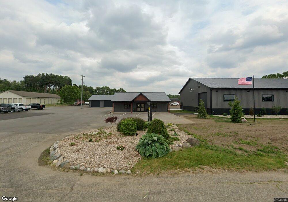
1083 S Patterson Rd Wayland, MI 49348
Estimated Value: $732,787
--
Bed
--
Bath
3,088
Sq Ft
$237/Sq Ft
Est. Value
About This Home
This home is located at 1083 S Patterson Rd, Wayland, MI 49348 and is currently estimated at $732,787, approximately $237 per square foot. 1083 S Patterson Rd is a home located in Barry County with nearby schools including Wayland High School.
Ownership History
Date
Name
Owned For
Owner Type
Purchase Details
Closed on
Feb 5, 2024
Sold by
Gun Lake Investments Llc
Bought by
Arc Land Development Llc
Current Estimated Value
Home Financials for this Owner
Home Financials are based on the most recent Mortgage that was taken out on this home.
Original Mortgage
$280,000
Outstanding Balance
$275,052
Interest Rate
6.61%
Mortgage Type
New Conventional
Estimated Equity
$457,735
Purchase Details
Closed on
Dec 29, 2003
Bought by
Gun Lake Investments Llc
Home Financials for this Owner
Home Financials are based on the most recent Mortgage that was taken out on this home.
Original Mortgage
$245,000
Interest Rate
5.94%
Create a Home Valuation Report for This Property
The Home Valuation Report is an in-depth analysis detailing your home's value as well as a comparison with similar homes in the area
Home Values in the Area
Average Home Value in this Area
Purchase History
| Date | Buyer | Sale Price | Title Company |
|---|---|---|---|
| Arc Land Development Llc | -- | Sun Title Agency Of Michigan | |
| Gun Lake Investments Llc | $290,000 | -- | |
| Gun Lake Investments Llc | $290,000 | Unified Title & Settlement |
Source: Public Records
Mortgage History
| Date | Status | Borrower | Loan Amount |
|---|---|---|---|
| Open | Arc Land Development Llc | $280,000 | |
| Previous Owner | Gun Lake Investments Llc | $245,000 |
Source: Public Records
Tax History Compared to Growth
Tax History
| Year | Tax Paid | Tax Assessment Tax Assessment Total Assessment is a certain percentage of the fair market value that is determined by local assessors to be the total taxable value of land and additions on the property. | Land | Improvement |
|---|---|---|---|---|
| 2025 | $3,635 | $191,900 | $0 | $0 |
| 2024 | $3,635 | $80,000 | $0 | $0 |
| 2023 | $3,419 | $77,300 | $0 | $0 |
| 2022 | $3,419 | $77,300 | $0 | $0 |
| 2021 | $3,419 | $76,900 | $0 | $0 |
| 2020 | $3,303 | $80,100 | $0 | $0 |
| 2019 | $3,303 | $73,800 | $0 | $0 |
| 2018 | $3,143 | $71,000 | $37,600 | $33,400 |
| 2017 | $3,143 | $71,000 | $0 | $0 |
| 2016 | -- | $67,900 | $0 | $0 |
| 2015 | -- | $80,700 | $0 | $0 |
| 2014 | -- | $80,700 | $0 | $0 |
Source: Public Records
Map
Nearby Homes
- 12169 Pine Meadows Dr
- 12031 Sandstone Dr
- 1736 Parker Dr
- 1980 Parker Dr
- 12712 Sunrise Ct
- 2724 Pasture Ln
- 35 Cannonball Ln
- 11065 W M 179 Hwy
- 12720 S Grey Ct
- 1164 E Bernie Ct
- 12940 Cleland Ave
- 3140 Sandy Beach St
- 12857 Michael Dr Unit 49
- 1391 Shadowridge Dr
- 11753 Rosemary Ln
- 11751 Rosemary Ln
- 516 131st Ave
- 3298 Elmwood Beach Rd
- 590 129th Ave
- 2919 Beatrice Ave
- 12924 Rison Dr
- 8 Rison Dr
- 0 Rison Dr Unit 21 M16048640
- 0 Rison Dr Unit 24 M16048648
- 0 Rison Dr Unit 23 M16048645
- 0 Rison Dr Unit 22
- Lot B Patterson Rd
- Lot A Patterson Rd
- 1087 S Patterson Rd
- 1075 S Patterson Rd
- 1 Back Dr
- Unit 23 Rison Dr Unit 23
- Unit 22 Rison Dr Unit 22
- Unit 21 Rison Dr Unit 21
- 24 Rison Dr Unit 24
- 23 Rison Dr Unit 23
- 21 Rison Dr Unit 21
- 1207 S Patterson Rd
- 34 130th Ave
- 1 Minch