Estimated Value: $491,000 - $530,139
4
Beds
3
Baths
2,784
Sq Ft
$183/Sq Ft
Est. Value
About This Home
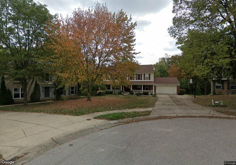
This home is located at 1083 Samuel Ct, Union, KY 41091 and is currently estimated at $508,535, approximately $182 per square foot. 1083 Samuel Ct is a home located in Boone County with nearby schools including Shirley Mann Elementary School, Gray Middle School, and Larry A. Ryle High School.
Ownership History
Date
Name
Owned For
Owner Type
Purchase Details
Closed on
Dec 11, 2020
Sold by
Murray John M and Murray Annette C
Bought by
Putnam Jayson A and Putnam Jennifer A
Current Estimated Value
Home Financials for this Owner
Home Financials are based on the most recent Mortgage that was taken out on this home.
Original Mortgage
$260,000
Outstanding Balance
$230,409
Interest Rate
2.7%
Mortgage Type
New Conventional
Estimated Equity
$278,126
Purchase Details
Closed on
Dec 9, 2020
Sold by
Murray John M and Murray Annette C
Bought by
Putnam Jayson A and Putnam Jennifer A
Home Financials for this Owner
Home Financials are based on the most recent Mortgage that was taken out on this home.
Original Mortgage
$260,000
Outstanding Balance
$230,409
Interest Rate
2.7%
Mortgage Type
New Conventional
Estimated Equity
$278,126
Create a Home Valuation Report for This Property
The Home Valuation Report is an in-depth analysis detailing your home's value as well as a comparison with similar homes in the area
Home Values in the Area
Average Home Value in this Area
Purchase History
| Date | Buyer | Sale Price | Title Company |
|---|---|---|---|
| Putnam Jayson A | $325,000 | Prominent Title | |
| Putnam Jayson A | $325,000 | Prominent Title Agency |
Source: Public Records
Mortgage History
| Date | Status | Borrower | Loan Amount |
|---|---|---|---|
| Open | Putnam Jayson A | $260,000 | |
| Closed | Putnam Jayson A | $260,000 |
Source: Public Records
Tax History
| Year | Tax Paid | Tax Assessment Tax Assessment Total Assessment is a certain percentage of the fair market value that is determined by local assessors to be the total taxable value of land and additions on the property. | Land | Improvement |
|---|---|---|---|---|
| 2025 | $5,007 | $441,300 | $75,000 | $366,300 |
| 2024 | $3,836 | $342,400 | $50,000 | $292,400 |
| 2023 | $3,897 | $342,400 | $50,000 | $292,400 |
| 2022 | $3,844 | $342,400 | $50,000 | $292,400 |
| 2021 | $3,927 | $342,400 | $50,000 | $292,400 |
| 2020 | $3,284 | $286,830 | $38,000 | $248,830 |
| 2019 | $3,322 | $286,830 | $38,000 | $248,830 |
| 2018 | $3,348 | $286,830 | $38,000 | $248,830 |
| 2017 | $3,273 | $286,830 | $38,000 | $248,830 |
| 2015 | $3,233 | $286,830 | $38,000 | $248,830 |
| 2013 | -- | $286,830 | $38,000 | $248,830 |
Source: Public Records
Map
Nearby Homes
- 1096 Whirlaway Dr
- 1049 Swale Ct
- 1095 Bold Forbes Ct
- 928 Dustwhirl Dr
- 10869 Arcaro Ln
- 1068 Charley Ct
- 1316 Oxley Ct
- 909 Riva Ridge Ln
- 6813 Green Isle Ln
- 10730 Stone St
- 10759 Crown Pointe Dr
- 1152 Monarchos Ridge
- 10771 Crown Pointe Dr
- 10802 Doral Ct
- 10803 Muirfield Ct
- 10878 Saint Andrews Dr
- 631 Coaltown Ct
- 1217 Citation Dr
- 10826 Omaha Trace
- 14086 Bridlegate Dr
- 1091 Samuel Ct
- 1075 Samuel Ct
- 1116 Kurtzinger Ct
- 1108 Kurtzinger Ct
- 1124 Kurtzinger Ct
- 1099 Samuel Ct
- 1062 Swale Ct
- 1070 Swale Ct
- 1132 Kurtzinger Ct
- 1090 Samuel Ct
- 1082 Samuel Ct
- 1071 Dustwhirl Dr
- 1076 Dustwhirl Dr
- 1098 Samuel Ct
- 1107 Samuel Ct
- 1100 Kurtzinger Ct
- 1058 Swale Ct
- 10938 War Admiral Dr
- 10920 War Admiral Dr
- 10946 War Admiral Dr
Your Personal Tour Guide
Ask me questions while you tour the home.