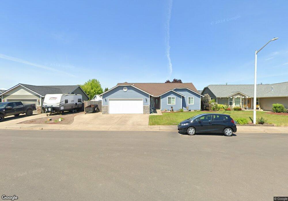
1083 Siuslaw St Harrisburg, OR 97446
Estimated Value: $424,000 - $466,604
3
Beds
2
Baths
1,928
Sq Ft
$231/Sq Ft
Est. Value
About This Home
This home is located at 1083 Siuslaw St, Harrisburg, OR 97446 and is currently estimated at $445,302, approximately $230 per square foot. 1083 Siuslaw St is a home located in Linn County with nearby schools including Harrisburg Elementary School, Harrisburg Middle School, and Harrisburg High School.
Ownership History
Date
Name
Owned For
Owner Type
Purchase Details
Closed on
Mar 25, 2005
Sold by
Harriswood Properties Inc
Bought by
Harris Thomas P and Harris Sue L
Current Estimated Value
Home Financials for this Owner
Home Financials are based on the most recent Mortgage that was taken out on this home.
Original Mortgage
$163,920
Outstanding Balance
$82,495
Interest Rate
5.6%
Mortgage Type
Unknown
Estimated Equity
$362,807
Create a Home Valuation Report for This Property
The Home Valuation Report is an in-depth analysis detailing your home's value as well as a comparison with similar homes in the area
Home Values in the Area
Average Home Value in this Area
Purchase History
| Date | Buyer | Sale Price | Title Company |
|---|---|---|---|
| Harris Thomas P | $204,903 | Ticor Title |
Source: Public Records
Mortgage History
| Date | Status | Borrower | Loan Amount |
|---|---|---|---|
| Open | Harris Thomas P | $163,920 | |
| Closed | Harris Thomas P | $20,490 |
Source: Public Records
Tax History Compared to Growth
Tax History
| Year | Tax Paid | Tax Assessment Tax Assessment Total Assessment is a certain percentage of the fair market value that is determined by local assessors to be the total taxable value of land and additions on the property. | Land | Improvement |
|---|---|---|---|---|
| 2025 | $4,725 | $259,490 | -- | -- |
| 2024 | $4,592 | $251,940 | -- | -- |
| 2023 | $4,466 | $244,610 | $0 | $0 |
| 2022 | $4,368 | $237,490 | $0 | $0 |
| 2021 | $4,239 | $230,580 | $0 | $0 |
| 2020 | $4,187 | $223,870 | $0 | $0 |
| 2019 | $4,080 | $217,350 | $0 | $0 |
| 2018 | $3,576 | $211,020 | $0 | $0 |
| 2017 | $3,431 | $204,880 | $0 | $0 |
| 2016 | $3,178 | $198,920 | $0 | $0 |
| 2015 | $3,090 | $193,130 | $0 | $0 |
| 2014 | $3,067 | $187,510 | $0 | $0 |
Source: Public Records
Map
Nearby Homes
- 961 S 9th St
- 1001 Sommerville Loop
- 1025 S 6th St
- 1025 S 6th St Unit 83
- 1025 S 6th St Unit 78
- 30540 Priceboro Dr
- 888 S 9th St
- 970 Lasalle St
- 950 Lasalle St
- 525 S 6th St Unit 4
- 370 S 6th St
- Lot 9th St
- 955 Territorial St
- Lot 7 Territorial St
- 375 N 6th St
- Lot 1st St
- 550 N 6th Place
- 645 Riley Way
- 735 N Periander
- 741 N Periander
- 1085 Siuslaw St
- 1081 Siuslaw St
- 1046 Heckart Ln
- 1048 Heckart Ln
- 1087 Siuslaw St
- 1044 Heckart Ln
- 1060 Applegate Place
- 1057 Whitledge Place
- 1050 Heckart Ln
- 1061 Applegate Place
- 1055 Whitledge Place
- 1089 Siuslaw St
- 1059 Whitledge Place
- 1042 Heckart Ln
- 1053 Whitledge Place
- 1052 Heckart Ln
- 1088 Siuslaw St
- 1061 Whitledge Place
- 1063 Applegate Place
- 1051 Whitledge Place