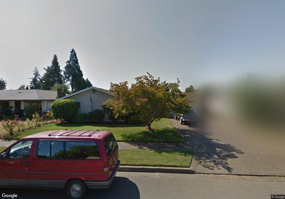
1083 W 7th Place Junction City, OR 97448
Estimated Value: $444,000 - $495,000
4
Beds
3
Baths
1,819
Sq Ft
$257/Sq Ft
Est. Value
About This Home
This home is located at 1083 W 7th Place, Junction City, OR 97448 and is currently estimated at $467,296, approximately $256 per square foot. 1083 W 7th Place is a home located in Lane County with nearby schools including Junction City High School.
Ownership History
Date
Name
Owned For
Owner Type
Purchase Details
Closed on
Aug 4, 2020
Sold by
Dunaway Michael L and Dunaway Carol J
Bought by
Dunaway Michael L and Dunaway Carol J
Current Estimated Value
Home Financials for this Owner
Home Financials are based on the most recent Mortgage that was taken out on this home.
Original Mortgage
$185,300
Outstanding Balance
$164,678
Interest Rate
3.1%
Mortgage Type
New Conventional
Estimated Equity
$302,618
Purchase Details
Closed on
Dec 26, 2014
Sold by
Ruecker Beverly L
Bought by
Dodge John and Dodge Brittanie
Home Financials for this Owner
Home Financials are based on the most recent Mortgage that was taken out on this home.
Original Mortgage
$200,450
Interest Rate
3.96%
Mortgage Type
New Conventional
Purchase Details
Closed on
Jan 10, 2000
Sold by
Andresen Gordon E and Andresen Gayla L
Bought by
Moye Jack and Moye Elizabeth M
Create a Home Valuation Report for This Property
The Home Valuation Report is an in-depth analysis detailing your home's value as well as a comparison with similar homes in the area
Home Values in the Area
Average Home Value in this Area
Purchase History
| Date | Buyer | Sale Price | Title Company |
|---|---|---|---|
| Dunaway Michael L | -- | None Available | |
| Dodge John | $211,000 | Cascade Title Company | |
| Moye Jack | $179,900 | Western Pioneer Title Co |
Source: Public Records
Mortgage History
| Date | Status | Borrower | Loan Amount |
|---|---|---|---|
| Open | Dunaway Michael L | $185,300 | |
| Closed | Dodge John | $200,450 |
Source: Public Records
Tax History Compared to Growth
Tax History
| Year | Tax Paid | Tax Assessment Tax Assessment Total Assessment is a certain percentage of the fair market value that is determined by local assessors to be the total taxable value of land and additions on the property. | Land | Improvement |
|---|---|---|---|---|
| 2024 | $4,370 | $260,283 | -- | -- |
| 2023 | $4,370 | $252,702 | $0 | $0 |
| 2022 | $4,076 | $245,342 | $0 | $0 |
| 2021 | $3,995 | $238,197 | $0 | $0 |
| 2020 | $3,867 | $231,260 | $0 | $0 |
| 2019 | $3,731 | $224,525 | $0 | $0 |
| 2018 | $3,624 | $211,637 | $0 | $0 |
| 2017 | $3,496 | $211,637 | $0 | $0 |
| 2016 | $3,399 | $205,473 | $0 | $0 |
| 2015 | $3,005 | $199,488 | $0 | $0 |
| 2014 | $2,721 | $193,678 | $0 | $0 |
Source: Public Records
Map
Nearby Homes
- 1225 W 10th Ave Unit 26
- 1225 W 10th Ave Unit 28
- 1225 W 10th Ave Unit 50
- 1225 W 10th Ave Unit 53
- 850 Spruce St
- 1011 Rose St
- 847 Unity Dr
- 617 Juniper St
- 1085 W 1st Ave Unit 8
- 1176 Unity Dr
- 351 Juniper St
- 1262 Kalmia St
- 188 Sumac Ct
- 0 Holly St
- 1816 W 4th Ave
- 930 Holly St
- 1377 Juniper St
- 93982 Prairie (Off Street) Rd
- 310 Pitney Ln Unit 76
- 310 Pitney Ln Unit 25