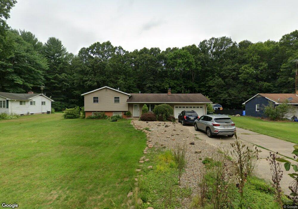
10831 Dot Ave NE Alliance, OH 44601
Estimated Value: $141,673 - $246,000
3
Beds
1
Bath
1,196
Sq Ft
$153/Sq Ft
Est. Value
About This Home
This home is located at 10831 Dot Ave NE, Alliance, OH 44601 and is currently estimated at $183,418, approximately $153 per square foot. 10831 Dot Ave NE is a home located in Stark County with nearby schools including Marlington High School and Regina Coeli/St Joseph School.
Ownership History
Date
Name
Owned For
Owner Type
Purchase Details
Closed on
Apr 23, 2003
Sold by
Hud
Bought by
Doty Amy L
Current Estimated Value
Home Financials for this Owner
Home Financials are based on the most recent Mortgage that was taken out on this home.
Original Mortgage
$87,400
Outstanding Balance
$37,850
Interest Rate
5.86%
Mortgage Type
Purchase Money Mortgage
Estimated Equity
$145,568
Purchase Details
Closed on
Jan 15, 2003
Sold by
Thornton Paul R and Thornton Kelly J
Bought by
Hud
Purchase Details
Closed on
Jun 28, 1994
Sold by
Norton Douglas A
Bought by
Thornton Paul R and Thornton Kelly
Home Financials for this Owner
Home Financials are based on the most recent Mortgage that was taken out on this home.
Original Mortgage
$78,646
Interest Rate
8.78%
Mortgage Type
FHA
Purchase Details
Closed on
Nov 13, 1991
Purchase Details
Closed on
May 1, 1989
Create a Home Valuation Report for This Property
The Home Valuation Report is an in-depth analysis detailing your home's value as well as a comparison with similar homes in the area
Home Values in the Area
Average Home Value in this Area
Purchase History
| Date | Buyer | Sale Price | Title Company |
|---|---|---|---|
| Doty Amy L | $92,000 | Lakeside Title & Escrow Agen | |
| Hud | $66,000 | -- | |
| Thornton Paul R | $79,300 | -- | |
| -- | $75,000 | -- | |
| -- | $64,500 | -- |
Source: Public Records
Mortgage History
| Date | Status | Borrower | Loan Amount |
|---|---|---|---|
| Open | Doty Amy L | $87,400 | |
| Previous Owner | Thornton Paul R | $78,646 |
Source: Public Records
Tax History Compared to Growth
Tax History
| Year | Tax Paid | Tax Assessment Tax Assessment Total Assessment is a certain percentage of the fair market value that is determined by local assessors to be the total taxable value of land and additions on the property. | Land | Improvement |
|---|---|---|---|---|
| 2025 | -- | $30,910 | $21,880 | $9,030 |
| 2024 | -- | $30,740 | $21,880 | $8,860 |
| 2023 | $998 | $28,350 | $11,620 | $16,730 |
| 2022 | $1,002 | $28,350 | $11,620 | $16,730 |
| 2021 | $1,005 | $28,350 | $11,620 | $16,730 |
| 2020 | $999 | $25,100 | $10,010 | $15,090 |
| 2019 | $992 | $25,100 | $10,010 | $15,090 |
| 2018 | $993 | $25,100 | $10,010 | $15,090 |
| 2017 | $1,611 | $38,120 | $9,520 | $28,600 |
| 2016 | $1,612 | $38,120 | $9,520 | $28,600 |
| 2015 | $1,534 | $38,120 | $9,520 | $28,600 |
| 2014 | $1,402 | $31,820 | $7,950 | $23,870 |
| 2013 | $697 | $31,820 | $7,950 | $23,870 |
Source: Public Records
Map
Nearby Homes
- 10666 Wilma Ave NE
- 13334 Cindy St NE
- 0 Meadow St NE
- 12355 Edison St NE
- 11960 Freshley Ave NE
- 11480 Aebi Ave NE
- 13109 Edison St NE
- 0 W Main St Unit 5090123
- 12252 Snode St NE
- 12415 Snode St NE
- 1430 Westwood Ave
- 2081 Marwood Cir
- 0 Reeder Ave NE
- 000 Klinger Ave
- 2377 Ansley St Unit 2377
- 432 Johnson Ave
- 14422 Sturbridge Rd NE
- 0 Homestead Ave NE
- 000 Meadowbrook Ave
- 0 Meadowbrook Ave
- 10851 Dot Ave NE
- 10811 Dot Ave NE
- 10871 Dot Ave NE
- 10791 Dot Ave NE
- 10830 Dot Ave NE
- 10891 Dot Ave NE
- 10771 Dot Ave NE
- 10870 Dot Ave NE
- 10790 Dot Ave NE
- 10890 Dot Ave NE
- 10770 Dot Ave NE
- 10905 Dot Ave NE
- 10831 Barcus Ave NE
- 10851 Barcus Ave NE
- 10811 Barcus Ave NE
- 10745 Dot Ave NE
- 10871 Barcus Ave NE
- 10791 Barcus Ave NE
- 10744 Dot Ave NE
- 10891 Barcus Ave NE