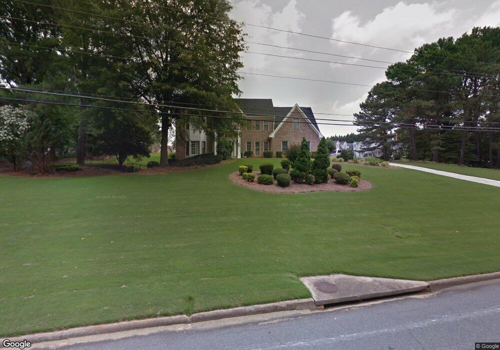
10835 Parsons Rd Duluth, GA 30097
Estimated Value: $743,470 - $921,000
4
Beds
3
Baths
3,778
Sq Ft
$226/Sq Ft
Est. Value
About This Home
This home is located at 10835 Parsons Rd, Duluth, GA 30097 and is currently estimated at $852,618, approximately $225 per square foot. 10835 Parsons Rd is a home located in Fulton County with nearby schools including Medlock Bridge Elementary School, River Trail Middle School, and Northview High School.
Ownership History
Date
Name
Owned For
Owner Type
Purchase Details
Closed on
Feb 25, 2019
Sold by
Treminio Susana
Bought by
Perazza Susana Glaribel
Current Estimated Value
Purchase Details
Closed on
Mar 24, 2000
Sold by
Parsons John T and Parsons Judy K
Bought by
Treminio Susan
Home Financials for this Owner
Home Financials are based on the most recent Mortgage that was taken out on this home.
Original Mortgage
$283,500
Interest Rate
7.5%
Mortgage Type
New Conventional
Create a Home Valuation Report for This Property
The Home Valuation Report is an in-depth analysis detailing your home's value as well as a comparison with similar homes in the area
Home Values in the Area
Average Home Value in this Area
Purchase History
| Date | Buyer | Sale Price | Title Company |
|---|---|---|---|
| Perazza Susana Glaribel | -- | -- | |
| Treminio Susan | $315,000 | -- |
Source: Public Records
Mortgage History
| Date | Status | Borrower | Loan Amount |
|---|---|---|---|
| Previous Owner | Treminio Susan | $283,500 |
Source: Public Records
Tax History Compared to Growth
Tax History
| Year | Tax Paid | Tax Assessment Tax Assessment Total Assessment is a certain percentage of the fair market value that is determined by local assessors to be the total taxable value of land and additions on the property. | Land | Improvement |
|---|---|---|---|---|
| 2025 | $5,698 | $180,120 | $38,520 | $141,600 |
| 2023 | $5,698 | $189,840 | $38,520 | $151,320 |
| 2022 | $5,825 | $189,840 | $38,520 | $151,320 |
| 2021 | $5,517 | $175,120 | $37,200 | $137,920 |
| 2020 | $5,570 | $173,040 | $36,760 | $136,280 |
| 2019 | $566 | $169,960 | $36,080 | $133,880 |
| 2018 | $5,006 | $165,960 | $35,240 | $130,720 |
| 2017 | $4,674 | $149,480 | $36,480 | $113,000 |
| 2016 | $4,598 | $149,480 | $36,480 | $113,000 |
| 2015 | $4,648 | $149,480 | $36,480 | $113,000 |
| 2014 | $4,812 | $149,480 | $36,480 | $113,000 |
Source: Public Records
Map
Nearby Homes
- 10595 Highgate Manor Ct
- 523 Willsford Ct Unit 8
- 10950 Glenhurst Pass
- 5640 Sandown Way
- 380 Victorian Ln
- 3560 Bexton Dr
- 4243 Baden Alley
- 10567 Bent Tree View
- 5765 Bailey Ridge Ct
- 6050 China Rose Ln
- 10475 Medlock Bridge Rd
- 540 Abbotts Mill Dr
- 755 Abbotts Mill Ct Unit 69
- 11035 Parsons Rd
- 11041 Parsons Rd
- 11065 Brunson Dr Unit 247
- 10640 Arlington Point
- 10685 Parsons Rd Unit 1
- 10685 Parsons Rd Unit 1
- 10685 Parsons Rd
- 10685 Parsons Rd
- 10855 Parsons Rd
- 10610 Branham Fields Rd
- 10900 Old Stone Ct
- 10620 Branham Fields Rd Unit 1
- 30097 Old Stone Ct
- 10630 Branham Fields Rd
- 10600 Branham Fields Rd
- 10655 Stonefield Landing
- 10510 Highgate Manor Ct
- 10530 Highgate Manor Ct
- 10530 Highgate Manor Ct Unit 1
- 10485 High Manor
- 10485 High Manor Ct
- 10590 Branham Fields Rd
- 10495 Highgate Manor Ct
- 10495 Highgate