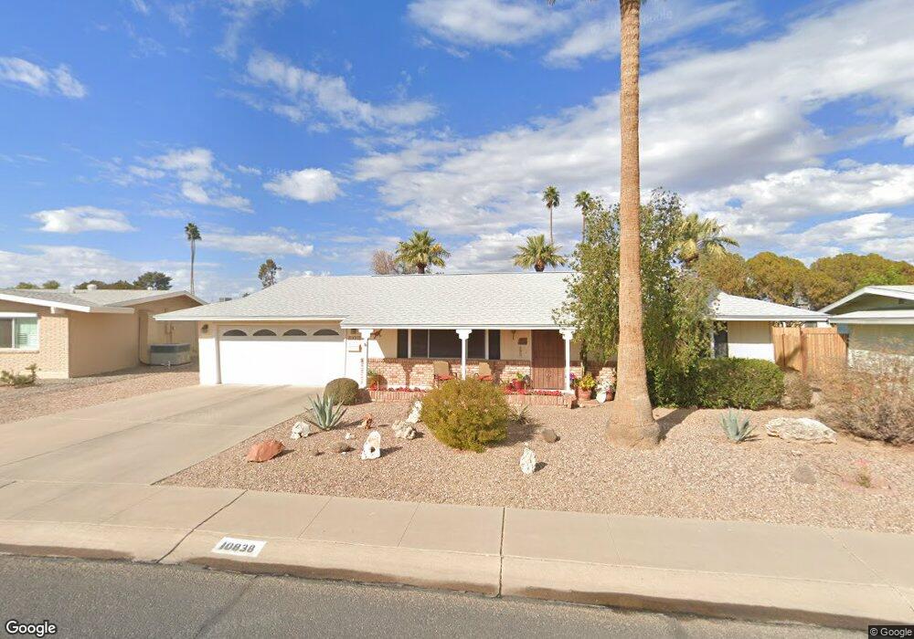
10838 W Deanne Dr Sun City, AZ 85351
Estimated Value: $204,612 - $289,000
--
Bed
1
Bath
984
Sq Ft
$255/Sq Ft
Est. Value
About This Home
This home is located at 10838 W Deanne Dr, Sun City, AZ 85351 and is currently estimated at $251,153, approximately $255 per square foot. 10838 W Deanne Dr is a home located in Maricopa County with nearby schools including Desert Mirage Elementary School, Ombudsman - Northwest Charter, and Peoria Accelerated High School.
Ownership History
Date
Name
Owned For
Owner Type
Purchase Details
Closed on
Sep 28, 2005
Sold by
Brodland Ray L and Brodland Constance L
Bought by
Brodland Ray L and Brodland Constance L
Current Estimated Value
Purchase Details
Closed on
Mar 5, 2002
Sold by
Wolff Warren W
Bought by
Brodland Ray L and Brodland Constance L
Home Financials for this Owner
Home Financials are based on the most recent Mortgage that was taken out on this home.
Original Mortgage
$70,000
Outstanding Balance
$28,994
Interest Rate
6.94%
Mortgage Type
New Conventional
Estimated Equity
$222,159
Create a Home Valuation Report for This Property
The Home Valuation Report is an in-depth analysis detailing your home's value as well as a comparison with similar homes in the area
Home Values in the Area
Average Home Value in this Area
Purchase History
| Date | Buyer | Sale Price | Title Company |
|---|---|---|---|
| Brodland Ray L | -- | -- | |
| Brodland Ray L | $101,000 | First Southwestern Title |
Source: Public Records
Mortgage History
| Date | Status | Borrower | Loan Amount |
|---|---|---|---|
| Open | Brodland Ray L | $70,000 |
Source: Public Records
Tax History Compared to Growth
Tax History
| Year | Tax Paid | Tax Assessment Tax Assessment Total Assessment is a certain percentage of the fair market value that is determined by local assessors to be the total taxable value of land and additions on the property. | Land | Improvement |
|---|---|---|---|---|
| 2025 | $686 | $8,518 | -- | -- |
| 2024 | $617 | $8,112 | -- | -- |
| 2023 | $617 | $16,960 | $3,390 | $13,570 |
| 2022 | $582 | $13,200 | $2,640 | $10,560 |
| 2021 | $600 | $12,150 | $2,430 | $9,720 |
| 2020 | $584 | $10,470 | $2,090 | $8,380 |
| 2019 | $579 | $9,410 | $1,880 | $7,530 |
| 2018 | $555 | $8,310 | $1,660 | $6,650 |
| 2017 | $538 | $7,160 | $1,430 | $5,730 |
| 2016 | $503 | $6,610 | $1,320 | $5,290 |
| 2015 | $479 | $5,910 | $1,180 | $4,730 |
Source: Public Records
Map
Nearby Homes
- 10931 W Peoria Ave Unit 7
- 11001 W Peoria Ave Unit 9
- 10895 W Clair Dr Unit 31
- 10916 W Peoria Ave
- 10908 W Peoria Ave Unit 3
- 11024 W Peoria Ave Unit 3
- 10926 W Abbott Ave
- 10873 W Clair Dr Unit 26
- 11002 W Deanne Dr
- 10232 N 109th Ave
- 11002 W Greer Ave
- 10235 N 108th Dr Unit 45
- 10216 N 110th Ave
- 10816 N Madison Dr
- 11132 W Kolina Ln
- 11118 W Missouri Ave
- 10743 W Clair Dr Unit 8
- 10711 W Abbott Ave Unit 2
- 10709 W Clair Dr Unit 1
- 10230 N 106th Dr
- 10834 W Deanne Dr
- 10842 W Deanne Dr
- 10923 W Peoria Ave Unit 5
- 10911 W Peoria Ave
- 10909 W Peoria Ave
- 10830 W Deanne Dr
- 10846 W Deanne Dr
- 10843 W Deanne Dr
- 10905 W Peoria Ave Unit 2
- 10905 W Peoria Ave Unit 2
- 10831 W Deanne Dr
- 10826 W Deanne Dr
- 10935 W Peoria Ave Unit 8
- 10824 W Deanne Dr
- 10901 W Peoria Ave Unit 1
- 10850 W Deanne Dr
- 10283 N 109th Ave
- 10899 W Clair Dr
- 10901 W Deanne Dr
- 10908 W Deanne Dr