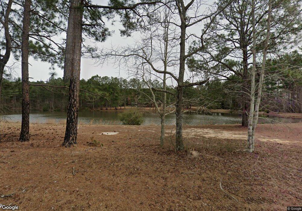
1084 Gresston Baptist Rd Eastman, GA 31023
Estimated Value: $203,000 - $656,000
1
Bed
3
Baths
1,957
Sq Ft
$217/Sq Ft
Est. Value
About This Home
This home is located at 1084 Gresston Baptist Rd, Eastman, GA 31023 and is currently estimated at $424,169, approximately $216 per square foot. 1084 Gresston Baptist Rd is a home located in Dodge County with nearby schools including Dodge County High School.
Ownership History
Date
Name
Owned For
Owner Type
Purchase Details
Closed on
Oct 14, 2016
Sold by
Jason Michael
Bought by
Pritchett Stephen L
Current Estimated Value
Purchase Details
Closed on
Nov 3, 2015
Sold by
Pritchett Raymon L
Bought by
Hersey Jason Michael
Home Financials for this Owner
Home Financials are based on the most recent Mortgage that was taken out on this home.
Original Mortgage
$250,000
Interest Rate
3.78%
Mortgage Type
VA
Create a Home Valuation Report for This Property
The Home Valuation Report is an in-depth analysis detailing your home's value as well as a comparison with similar homes in the area
Home Values in the Area
Average Home Value in this Area
Purchase History
| Date | Buyer | Sale Price | Title Company |
|---|---|---|---|
| Pritchett Stephen L | -- | -- | |
| Hersey Jason Michael | $250,000 | -- |
Source: Public Records
Mortgage History
| Date | Status | Borrower | Loan Amount |
|---|---|---|---|
| Previous Owner | Hersey Jason Michael | $250,000 |
Source: Public Records
Tax History Compared to Growth
Tax History
| Year | Tax Paid | Tax Assessment Tax Assessment Total Assessment is a certain percentage of the fair market value that is determined by local assessors to be the total taxable value of land and additions on the property. | Land | Improvement |
|---|---|---|---|---|
| 2024 | $2,701 | $104,616 | $20,882 | $83,734 |
| 2023 | $2,701 | $104,616 | $20,882 | $83,734 |
| 2022 | $2,390 | $92,548 | $14,813 | $77,735 |
| 2021 | $2,354 | $89,766 | $14,813 | $74,953 |
| 2020 | $2,289 | $87,297 | $12,344 | $74,953 |
| 2019 | $2,008 | $75,658 | $12,344 | $63,314 |
| 2018 | $1,934 | $75,658 | $12,344 | $63,314 |
| 2017 | $1,934 | $75,658 | $12,344 | $63,314 |
| 2016 | $2,006 | $78,504 | $12,344 | $66,160 |
| 2015 | -- | $85,368 | $14,813 | $70,555 |
| 2014 | -- | $89,704 | $14,813 | $74,891 |
| 2013 | -- | $89,703 | $14,812 | $74,890 |
Source: Public Records
Map
Nearby Homes
- 238 Wilson Woodard Rd
- 0 Gooch Rd - Lot C
- 0 Gooch Rd Unit LOT F 10320712
- 3557 Antioch Church Rd
- 115 Log Cabin Rd
- 140 Antioch Church Rd
- 251 Bill Hambrick Rd
- 0 Bethel Church Rd Unit 10601037
- 415 Ga Highway 257
- 139 and 137 Ga Hwy 257
- 0 Log Cabin Rd Unit LOT WP001 10506501
- 0 Log Cabin Rd Unit LotWP001 23229925
- 596 Ga Highway 257
- 983 Cochran Hwy
- 00 Log Cabin Rd
- 94 24th Ave
- 191 Cheek Rd
- 0 Cheek Rd
- 1227 Hawkinsville Hwy
- 2734 Empire-Chester Hwy
- 1166 Gresston Baptist Rd
- 1002 Gresston Baptist Rd
- 1141 Gresston Baptist Rd
- 1141 Gresston Baptist Rd
- 530 Garrett Oxley Rd
- 1314 Gresston Baptist Rd
- 1330 Gresston Baptist Rd
- 119 Wallace Cir
- 137 Wallace Cir
- 519 Garrett Oxley Rd
- 553 Garrett Oxley Rd
- 153 Wallace Cir
- 1407 Gresston Baptist Rd
- 107 Wallace Cir
- 175 Wallace Cir
- 3809 Cochran Hwy
- 148 Wallace Cir
- 0 Wallace Cir Unit 8431530
- 0 Wallace Cir Unit 9057922
- 0 Wallace Cir Unit 8870663
