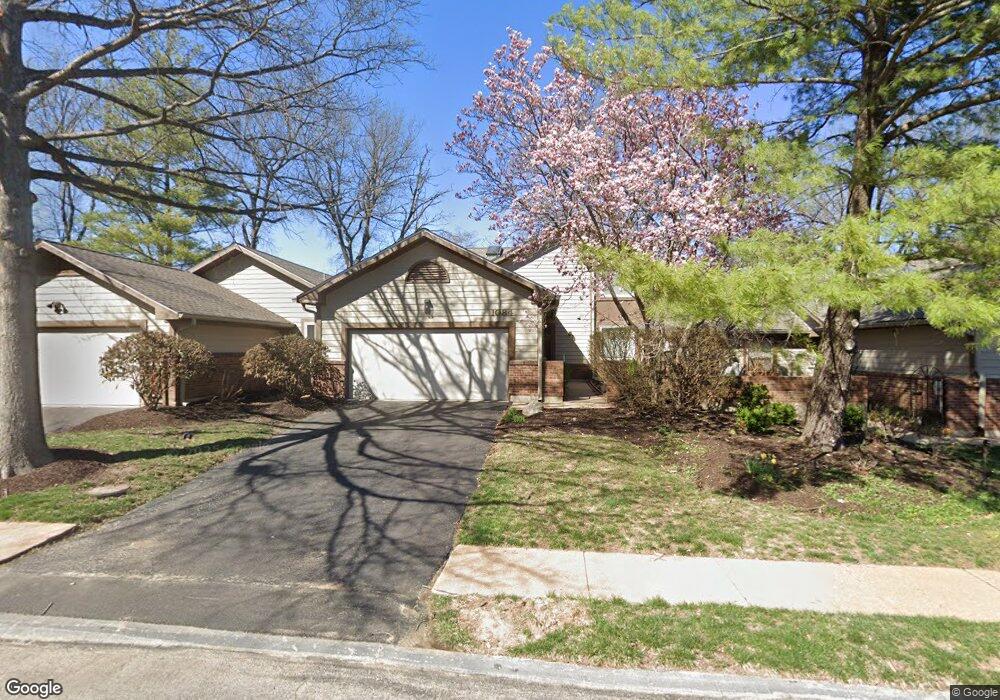
1084 N Spoede Rd Unit 1084 Saint Louis, MO 63146
Estimated Value: $354,000 - $483,000
3
Beds
3
Baths
2,156
Sq Ft
$188/Sq Ft
Est. Value
About This Home
This home is located at 1084 N Spoede Rd Unit 1084, Saint Louis, MO 63146 and is currently estimated at $404,670, approximately $187 per square foot. 1084 N Spoede Rd Unit 1084 is a home located in St. Louis County with nearby schools including Spoede Elementary School, Ladue 5th Grade Center, and Ladue Middle.
Ownership History
Date
Name
Owned For
Owner Type
Purchase Details
Closed on
Aug 18, 2025
Sold by
Aucamp Donald and Hanks Carol
Bought by
Aucamp Family Trust and Aucamp
Current Estimated Value
Purchase Details
Closed on
May 22, 2003
Sold by
Brown Robert M and Brown Julie M
Bought by
Aucamp Donald and Aucamp Carol Hanks
Purchase Details
Closed on
Feb 18, 2000
Sold by
Lima Jose A and Lima Carol J
Bought by
Brown Robert M
Home Financials for this Owner
Home Financials are based on the most recent Mortgage that was taken out on this home.
Original Mortgage
$184,000
Interest Rate
8.31%
Mortgage Type
Balloon
Create a Home Valuation Report for This Property
The Home Valuation Report is an in-depth analysis detailing your home's value as well as a comparison with similar homes in the area
Home Values in the Area
Average Home Value in this Area
Purchase History
| Date | Buyer | Sale Price | Title Company |
|---|---|---|---|
| Aucamp Family Trust | -- | None Listed On Document | |
| Aucamp Donald | $280,000 | -- | |
| Brown Robert M | $230,000 | -- |
Source: Public Records
Mortgage History
| Date | Status | Borrower | Loan Amount |
|---|---|---|---|
| Previous Owner | Brown Robert M | $184,000 |
Source: Public Records
Tax History Compared to Growth
Tax History
| Year | Tax Paid | Tax Assessment Tax Assessment Total Assessment is a certain percentage of the fair market value that is determined by local assessors to be the total taxable value of land and additions on the property. | Land | Improvement |
|---|---|---|---|---|
| 2025 | $4,365 | $72,050 | $19,530 | $52,520 |
| 2024 | $4,365 | $62,930 | $12,220 | $50,710 |
| 2023 | $4,360 | $62,930 | $12,220 | $50,710 |
| 2022 | $3,592 | $49,840 | $12,220 | $37,620 |
| 2021 | $3,564 | $49,840 | $12,220 | $37,620 |
| 2020 | $3,549 | $49,000 | $13,430 | $35,570 |
| 2019 | $3,521 | $49,000 | $13,430 | $35,570 |
| 2018 | $3,235 | $41,550 | $5,700 | $35,850 |
| 2017 | $3,230 | $41,550 | $5,700 | $35,850 |
| 2016 | $3,742 | $46,990 | $8,950 | $38,040 |
| 2015 | $3,500 | $46,990 | $8,950 | $38,040 |
| 2014 | $3,209 | $41,800 | $10,810 | $30,990 |
Source: Public Records
Map
Nearby Homes
- 1060 Port Diane Dr
- 1033 Wilton Royal Dr Unit 210
- 1033 Wilton Royal Dr Unit 107
- 1033 Wilton Royal Dr Unit 204
- 18 Sona Ln
- 866 Deaver Ln
- 11017 Sandistan Dr
- 832 Larkin Ave
- 1054 Willow Brook Dr
- 817 Larkin Ave
- 50 Willow Brook Dr
- 814 Mary Meadows Ln
- 11045 Graeser Ln
- 10469 Briarbend Dr Unit 3
- 2 Wedgewood Ln
- 10401 Briarbend Dr Unit 2
- 942 Guelbreth Ln Unit 200
- 11220 Trieste Dr
- 10 Spoede Woods Dr
- 556 N Graeser Rd
- 1082 N Spoede Rd
- 1080 N Spoede Rd
- 1078 N Spoede Rd
- 1086 N Spoede Rd
- 1087 N Spoede Rd Unit 1087
- 1081 N Spoede Rd
- 1085 N Spoede Rd Unit 1085
- 10925 Vauxhall Dr
- 1074 N Spoede Rd
- 10923 Vauxhall Dr Unit 10923
- 1079 N Spoede Rd Unit 1079
- 10927 Vauxhall Dr Unit 10927
- 1072 N Spoede Rd Unit 1072
- 10901 Vauxhall Dr Unit 10901
- 1067 N Spoede Rd Unit 1067
- 10915 Vauxhall Dr Unit 10915
- 1083 N Spoede Rd
- 1077 N Spoede Rd
- 1075 N Spoede Rd
- 10907 Vauxhall Dr Unit 10907