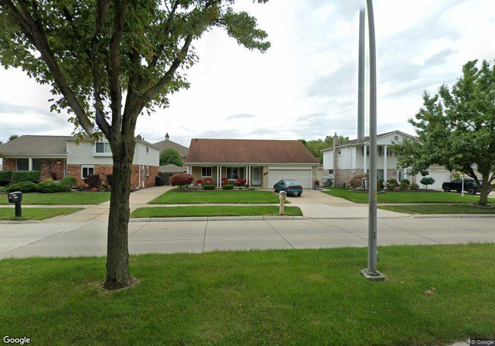
10846 Continental Dr Taylor, MI 48180
Estimated Value: $259,511 - $310,000
--
Bed
1
Bath
1,566
Sq Ft
$180/Sq Ft
Est. Value
About This Home
This home is located at 10846 Continental Dr, Taylor, MI 48180 and is currently estimated at $282,628, approximately $180 per square foot. 10846 Continental Dr is a home located in Wayne County with nearby schools including Holland Elementary School, Hoover Middle School, and Taylor High School.
Ownership History
Date
Name
Owned For
Owner Type
Purchase Details
Closed on
Sep 19, 2024
Sold by
Borg Philip N and Borg Philip N
Bought by
Philip N Borg Jr Revocable Living Trust and Borg
Current Estimated Value
Purchase Details
Closed on
Sep 5, 2024
Sold by
Anne Marie Borg Revocable Living Trust and Borg Philip N
Bought by
Borg Philip N and Borg Philip N
Purchase Details
Closed on
Apr 2, 2007
Sold by
Borg Anne Marie and Borg Philip
Bought by
Borg Anne Marie
Create a Home Valuation Report for This Property
The Home Valuation Report is an in-depth analysis detailing your home's value as well as a comparison with similar homes in the area
Home Values in the Area
Average Home Value in this Area
Purchase History
| Date | Buyer | Sale Price | Title Company |
|---|---|---|---|
| Philip N Borg Jr Revocable Living Trust | -- | None Listed On Document | |
| Borg Philip N | -- | None Listed On Document | |
| Borg Anne Marie | -- | None Available |
Source: Public Records
Tax History Compared to Growth
Tax History
| Year | Tax Paid | Tax Assessment Tax Assessment Total Assessment is a certain percentage of the fair market value that is determined by local assessors to be the total taxable value of land and additions on the property. | Land | Improvement |
|---|---|---|---|---|
| 2025 | $2,431 | $135,600 | $0 | $0 |
| 2024 | $2,431 | $114,500 | $0 | $0 |
| 2023 | $2,958 | $103,500 | $0 | $0 |
| 2022 | $2,320 | $93,700 | $0 | $0 |
| 2021 | $2,603 | $86,800 | $0 | $0 |
| 2020 | $2,580 | $80,300 | $0 | $0 |
| 2019 | $258,218 | $76,100 | $0 | $0 |
| 2018 | $1,992 | $65,800 | $0 | $0 |
| 2017 | $1,206 | $62,800 | $0 | $0 |
| 2016 | $2,525 | $61,000 | $0 | $0 |
| 2015 | $4,501 | $50,900 | $0 | $0 |
| 2013 | $4,490 | $45,700 | $0 | $0 |
| 2012 | $1,969 | $45,300 | $15,300 | $30,000 |
Source: Public Records
Map
Nearby Homes
- 0 Goddard Unit 20251010304
- 11098 Partridge Dr Unit 12
- 11098 Partridge Dr
- 11081 Coventry Ct Unit 31
- Bayberry Plan at Cypress Garden
- Bannister Plan at Cypress Garden
- Cypress Plan at Cypress Garden
- Evanston IV Plan at Cypress Garden
- Cedar III Plan at Cypress Garden
- Aspen Plan at Cypress Garden
- Evanston III Plan at Cypress Garden
- Cedar IV Plan at Cypress Garden
- 25873 Cove Creek Dr Unit 7
- 25822 Cove Creek Dr
- 25830 Belledale St
- 25737 Rusty St
- 11693 Partridge Dr Unit 38
- 11693 Partridge Dr
- 11737 Partridge Dr Unit 70
- 11825 Partridge Dr Unit 74
- 10858 Continental Dr
- 10834 Continental Dr
- 10870 Continental Dr
- 10822 Continental Dr
- 10810 Continental Dr
- 10884 Continental Dr
- 10845 Continental Dr
- 10857 Continental Dr
- 10833 Continental Dr
- 10869 Continental Dr
- 10821 Continental Dr
- 10698 Continental Dr
- 10883 Continental Dr
- 10809 Continental Dr
- 10686 Continental Dr
- 10697 Continental Dr
- 10674 Continental Dr
- 10685 Continental Dr
- 10673 Continental Dr
- 26131 Goddard Rd