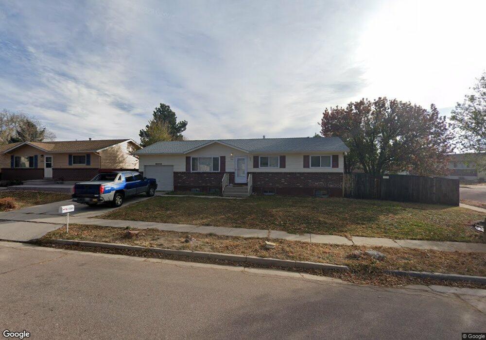
1085 Branding Iron Dr Colorado Springs, CO 80915
Rustic Hills NeighborhoodEstimated Value: $343,100 - $415,000
4
Beds
2
Baths
1,033
Sq Ft
$366/Sq Ft
Est. Value
About This Home
This home is located at 1085 Branding Iron Dr, Colorado Springs, CO 80915 and is currently estimated at $378,275, approximately $366 per square foot. 1085 Branding Iron Dr is a home located in El Paso County with nearby schools including Henry Elementary School, Jack Swigert Aerospace Academy, and Mitchell High School.
Ownership History
Date
Name
Owned For
Owner Type
Purchase Details
Closed on
Jul 9, 2010
Sold by
The Donald V Stites & Carol R Stites Rev
Bought by
Great Mountain Llc
Current Estimated Value
Purchase Details
Closed on
Jan 16, 2008
Sold by
Nuckolls Matthew A and Nuckolls Leanne J
Bought by
The Donald V Stites & Carol R Stites Rev
Purchase Details
Closed on
Jan 5, 2005
Sold by
Pounds Michael P and Pounds Esther J
Bought by
Nuckolls Matthew A and Nuckolls Leanne J
Home Financials for this Owner
Home Financials are based on the most recent Mortgage that was taken out on this home.
Original Mortgage
$157,311
Interest Rate
5.74%
Mortgage Type
VA
Purchase Details
Closed on
Jul 1, 1977
Bought by
Great Mountain Llc
Create a Home Valuation Report for This Property
The Home Valuation Report is an in-depth analysis detailing your home's value as well as a comparison with similar homes in the area
Home Values in the Area
Average Home Value in this Area
Purchase History
| Date | Buyer | Sale Price | Title Company |
|---|---|---|---|
| Great Mountain Llc | $150,000 | None Available | |
| The Donald V Stites & Carol R Stites Rev | $151,300 | Empire Title Of Colorado Spr | |
| Nuckolls Matthew A | $154,000 | North American Title Company | |
| Great Mountain Llc | -- | -- |
Source: Public Records
Mortgage History
| Date | Status | Borrower | Loan Amount |
|---|---|---|---|
| Previous Owner | Nuckolls Matthew A | $157,311 |
Source: Public Records
Tax History Compared to Growth
Tax History
| Year | Tax Paid | Tax Assessment Tax Assessment Total Assessment is a certain percentage of the fair market value that is determined by local assessors to be the total taxable value of land and additions on the property. | Land | Improvement |
|---|---|---|---|---|
| 2025 | $1,321 | $26,790 | -- | -- |
| 2024 | $1,208 | $28,190 | $4,150 | $24,040 |
| 2023 | $1,208 | $28,190 | $4,150 | $24,040 |
| 2022 | $1,058 | $18,910 | $3,340 | $15,570 |
| 2021 | $1,148 | $19,450 | $3,430 | $16,020 |
| 2020 | $1,064 | $15,670 | $3,000 | $12,670 |
| 2019 | $1,058 | $15,670 | $3,000 | $12,670 |
| 2018 | $927 | $12,640 | $2,380 | $10,260 |
| 2017 | $878 | $12,640 | $2,380 | $10,260 |
| 2016 | $693 | $11,960 | $2,310 | $9,650 |
| 2015 | $691 | $11,960 | $2,310 | $9,650 |
| 2014 | $679 | $11,280 | $2,310 | $8,970 |
Source: Public Records
Map
Nearby Homes
- 921 Grissom Dr
- 5452 Hammond Dr
- 888 Endeavor Way
- 863 Endeavor Way
- 831 Endeavor Way
- 834 Grissom Dr
- 5320 Saddle Horn Ave
- 802 Grissom Dr
- 769 Grissom Dr
- 956 Bidwell Dr
- 738 Grissom Dr
- 1044 Doyle Place
- 5330 Silver Spur Ave
- 5375 Babcock Ct
- 5509 Timeless View
- 5102 Galley Rd Unit 136A
- 5102 Galley Rd Unit 520AE
- 5102 Galley Rd Unit 120A
- 1717 van Diest Rd
- 5014 Palmer Park Blvd
- 1095 Branding Iron Dr
- 1088 Branding Iron Cir
- 1105 Branding Iron Dr
- 1079 Branding Iron Cir
- 1083 Branding Iron Cir
- 1080 Branding Iron Dr
- 1102 Branding Iron Cir
- 1075 Branding Iron Dr
- 1070 Branding Iron Dr
- 1087 Branding Iron Cir
- 1115 Branding Iron Dr
- 1114 Branding Iron Cir
- 1091 Branding Iron Cir
- 1065 Branding Iron Dr
- 1045 Wagon Wheel Ave
- 5529 Branding Iron Ct
- 1045Wagon Wheelave
- 1097 Branding Iron Cir
- 1110 Branding Iron Dr
- 1055 Wagon Wheel Ave