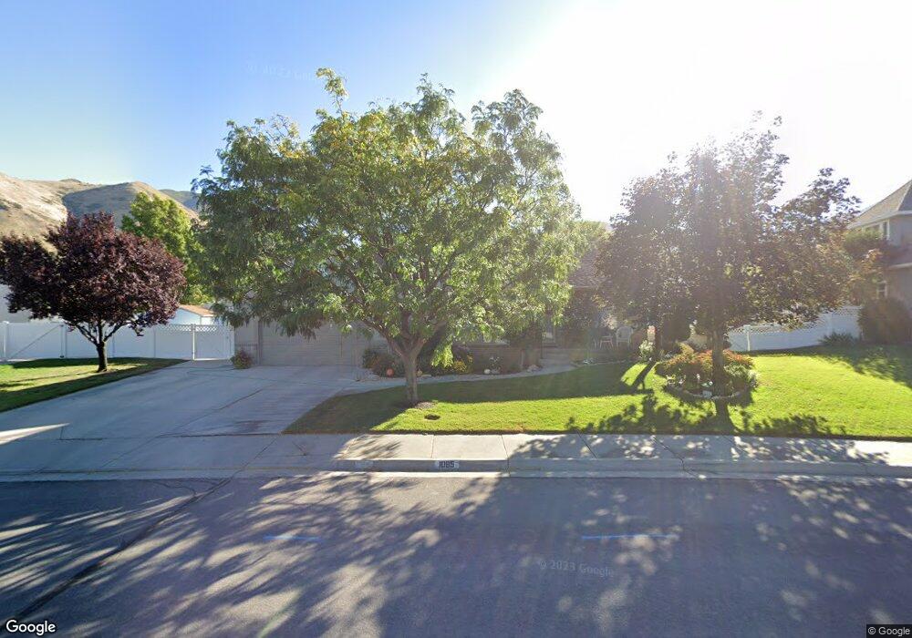
1085 Cranberry Way Springville, UT 84663
East Hobble Creek NeighborhoodEstimated Value: $646,000 - $715,000
3
Beds
2
Baths
1,880
Sq Ft
$355/Sq Ft
Est. Value
About This Home
This home is located at 1085 Cranberry Way, Springville, UT 84663 and is currently estimated at $667,107, approximately $354 per square foot. 1085 Cranberry Way is a home located in Utah County with nearby schools including Hobble Creek School, Springville High School, and Springville Junior High School.
Ownership History
Date
Name
Owned For
Owner Type
Purchase Details
Closed on
Mar 3, 2022
Sold by
Goodrich Michael A
Bought by
Mike And Patti Goodrich Revocable Trust
Current Estimated Value
Purchase Details
Closed on
Jun 28, 1999
Sold by
Corbin Carter Construction Company Inc
Bought by
Goodrich Michael A and Goodrich Patricia A
Home Financials for this Owner
Home Financials are based on the most recent Mortgage that was taken out on this home.
Original Mortgage
$170,300
Interest Rate
7.2%
Create a Home Valuation Report for This Property
The Home Valuation Report is an in-depth analysis detailing your home's value as well as a comparison with similar homes in the area
Home Values in the Area
Average Home Value in this Area
Purchase History
| Date | Buyer | Sale Price | Title Company |
|---|---|---|---|
| Mike And Patti Goodrich Revocable Trust | -- | None Listed On Document | |
| Goodrich Michael A | -- | First American Title Co |
Source: Public Records
Mortgage History
| Date | Status | Borrower | Loan Amount |
|---|---|---|---|
| Previous Owner | Goodrich Michael A | $170,300 |
Source: Public Records
Tax History Compared to Growth
Tax History
| Year | Tax Paid | Tax Assessment Tax Assessment Total Assessment is a certain percentage of the fair market value that is determined by local assessors to be the total taxable value of land and additions on the property. | Land | Improvement |
|---|---|---|---|---|
| 2025 | $3,012 | $312,345 | $257,500 | $310,400 |
| 2024 | $3,012 | $308,550 | $0 | $0 |
| 2023 | $3,040 | $311,740 | $0 | $0 |
| 2022 | $3,467 | $349,195 | $0 | $0 |
| 2021 | $2,952 | $462,700 | $166,800 | $295,900 |
| 2020 | $2,718 | $413,100 | $133,400 | $279,700 |
| 2019 | $2,479 | $383,500 | $129,600 | $253,900 |
| 2018 | $2,397 | $353,900 | $129,600 | $224,300 |
| 2017 | $2,242 | $175,780 | $0 | $0 |
| 2016 | $1,915 | $147,235 | $0 | $0 |
| 2015 | $1,858 | $146,025 | $0 | $0 |
| 2014 | $1,816 | $141,790 | $0 | $0 |
Source: Public Records
Map
Nearby Homes
- 59 E 775 S Unit 21
- 51 E 775 S Unit 20
- 695 E 1700 N
- 662 E 1700 N
- 715 E 1700 N
- 687 S 2080 E
- 2295 E 700 S Unit 8
- 2295 E 700 S Unit 18
- 61 E 750 S Unit 2
- 66 E 750 S Unit 23
- 1567 N 600 E Unit 26
- 868 E 1400 N
- 2541 Stonebury Loop Rd
- 645 S Red Devil Dr
- 2572 Stonebury Loop Rd
- 1206 E 1150 S
- 314 S 1850 E
- 1020 W 2000 N
- 1138 N 1000 E
- 1653 E 300 S
- 1097 S Cranberry Way
- 1077 Cranberry Way
- 1090 Wildflower Way
- 1097 Cranberry Way
- 1080 Wildflower Way
- 1887 River Bottom Rd
- 1943 River Bottom Rd
- 1943 E 900 S
- 1072 Wildflower Way
- 1887 E 900 S
- 1076 Cranberry Way
- 1069 Cranberry Way
- 1875 River Bottom Rd
- 1875 E 900 S
- 1089 Wildflower Way
- 1068 Wildflower Way
- 1062 Cranberry Way
- 1902 E 900 S
- 1099 Wildflower Way
- 1922 E 900 S