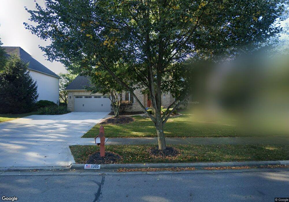
1085 Hooverview Dr Westerville, OH 43082
Genoa NeighborhoodEstimated Value: $541,000 - $609,000
4
Beds
3
Baths
2,538
Sq Ft
$222/Sq Ft
Est. Value
About This Home
This home is located at 1085 Hooverview Dr, Westerville, OH 43082 and is currently estimated at $563,094, approximately $221 per square foot. 1085 Hooverview Dr is a home located in Delaware County with nearby schools including Robert Frost Elementary School, Heritage Middle School, and Westerville-North High School.
Ownership History
Date
Name
Owned For
Owner Type
Purchase Details
Closed on
Sep 21, 1994
Sold by
Volpe Antonio
Bought by
Watts Arthur R and Watts Rebecca M
Current Estimated Value
Home Financials for this Owner
Home Financials are based on the most recent Mortgage that was taken out on this home.
Original Mortgage
$200,000
Interest Rate
8.62%
Mortgage Type
New Conventional
Create a Home Valuation Report for This Property
The Home Valuation Report is an in-depth analysis detailing your home's value as well as a comparison with similar homes in the area
Home Values in the Area
Average Home Value in this Area
Purchase History
| Date | Buyer | Sale Price | Title Company |
|---|---|---|---|
| Watts Arthur R | $230,000 | -- |
Source: Public Records
Mortgage History
| Date | Status | Borrower | Loan Amount |
|---|---|---|---|
| Closed | Watts Arthur R | $200,000 |
Source: Public Records
Tax History Compared to Growth
Tax History
| Year | Tax Paid | Tax Assessment Tax Assessment Total Assessment is a certain percentage of the fair market value that is determined by local assessors to be the total taxable value of land and additions on the property. | Land | Improvement |
|---|---|---|---|---|
| 2024 | $7,691 | $150,960 | $36,050 | $114,910 |
| 2023 | $7,603 | $150,960 | $36,050 | $114,910 |
| 2022 | $7,309 | $112,280 | $22,750 | $89,530 |
| 2021 | $7,372 | $112,280 | $22,750 | $89,530 |
| 2020 | $7,421 | $112,280 | $22,750 | $89,530 |
| 2019 | $6,824 | $98,630 | $22,750 | $75,880 |
| 2018 | $6,709 | $98,630 | $22,750 | $75,880 |
| 2017 | $6,581 | $91,670 | $20,370 | $71,300 |
| 2016 | $6,803 | $91,670 | $20,370 | $71,300 |
| 2015 | $6,507 | $91,670 | $20,370 | $71,300 |
| 2014 | $6,572 | $91,670 | $20,370 | $71,300 |
| 2013 | $6,575 | $91,670 | $20,370 | $71,300 |
Source: Public Records
Map
Nearby Homes
- 1155 Ashford Ct
- 1182 Lake Point
- 203 N Hempstead Rd
- 974 Lakeland Dr
- 8183 Chateau Ln
- 73 Keethler Dr S
- 7356 Park Bend Dr
- 764 Mill Crossing Dr
- 518 Kingfisher Dr
- 6618 Wild Rose Ln
- 6639 Meadow Glen Dr S
- 8357 Danbridge Way
- 90 Spring Creek Dr
- 6460 Bromfield Dr
- 9119 Robinhood Cir
- 763 Kingsmead Rd
- 7524 Center Green Dr
- 1201 Wallean Dr
- 768 Collingwood Dr
- 7663 Rolling Ridge Way
- 1093 Hooverview Dr
- 1075 Hooverview Dr
- 1082 Blue Heron Dr
- 1101 Hooverview Dr
- 1072 Blue Heron Dr
- 484 Havendale Dr
- 1090 Blue Heron Dr
- 1086 Hooverview Dr
- 1096 Hooverview Dr
- 1062 Blue Heron Dr
- 1109 Hooverview Dr
- 1104 Hooverview Dr
- 491 Havendale Dr
- 1096 Blue Heron Dr
- 1052 Blue Heron Dr
- 1112 Hooverview Dr
- 1117 Hooverview Dr
- 1103 Nautilus Place
- 1081 Blue Heron Dr
- 485 Havendale Dr