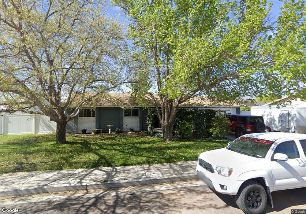
1085 N 1900 W Saint George, UT 84770
Estimated Value: $362,228 - $408,000
3
Beds
2
Baths
1,066
Sq Ft
$353/Sq Ft
Est. Value
About This Home
This home is located at 1085 N 1900 W, Saint George, UT 84770 and is currently estimated at $375,807, approximately $352 per square foot. 1085 N 1900 W is a home located in Washington County with nearby schools including Snow Canyon Middle School, Red Mountain School, and Lava Ridge Intermediate School.
Ownership History
Date
Name
Owned For
Owner Type
Purchase Details
Closed on
Dec 23, 2021
Sold by
Lovewell Jamie Michael and Staheli Tasha Lynn
Bought by
Lovewell Jamie Michael and Staheli Tasha Lynn
Current Estimated Value
Home Financials for this Owner
Home Financials are based on the most recent Mortgage that was taken out on this home.
Original Mortgage
$240,000
Outstanding Balance
$220,737
Interest Rate
3.11%
Mortgage Type
New Conventional
Estimated Equity
$155,070
Purchase Details
Closed on
Jan 8, 2007
Sold by
Fullwood Lionel and Fullwood Gayle
Bought by
Lovewell Jamie Michael and Lovewell Tasha Lynn
Home Financials for this Owner
Home Financials are based on the most recent Mortgage that was taken out on this home.
Original Mortgage
$192,680
Interest Rate
6.16%
Mortgage Type
Seller Take Back
Create a Home Valuation Report for This Property
The Home Valuation Report is an in-depth analysis detailing your home's value as well as a comparison with similar homes in the area
Home Values in the Area
Average Home Value in this Area
Purchase History
| Date | Buyer | Sale Price | Title Company |
|---|---|---|---|
| Lovewell Jamie Michael | -- | First American Foothill | |
| Lovewell Jamie Michael | -- | None Available |
Source: Public Records
Mortgage History
| Date | Status | Borrower | Loan Amount |
|---|---|---|---|
| Open | Lovewell Jamie Michael | $240,000 | |
| Closed | Lovewell Jamie Michael | $192,680 |
Source: Public Records
Tax History Compared to Growth
Tax History
| Year | Tax Paid | Tax Assessment Tax Assessment Total Assessment is a certain percentage of the fair market value that is determined by local assessors to be the total taxable value of land and additions on the property. | Land | Improvement |
|---|---|---|---|---|
| 2025 | $2,060 | $322,000 | $85,000 | $237,000 |
| 2023 | $2,241 | $334,900 | $80,000 | $254,900 |
| 2022 | $2,439 | $342,700 | $80,000 | $262,700 |
| 2021 | $1,138 | $238,500 | $60,000 | $178,500 |
| 2020 | $1,029 | $203,100 | $60,000 | $143,100 |
| 2019 | $975 | $187,900 | $55,000 | $132,900 |
| 2018 | $969 | $93,610 | $0 | $0 |
| 2017 | $1,012 | $78,485 | $0 | $0 |
| 2016 | $720 | $72,765 | $0 | $0 |
| 2015 | $778 | $66,715 | $0 | $0 |
| 2014 | $778 | $67,100 | $0 | $0 |
Source: Public Records
Map
Nearby Homes
- 1840 W 1100 N Unit 28
- 1840 W 1100 N Unit 17
- 1840 W 1100 N Unit 55
- 1782 W 1020 N Unit 133
- 1225 N Dixie Downs Rd Unit 29
- 1225 N Dixie Downs Rd Unit 103
- 1225 N Dixie Downs Rd Unit 52
- 1225 N Dixie Downs Rd Unit 16
- 1225 N Dixie Downs Rd Unit 42
- 1225 N Dixie Downs Rd Unit 136
- 1225 N Dixie Downs Rd Unit 69
- 1225 N Dixie Downs Rd Unit 100
- 1742 W 1020 N Unit 123
- 1793 W 950 N Unit 3
- 2166 W 1010 N Unit 42
- 2157 W 1230 N
- 1331 N Dixie Downs Rd Unit 100
- 1331 N Dixie Downs Rd Unit 56
- 1331 N Dixie Downs Rd Unit 56
- 1811 W 1300 N
- 1073 N Jefferson St
- 1093 N 1900 W
- 1937 W Monroe St
- 1083 N 1900 W
- 1059 N Jefferson St
- 1066 N Jefferson St
- 1951 W Monroe St
- 1098 N Jefferson St
- 1103 N Jefferson St
- 1054 N Jefferson St
- 1957 W Monroe St
- 1124 N Monroe St
- 1105 N Monroe St
- 1045 N Jefferson St
- 1053 N 1900 W
- 1934 W Monroe St
- 1963 W Monroe St
- 1086 N 1900 W
- 1966 W 1030 N
- 1119 N Monroe St