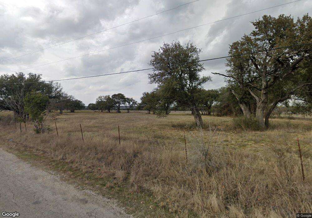
1085 Shattles Rd Mineral Wells, TX 76067
Estimated Value: $475,004 - $1,039,000
--
Bed
--
Bath
6,940
Sq Ft
$97/Sq Ft
Est. Value
About This Home
This home is located at 1085 Shattles Rd, Mineral Wells, TX 76067 and is currently estimated at $670,001, approximately $96 per square foot. 1085 Shattles Rd is a home located in Palo Pinto County with nearby schools including Lamar Elementary School, Travis Elementary School, and Houston Elementary School.
Ownership History
Date
Name
Owned For
Owner Type
Purchase Details
Closed on
Jan 13, 2022
Sold by
Scott Duncan
Bought by
Mccluskey William and Mccluskey Tonya
Current Estimated Value
Home Financials for this Owner
Home Financials are based on the most recent Mortgage that was taken out on this home.
Original Mortgage
$400,000
Outstanding Balance
$368,650
Interest Rate
3.11%
Mortgage Type
VA
Estimated Equity
$301,351
Create a Home Valuation Report for This Property
The Home Valuation Report is an in-depth analysis detailing your home's value as well as a comparison with similar homes in the area
Home Values in the Area
Average Home Value in this Area
Purchase History
| Date | Buyer | Sale Price | Title Company |
|---|---|---|---|
| Mccluskey William | -- | Alamo Title |
Source: Public Records
Mortgage History
| Date | Status | Borrower | Loan Amount |
|---|---|---|---|
| Open | Mccluskey William | $400,000 |
Source: Public Records
Tax History Compared to Growth
Tax History
| Year | Tax Paid | Tax Assessment Tax Assessment Total Assessment is a certain percentage of the fair market value that is determined by local assessors to be the total taxable value of land and additions on the property. | Land | Improvement |
|---|---|---|---|---|
| 2024 | $7,436 | $461,810 | $97,010 | $364,800 |
| 2023 | $7,520 | $448,200 | $83,400 | $364,800 |
| 2022 | $6,639 | $415,010 | $51,060 | $363,950 |
| 2021 | $7,245 | $363,820 | $37,660 | $326,160 |
| 2020 | $6,504 | $297,370 | $28,240 | $269,130 |
| 2019 | $5,814 | $267,540 | $28,240 | $239,300 |
| 2018 | $5,330 | $253,640 | $24,990 | $228,650 |
| 2017 | $4,260 | $202,710 | $23,540 | $179,170 |
| 2016 | $3,289 | $208,240 | $21,730 | $186,510 |
| 2015 | $3,110 | $214,280 | $21,730 | $192,550 |
| 2014 | $3,110 | $214,280 | $21,730 | $192,550 |
Source: Public Records
Map
Nearby Homes
- 3715 Highway 281
- 15 Cliff Dr
- 5 Cliff Dr
- 149 Tatem Hill Rd
- 1408 NE 23rd St
- 156 Tatem Hill Rd
- 2313 Springhill Ct
- 1111 Brazos Dr
- 201 NW 31st St
- 00 Beletta Dr
- tbd Beletta Dr
- 1910 NE 2nd Ave
- 190 Brazos Dr
- 170 Brazos Dr
- 180 Brazos Dr
- 805 Brazos Dr
- 3911 N Highway 281
- 216 NE 19th St
- 87 Ledbetter Rd
- 5210 Laurie Dr
- 3775 Flintrock Dr
- 3300 Kiowa Dr
- 3301 Gunsmoke Dr
- 3300 Gunsmoke Dr
- 3301 Kiowa Dr
- 3303 Kiowa Dr
- 3665 Flintrock Dr
- 3305 Kiowa Dr
- 3307 Kiowa Dr
- 1099 Shattles Rd
- 3309 Kiowa Dr
- 3400 Gunsmoke Dr
- 3300 Apache Dr
- 3306 Apache Dr
- 3302 Apache Dr
- 3401 Gunsmoke Dr
- 3301 Apache Dr
- 3311 Kiowa Dr
- 1285 Shattles Rd
- 1218 Shattles Rd
