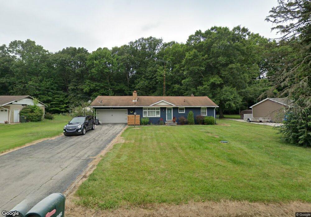
10851 Dot Ave NE Alliance, OH 44601
Estimated Value: $214,112 - $238,000
3
Beds
2
Baths
1,107
Sq Ft
$203/Sq Ft
Est. Value
About This Home
This home is located at 10851 Dot Ave NE, Alliance, OH 44601 and is currently estimated at $225,028, approximately $203 per square foot. 10851 Dot Ave NE is a home located in Stark County with nearby schools including Marlington High School and Regina Coeli/St Joseph School.
Ownership History
Date
Name
Owned For
Owner Type
Purchase Details
Closed on
Mar 5, 2003
Sold by
Weaver Janet Lea
Bought by
Hoops Ronald M
Current Estimated Value
Home Financials for this Owner
Home Financials are based on the most recent Mortgage that was taken out on this home.
Original Mortgage
$119,948
Outstanding Balance
$52,017
Interest Rate
6%
Mortgage Type
FHA
Estimated Equity
$173,011
Purchase Details
Closed on
May 23, 2001
Sold by
Weaver Randy Howard and Weaver Randy H
Bought by
Weaver Janet Lea
Purchase Details
Closed on
Oct 8, 1999
Sold by
Harris Gerald L
Bought by
Weaver Randy H and Weaver Janet L
Home Financials for this Owner
Home Financials are based on the most recent Mortgage that was taken out on this home.
Original Mortgage
$92,150
Interest Rate
7.83%
Mortgage Type
Purchase Money Mortgage
Create a Home Valuation Report for This Property
The Home Valuation Report is an in-depth analysis detailing your home's value as well as a comparison with similar homes in the area
Home Values in the Area
Average Home Value in this Area
Purchase History
| Date | Buyer | Sale Price | Title Company |
|---|---|---|---|
| Hoops Ronald M | $121,000 | Portage Lawyers Title | |
| Weaver Janet Lea | -- | -- | |
| Weaver Randy H | $97,000 | -- |
Source: Public Records
Mortgage History
| Date | Status | Borrower | Loan Amount |
|---|---|---|---|
| Open | Hoops Ronald M | $119,948 | |
| Previous Owner | Weaver Randy H | $92,150 |
Source: Public Records
Tax History Compared to Growth
Tax History
| Year | Tax Paid | Tax Assessment Tax Assessment Total Assessment is a certain percentage of the fair market value that is determined by local assessors to be the total taxable value of land and additions on the property. | Land | Improvement |
|---|---|---|---|---|
| 2025 | $1,938 | $61,640 | $21,880 | $39,760 |
| 2024 | -- | $61,640 | $21,880 | $39,760 |
| 2023 | $2,835 | $47,110 | $11,620 | $35,490 |
| 2022 | $1,665 | $47,110 | $11,620 | $35,490 |
| 2021 | $1,670 | $47,110 | $11,620 | $35,490 |
| 2020 | $1,593 | $40,040 | $10,010 | $30,030 |
| 2019 | $1,582 | $40,040 | $10,010 | $30,030 |
| 2018 | $1,584 | $40,040 | $10,010 | $30,030 |
| 2017 | $1,503 | $35,560 | $9,520 | $26,040 |
| 2016 | $1,542 | $36,470 | $9,520 | $26,950 |
| 2015 | $1,541 | $36,470 | $9,520 | $26,950 |
| 2014 | $1,342 | $30,460 | $7,950 | $22,510 |
| 2013 | $668 | $30,460 | $7,950 | $22,510 |
Source: Public Records
Map
Nearby Homes
- 10666 Wilma Ave NE
- 13334 Cindy St NE
- 0 Meadow St NE
- 12355 Edison St NE
- 11960 Freshley Ave NE
- 11480 Aebi Ave NE
- 13109 Edison St NE
- 12252 Snode St NE
- 0 W Main St Unit 5090123
- 12415 Snode St NE
- 1430 Westwood Ave
- 2081 Marwood Cir
- 000 Klinger Ave
- 0 Reeder Ave NE
- 2377 Ansley St Unit 2377
- 432 Johnson Ave
- 14422 Sturbridge Rd NE
- 0 Homestead Ave NE
- 000 Meadowbrook Ave
- 0 Meadowbrook Ave
- 10831 Dot Ave NE
- 10871 Dot Ave NE
- 10891 Dot Ave NE
- 10811 Dot Ave NE
- 10870 Dot Ave NE
- 10830 Dot Ave NE
- 10791 Dot Ave NE
- 10905 Dot Ave NE
- 10890 Dot Ave NE
- 10790 Dot Ave NE
- 10771 Dot Ave NE
- 10851 Barcus Ave NE
- 10871 Barcus Ave NE
- 10831 Barcus Ave NE
- 10891 Barcus Ave NE
- 10920 Dot Ave NE
- 10811 Barcus Ave NE
- 10770 Dot Ave NE
- 10935 Dot Ave NE
- 10905 Barcus Ave NE