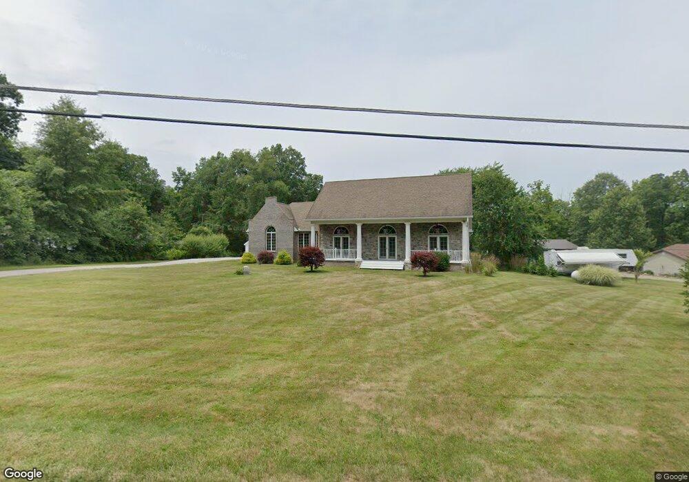
10859 Clapsaddle Ave NE Alliance, OH 44601
Estimated Value: $433,000 - $477,826
3
Beds
2
Baths
1,777
Sq Ft
$254/Sq Ft
Est. Value
About This Home
This home is located at 10859 Clapsaddle Ave NE, Alliance, OH 44601 and is currently estimated at $451,207, approximately $253 per square foot. 10859 Clapsaddle Ave NE is a home located in Stark County with nearby schools including Marlington High School and Regina Coeli/St Joseph School.
Ownership History
Date
Name
Owned For
Owner Type
Purchase Details
Closed on
Jan 9, 2024
Sold by
Lefever William H
Bought by
Ray Matthew and Ray Heather L
Current Estimated Value
Home Financials for this Owner
Home Financials are based on the most recent Mortgage that was taken out on this home.
Original Mortgage
$340,000
Outstanding Balance
$334,422
Interest Rate
7.29%
Mortgage Type
New Conventional
Estimated Equity
$116,785
Purchase Details
Closed on
Jan 16, 1996
Sold by
Hill Patricia B
Bought by
Lefever William H
Create a Home Valuation Report for This Property
The Home Valuation Report is an in-depth analysis detailing your home's value as well as a comparison with similar homes in the area
Home Values in the Area
Average Home Value in this Area
Purchase History
| Date | Buyer | Sale Price | Title Company |
|---|---|---|---|
| Ray Matthew | $425,000 | Heritage Union Title | |
| Lefever William H | $50,000 | -- |
Source: Public Records
Mortgage History
| Date | Status | Borrower | Loan Amount |
|---|---|---|---|
| Open | Ray Matthew | $340,000 | |
| Closed | Lefever William H | -- |
Source: Public Records
Tax History Compared to Growth
Tax History
| Year | Tax Paid | Tax Assessment Tax Assessment Total Assessment is a certain percentage of the fair market value that is determined by local assessors to be the total taxable value of land and additions on the property. | Land | Improvement |
|---|---|---|---|---|
| 2025 | -- | $150,370 | $38,260 | $112,110 |
| 2024 | -- | $147,390 | $38,260 | $109,130 |
| 2023 | $3,853 | $104,410 | $23,870 | $80,540 |
| 2022 | $1,933 | $104,410 | $23,870 | $80,540 |
| 2021 | $3,991 | $107,380 | $23,870 | $83,510 |
| 2020 | $3,570 | $88,030 | $20,060 | $67,970 |
| 2019 | $3,545 | $88,040 | $20,060 | $67,980 |
| 2018 | $3,385 | $88,040 | $20,060 | $67,980 |
| 2017 | $3,403 | $81,850 | $19,820 | $62,030 |
| 2016 | $3,405 | $81,850 | $19,820 | $62,030 |
| 2015 | $3,410 | $81,850 | $19,820 | $62,030 |
| 2014 | $1,214 | $71,340 | $17,260 | $54,080 |
| 2013 | $1,572 | $71,340 | $17,260 | $54,080 |
Source: Public Records
Map
Nearby Homes
- 0 Reeder Ave NE
- 10666 Wilma Ave NE
- 12355 Edison St NE
- 11960 Freshley Ave NE
- 12415 Snode St NE
- 13334 Cindy St NE
- 0 Meadow St NE
- 13109 Edison St NE
- 11480 Aebi Ave NE
- 1430 Westwood Ave
- 2377 Ansley St Unit 2377
- 0 W Main St Unit 5090123
- 2081 Marwood Cir
- 2851 Patriots Path Unit 3D
- 2435 Queensbury Rd
- 000 Klinger Ave
- 0 Valewood Cir Unit 5006281
- 14422 Sturbridge Rd NE
- 432 Johnson Ave
- 0 Easton St NE
- 10893 Clapsaddle Ave NE
- 10829 Clapsaddle Ave NE
- 11206 Clapsaddle Ave NE
- 10838 Clapsaddle Ave NE
- 10785 Clapsaddle Ave NE
- 10785 Clapsaddle Ave NE
- 10870 Clapsaddle Ave NE
- 10790 Clapsaddle Ave NE
- 10953 Clapsaddle Ave NE
- 10861 Clapsaddle Ave NE
- 10970 Clapsaddle Ave NE
- 11067 Clapsaddle Ave NE
- 10770 Clapsaddle Ave NE
- 10730 Clapsaddle Ave NE
- 10690 Clapsaddle Ave NE
- 11028 Clapsaddle Ave NE
- 10636 Clapsaddle Ave NE
- 10566 Clapsaddle Ave NE
- 11095 Clapsaddle Ave NE
- 11124 Clapsaddle Ave NE