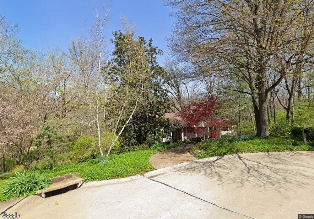
10859 Forest Circle Dr Saint Louis, MO 63128
Estimated Value: $395,413 - $481,000
4
Beds
3
Baths
1,792
Sq Ft
$245/Sq Ft
Est. Value
About This Home
This home is located at 10859 Forest Circle Dr, Saint Louis, MO 63128 and is currently estimated at $439,603, approximately $245 per square foot. 10859 Forest Circle Dr is a home located in St. Louis County with nearby schools including Kennerly Elementary School, Sperreng Middle School, and Lindbergh High School.
Ownership History
Date
Name
Owned For
Owner Type
Purchase Details
Closed on
Jan 29, 2008
Sold by
Sturhahn Joeine Francesca
Bought by
Suda Paul R and Suda Karen J
Current Estimated Value
Home Financials for this Owner
Home Financials are based on the most recent Mortgage that was taken out on this home.
Original Mortgage
$228,000
Outstanding Balance
$143,843
Interest Rate
6.15%
Mortgage Type
Purchase Money Mortgage
Estimated Equity
$295,760
Purchase Details
Closed on
Mar 4, 1999
Sold by
Sturhahn Kent H and Sturhahn Joeine F
Bought by
Sturhahn Joeine F and The Joeine Francesca Sturhahn Revocable
Purchase Details
Closed on
Nov 4, 1997
Sold by
Toscano Sebastian J and Toscano Helen A
Bought by
Sturhahn Kent H and Sturhahn Joeine F
Home Financials for this Owner
Home Financials are based on the most recent Mortgage that was taken out on this home.
Original Mortgage
$60,000
Interest Rate
7.23%
Create a Home Valuation Report for This Property
The Home Valuation Report is an in-depth analysis detailing your home's value as well as a comparison with similar homes in the area
Home Values in the Area
Average Home Value in this Area
Purchase History
| Date | Buyer | Sale Price | Title Company |
|---|---|---|---|
| Suda Paul R | $285,000 | None Available | |
| Sturhahn Joeine F | -- | -- | |
| Sturhahn Kent H | -- | -- |
Source: Public Records
Mortgage History
| Date | Status | Borrower | Loan Amount |
|---|---|---|---|
| Open | Suda Paul R | $228,000 | |
| Previous Owner | Sturhahn Kent H | $60,000 |
Source: Public Records
Tax History Compared to Growth
Tax History
| Year | Tax Paid | Tax Assessment Tax Assessment Total Assessment is a certain percentage of the fair market value that is determined by local assessors to be the total taxable value of land and additions on the property. | Land | Improvement |
|---|---|---|---|---|
| 2025 | $3,861 | $69,920 | $31,180 | $38,740 |
| 2024 | $3,861 | $59,370 | $23,730 | $35,640 |
| 2023 | $3,851 | $59,370 | $23,730 | $35,640 |
| 2022 | $3,150 | $46,610 | $16,970 | $29,640 |
| 2021 | $3,038 | $46,610 | $16,970 | $29,640 |
| 2020 | $3,848 | $56,960 | $19,680 | $37,280 |
| 2019 | $3,838 | $56,960 | $19,680 | $37,280 |
| 2018 | $3,044 | $41,090 | $10,940 | $30,150 |
| 2017 | $3,010 | $41,090 | $10,940 | $30,150 |
| 2016 | $2,652 | $34,370 | $10,940 | $23,430 |
| 2015 | $2,613 | $34,370 | $10,940 | $23,430 |
| 2014 | $2,789 | $36,340 | $13,410 | $22,930 |
Source: Public Records
Map
Nearby Homes
- 10610 Deerpath Acres Ct
- 12817 Pointe Dr
- 11226 Pointe Ct
- 12224 Bird Haven Ln
- 10755 Kennerly Rd
- 9918 Benbury Ct Unit 1D
- 5512 & 5516 Elk Valley Estates Dr
- 5507 Elk Valley Estates Dr
- 10000 Hilltop Dr
- 10315 Kennerly Rd
- 10336 Bauer Rd
- 10016 Schuessler Rd
- 10652 Roanna Ln
- 115 Harbor Ct
- 10627 Leebur Dr
- 12830 Weber Hill Rd
- 13310 W Watson Rd
- 1010 Winter Lake Dr
- 546 Gravois Rd
- 166 Samarra Estates Dr Unit G
- 10845 Forest Circle Dr
- 10870 Woodforest Dr
- 10846 Forest Circle Dr
- 10833 Forest Circle Dr
- 10834 Forest Circle Dr
- 10834 Forest Circle Dr Unit L
- 10844 Woodforest Dr
- 10825 Forest Circle Dr
- 10822 Forest Circle Dr
- 10847 Woodforest Dr
- 10828 Woodforest Dr
- 10814 Forest Circle Dr
- 10817 Forest Path Dr
- 10839 Woodforest Dr
- 10803 Forest Circle Dr
- 10820 Woodforest Dr
- 10824 Forest Path Dr
- 10831 Woodforest Dr
- 10809 Forest Path Dr
- 10823 Woodforest Dr