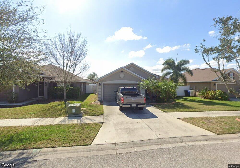
10859 Kirkwall Port Dr Wimauma, FL 33598
Estimated Value: $282,000 - $327,000
4
Beds
2
Baths
2,424
Sq Ft
$129/Sq Ft
Est. Value
About This Home
This home is located at 10859 Kirkwall Port Dr, Wimauma, FL 33598 and is currently estimated at $313,431, approximately $129 per square foot. 10859 Kirkwall Port Dr is a home located in Hillsborough County with nearby schools including Summer High School, Shields Middle School, and Creekside Charter Academy.
Ownership History
Date
Name
Owned For
Owner Type
Purchase Details
Closed on
Mar 21, 2017
Sold by
Heisler Richard R
Bought by
Salmon John R and Salmon Lori A
Current Estimated Value
Home Financials for this Owner
Home Financials are based on the most recent Mortgage that was taken out on this home.
Original Mortgage
$178,571
Outstanding Balance
$148,409
Interest Rate
4.25%
Mortgage Type
FHA
Estimated Equity
$165,022
Purchase Details
Closed on
Aug 28, 2014
Sold by
Adams Homes Of Northwest Florida Inc
Bought by
Heisler Richard R
Create a Home Valuation Report for This Property
The Home Valuation Report is an in-depth analysis detailing your home's value as well as a comparison with similar homes in the area
Home Values in the Area
Average Home Value in this Area
Purchase History
| Date | Buyer | Sale Price | Title Company |
|---|---|---|---|
| Salmon John R | $187,500 | First American Title Ins Co | |
| Heisler Richard R | $190,900 | Paramount Title |
Source: Public Records
Mortgage History
| Date | Status | Borrower | Loan Amount |
|---|---|---|---|
| Open | Salmon John R | $178,571 |
Source: Public Records
Tax History Compared to Growth
Tax History
| Year | Tax Paid | Tax Assessment Tax Assessment Total Assessment is a certain percentage of the fair market value that is determined by local assessors to be the total taxable value of land and additions on the property. | Land | Improvement |
|---|---|---|---|---|
| 2024 | $4,735 | $173,645 | -- | -- |
| 2023 | $4,569 | $168,587 | $0 | $0 |
| 2022 | $4,203 | $163,677 | $0 | $0 |
| 2021 | $4,167 | $158,910 | $0 | $0 |
| 2020 | $4,081 | $156,716 | $0 | $0 |
| 2019 | $3,986 | $153,193 | $41,055 | $112,138 |
| 2018 | $4,174 | $163,248 | $0 | $0 |
| 2017 | $4,668 | $147,174 | $0 | $0 |
| 2016 | $3,930 | $142,970 | $0 | $0 |
| 2015 | $4,148 | $150,461 | $0 | $0 |
| 2014 | $2,508 | $19,367 | $0 | $0 |
| 2013 | -- | $17,606 | $0 | $0 |
Source: Public Records
Map
Nearby Homes
- 10909 Kirkwall Port Dr
- 14308 Edinburgh Moor Dr
- 14344 Edinburgh Moor Dr
- 10915 Dunscore Cottage Way
- 10540 Carloway Hills Dr
- 14613 Brogan Castle Place
- 14211 Edinburgh Moor Dr
- 10639 Carloway Hills Dr
- 10836 Standing Stone Dr
- 14715 Scottburgh Glen Dr
- 10646 Standing Stone Dr
- 10944 Rainbow Pyrite Dr
- 14704 Scottburgh Glen Dr
- 10649 Standing Stone Dr
- 10707 Standing Stone Dr
- 10429 Carloway Hills Dr
- 14403 Dunrobin Dr
- 14460 English Lavender Dr
- 14475 English Lavender Dr
- 14417 Barley Field Dr
- 10901 Kirkwall Port Dr
- 10857 Kirkwall Port Dr
- 10903 Kirkwall Port Dr
- 10855 Kirkwall Port Dr
- 10886 Standing Stone Dr
- 10905 Kirkwall Port Dr
- 10904 Standing Stone Dr
- 10882 Standing Stone Dr
- 10853 Kirkwall Port Dr
- 10858 Kirkwall Port Dr
- 10884 Standing Stone Dr
- 10856 Kirkwall Port Dr
- 10902 Kirkwall Port Dr
- 10906 Standing Stone Dr
- 10880 Standing Stone Dr
- 10854 Kirkwall Port Dr
- 10907 Kirkwall Port Dr
- 10904 Kirkwall Port Dr
- 10851 Kirkwall Port Dr
- 10908 Standing Stone Dr