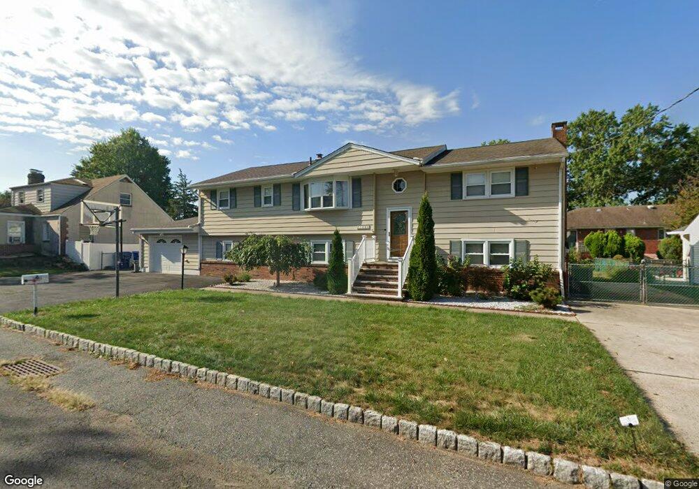
1086 Apache St North Brunswick, NJ 08902
Estimated Value: $651,739 - $1,007,000
5
Beds
2
Baths
3,170
Sq Ft
$252/Sq Ft
Est. Value
About This Home
This home is located at 1086 Apache St, North Brunswick, NJ 08902 and is currently estimated at $797,685, approximately $251 per square foot. 1086 Apache St is a home located in Middlesex County with nearby schools including John Adams Elementary School, Linwood Middle School, and North Brunswick Twp High School.
Ownership History
Date
Name
Owned For
Owner Type
Purchase Details
Closed on
Jun 16, 1998
Sold by
Grinaway Bryan
Bought by
Rosado Carmen
Current Estimated Value
Home Financials for this Owner
Home Financials are based on the most recent Mortgage that was taken out on this home.
Original Mortgage
$140,000
Interest Rate
6.92%
Purchase Details
Closed on
May 14, 1997
Sold by
Grinaway Thomas
Bought by
Grinaay Bryan
Home Financials for this Owner
Home Financials are based on the most recent Mortgage that was taken out on this home.
Original Mortgage
$165,000
Interest Rate
8.08%
Create a Home Valuation Report for This Property
The Home Valuation Report is an in-depth analysis detailing your home's value as well as a comparison with similar homes in the area
Home Values in the Area
Average Home Value in this Area
Purchase History
| Date | Buyer | Sale Price | Title Company |
|---|---|---|---|
| Rosado Carmen | $204,000 | -- | |
| Grinaay Bryan | $210,000 | -- |
Source: Public Records
Mortgage History
| Date | Status | Borrower | Loan Amount |
|---|---|---|---|
| Previous Owner | Rosado Carmen | $140,000 | |
| Previous Owner | Grinaay Bryan | $165,000 |
Source: Public Records
Tax History Compared to Growth
Tax History
| Year | Tax Paid | Tax Assessment Tax Assessment Total Assessment is a certain percentage of the fair market value that is determined by local assessors to be the total taxable value of land and additions on the property. | Land | Improvement |
|---|---|---|---|---|
| 2025 | $11,398 | $179,900 | $58,000 | $121,900 |
| 2024 | $11,193 | $179,900 | $58,000 | $121,900 |
| 2023 | $11,193 | $179,900 | $58,000 | $121,900 |
| 2022 | $10,812 | $179,900 | $58,000 | $121,900 |
| 2021 | $7,878 | $179,900 | $58,000 | $121,900 |
| 2020 | $10,409 | $179,900 | $58,000 | $121,900 |
| 2019 | $10,197 | $179,900 | $58,000 | $121,900 |
| 2018 | $9,988 | $179,900 | $58,000 | $121,900 |
| 2017 | $9,812 | $179,900 | $58,000 | $121,900 |
| 2016 | $9,607 | $179,900 | $58,000 | $121,900 |
| 2015 | $9,443 | $179,900 | $58,000 | $121,900 |
| 2014 | $9,337 | $179,900 | $58,000 | $121,900 |
Source: Public Records
Map
Nearby Homes
- 1067 Grove St
- 1 Michael Ct
- 18 Sheffield Ct
- 84 Clay St
- 1074 Schmidt Ln
- 4511 Birchwood Ct
- 38 Brighton Way Unit H2
- 4201 Birchwood Ct
- 174 Nathan Dr
- 280 Willowbrook Dr
- 1027 Schmidt Ln
- 17 David Dr
- 3910 Birchwood Ct
- 3807 Birchwood Ct
- 320 Willowbrook Dr
- 1008 Schmidt Ln
- 1632 Hudson Ave
- 66 Riverbend Dr
- 464 Northam Dr
- 448 Northam Dr Unit A3