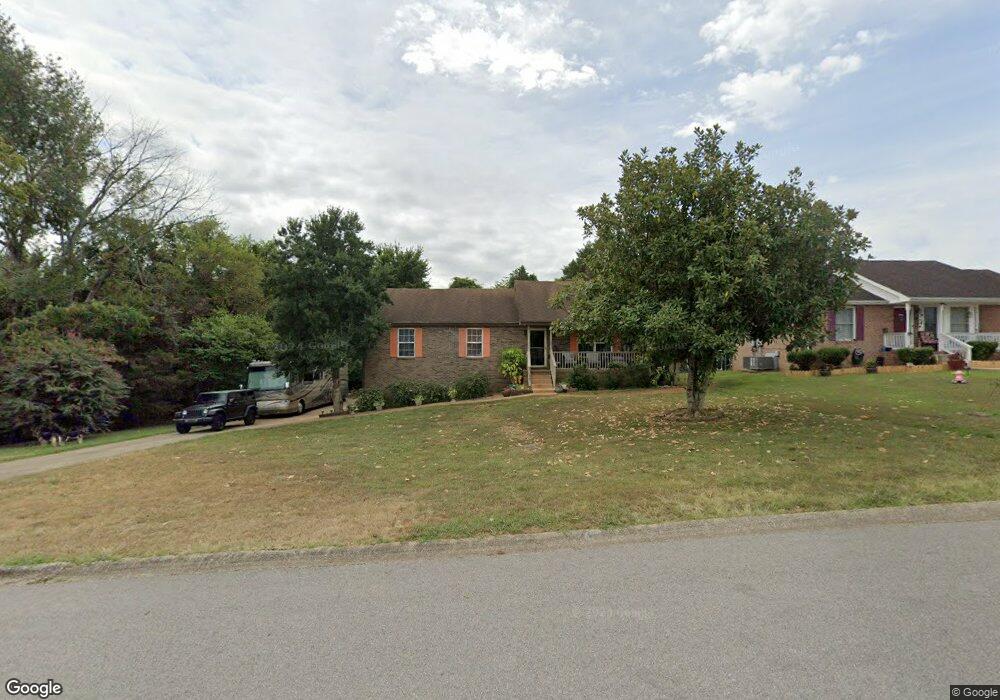
1086 Bobcat Dr Clarksville, TN 37042
Peachtree NeighborhoodEstimated Value: $271,000 - $302,917
Studio
2
Baths
2,008
Sq Ft
$142/Sq Ft
Est. Value
About This Home
This home is located at 1086 Bobcat Dr, Clarksville, TN 37042 and is currently estimated at $284,229, approximately $141 per square foot. 1086 Bobcat Dr is a home located in Montgomery County with nearby schools including West Creek Elementary School, Kenwood Middle School, and Kenwood High School.
Ownership History
Date
Name
Owned For
Owner Type
Purchase Details
Closed on
Apr 12, 2012
Sold by
Harbinson Jerome F
Bought by
Lane Leonard L
Current Estimated Value
Home Financials for this Owner
Home Financials are based on the most recent Mortgage that was taken out on this home.
Original Mortgage
$118,665
Outstanding Balance
$82,156
Interest Rate
3.96%
Mortgage Type
VA
Estimated Equity
$202,073
Purchase Details
Closed on
Apr 18, 2011
Sold by
Stovall Dick B
Bought by
Harbinson Jerome F and Harbinson Christine T
Purchase Details
Closed on
Feb 2, 2006
Sold by
Tierney Karyn Sub & Tr
Bought by
Secretary Of Housing And Urban
Purchase Details
Closed on
Sep 24, 1999
Sold by
Mark Young J
Bought by
Stovall Dick B
Purchase Details
Closed on
May 21, 1999
Sold by
Mark Young
Bought by
Mark Young J
Create a Home Valuation Report for This Property
The Home Valuation Report is an in-depth analysis detailing your home's value as well as a comparison with similar homes in the area
Home Values in the Area
Average Home Value in this Area
Purchase History
| Date | Buyer | Sale Price | Title Company |
|---|---|---|---|
| Lane Leonard L | $146,500 | -- | |
| Harbinson Jerome F | $135,000 | -- | |
| Secretary Of Housing And Urban | -- | -- | |
| Stovall Dick B | $97,900 | -- | |
| Mark Young J | -- | -- |
Source: Public Records
Mortgage History
| Date | Status | Borrower | Loan Amount |
|---|---|---|---|
| Open | Lane Leonard L | $118,665 |
Source: Public Records
Tax History
| Year | Tax Paid | Tax Assessment Tax Assessment Total Assessment is a certain percentage of the fair market value that is determined by local assessors to be the total taxable value of land and additions on the property. | Land | Improvement |
|---|---|---|---|---|
| 2024 | $2,359 | $78,100 | $0 | $0 |
| 2023 | $2,327 | $43,800 | $0 | $0 |
| 2022 | $1,849 | $43,800 | $0 | $0 |
| 2021 | $1,849 | $43,800 | $0 | $0 |
| 2020 | $1,781 | $44,300 | $0 | $0 |
| 2019 | $1,781 | $44,300 | $0 | $0 |
| 2018 | $1,643 | $37,050 | $0 | $0 |
| 2017 | $473 | $38,125 | $0 | $0 |
| 2016 | $1,170 | $38,125 | $0 | $0 |
| 2015 | $1,607 | $38,125 | $0 | $0 |
| 2014 | $1,585 | $38,125 | $0 | $0 |
| 2013 | $1,536 | $35,075 | $0 | $0 |
Source: Public Records
Map
Nearby Homes
- 1066 Bobcat Dr
- 1354 Whitt Ln
- 1315 Chucker Dr
- 1307 Sharptail Trail
- 1116 Gunpoint Dr
- 1108 Gunpoint Dr
- 1097 Gunpoint Dr
- 1419 McClardy Rd
- 1412 McClardy Rd
- 657 Peachers Mill Rd
- 1000 Monica Dr
- 854 Burley Barn Rd
- 858 Burley Barn Rd
- 1022 Harding Dr
- 864 Burley Barn Rd
- 901 Lindsey Dr
- 1540 Buchanon Dr
- 853 Burley Barn Rd
- 857 Burley Barn Rd
- 307 Griffey Estates
Your Personal Tour Guide
Ask me questions while you tour the home.