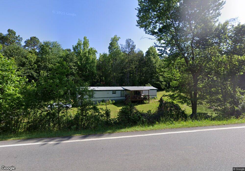
1086 Duncan Bridge Rd Cornelia, GA 30531
Estimated Value: $151,361 - $235,000
2
Beds
1
Bath
844
Sq Ft
$244/Sq Ft
Est. Value
About This Home
This home is located at 1086 Duncan Bridge Rd, Cornelia, GA 30531 and is currently estimated at $205,840, approximately $243 per square foot. 1086 Duncan Bridge Rd is a home located in Habersham County with nearby schools including Baldwin Elementary School, South Habersham Middle School, and Habersham Success Academy.
Ownership History
Date
Name
Owned For
Owner Type
Purchase Details
Closed on
May 1, 2023
Sold by
Llf Rentals Llc
Bought by
Meadowbrook Ridge Llc
Current Estimated Value
Purchase Details
Closed on
Mar 14, 2019
Sold by
Free Lenell Ferguson
Bought by
Llf Rentals Llc
Purchase Details
Closed on
Sep 11, 2014
Sold by
Ferguson Carroll Hubert Es
Bought by
Free Lenell Ferguson
Create a Home Valuation Report for This Property
The Home Valuation Report is an in-depth analysis detailing your home's value as well as a comparison with similar homes in the area
Home Values in the Area
Average Home Value in this Area
Purchase History
| Date | Buyer | Sale Price | Title Company |
|---|---|---|---|
| Meadowbrook Ridge Llc | $170,000 | -- | |
| Llf Rentals Llc | -- | -- | |
| Free Lenell Ferguson | $180,000 | -- |
Source: Public Records
Tax History Compared to Growth
Tax History
| Year | Tax Paid | Tax Assessment Tax Assessment Total Assessment is a certain percentage of the fair market value that is determined by local assessors to be the total taxable value of land and additions on the property. | Land | Improvement |
|---|---|---|---|---|
| 2025 | $1,599 | $48,978 | $25,808 | $23,170 |
| 2024 | $653 | $25,148 | $16,440 | $8,708 |
| 2023 | $588 | $23,536 | $16,440 | $7,096 |
| 2022 | $478 | $18,332 | $12,332 | $6,000 |
| 2021 | $456 | $17,580 | $12,332 | $5,248 |
| 2020 | $451 | $16,776 | $12,332 | $4,444 |
| 2019 | $452 | $16,776 | $12,332 | $4,444 |
| 2018 | $448 | $16,776 | $12,332 | $4,444 |
| 2017 | $0 | $16,804 | $12,332 | $4,472 |
| 2016 | $438 | $42,010 | $12,332 | $4,472 |
| 2015 | $433 | $42,010 | $12,332 | $4,472 |
| 2014 | $448 | $42,670 | $12,332 | $4,736 |
| 2013 | -- | $17,068 | $12,332 | $4,736 |
Source: Public Records
Map
Nearby Homes
- 179 Sunset Oaks Dr
- 190 Sunset Oaks Dr
- 1246 Duncan Bridge Rd
- 429 Hubert Harris Rd
- 0 State Route 365 Unit 10496178
- 0 State Route 365 Unit 10496183
- 0 Hubert Harris
- 0 Apple Pie Ridge Rd Unit TRACT ONE
- 0 Apple Pie Ridge Rd Unit TRACT TWO
- 290 Magnolia Villas Dr
- 490 Magnolia Grove Place
- 478 Magnolia Grove Place
- 150 Magnolia Villas Dr
- Plan 2628 at Magnolia Villas
- Plan 1709 at Magnolia Villas
- Plan 1522 at Magnolia Villas
- Plan 2030 at Magnolia Villas
- Plan 1727 at Magnolia Villas
- Plan 1634 at Magnolia Villas
- Plan 2709 at Magnolia Villas
- 106 Sunset Oaks Dr
- 1184 Duncan Bridge Rd
- 2731 B C Grant Rd
- 2731 Bc Grant Rd
- 1137 Duncan Bridge Rd
- 2137 B C Grant Rd
- 1202 Duncan Bridge Rd
- 120 Sunset Oaks Dr
- 112 Sunset Oaks Dr
- 2585 B C Grant Rd
- 2767 B C Grant Rd
- 2767 Bc Grant Rd
- 119 Sunset Oaks Dr
- 138 Sunset Oaks Dr
- 2553 B C Grant Rd
- 156 Sunset Oaks Dr
- 123 Sunset Oaks Dr
- 162 Sunset Oaks Dr Unit 16
- 162 Sunset Oaks Dr
- 2829 Bc Grant Rd