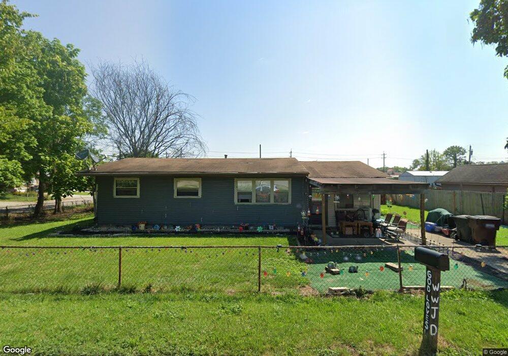
10866 Ruth Ave Cincinnati, OH 45231
Mount Healthy Heights NeighborhoodEstimated Value: $213,000 - $311,000
3
Beds
1
Bath
--
Sq Ft
5,053
Sq Ft Lot
About This Home
This home is located at 10866 Ruth Ave, Cincinnati, OH 45231 and is currently estimated at $262,000. 10866 Ruth Ave is a home located in Hamilton County with nearby schools including Mt Healthy High School, Hamilton County Mathematics and Science Academy, and Central Montessori Academy.
Ownership History
Date
Name
Owned For
Owner Type
Purchase Details
Closed on
Dec 30, 2004
Sold by
Clark Devore
Bought by
Bryson Jackie C
Current Estimated Value
Home Financials for this Owner
Home Financials are based on the most recent Mortgage that was taken out on this home.
Original Mortgage
$74,400
Outstanding Balance
$45,230
Interest Rate
8.99%
Mortgage Type
Fannie Mae Freddie Mac
Estimated Equity
$216,770
Purchase Details
Closed on
Sep 17, 2004
Sold by
National City Home Loan Services Inc
Bought by
Clark Devore
Home Financials for this Owner
Home Financials are based on the most recent Mortgage that was taken out on this home.
Original Mortgage
$59,625
Interest Rate
5.77%
Mortgage Type
Unknown
Purchase Details
Closed on
Jun 4, 2004
Sold by
Eisenecher George R and Eisenecher Catherine M
Bought by
National City Home Loan Services Inc
Create a Home Valuation Report for This Property
The Home Valuation Report is an in-depth analysis detailing your home's value as well as a comparison with similar homes in the area
Home Values in the Area
Average Home Value in this Area
Purchase History
| Date | Buyer | Sale Price | Title Company |
|---|---|---|---|
| Bryson Jackie C | $93,000 | Vantage Land Title | |
| Clark Devore | $48,500 | Metropolitan Title Company | |
| National City Home Loan Services Inc | $46,000 | -- |
Source: Public Records
Mortgage History
| Date | Status | Borrower | Loan Amount |
|---|---|---|---|
| Open | Bryson Jackie C | $74,400 | |
| Previous Owner | Clark Devore | $59,625 |
Source: Public Records
Tax History Compared to Growth
Tax History
| Year | Tax Paid | Tax Assessment Tax Assessment Total Assessment is a certain percentage of the fair market value that is determined by local assessors to be the total taxable value of land and additions on the property. | Land | Improvement |
|---|---|---|---|---|
| 2024 | $119 | $1,946 | $1,946 | -- |
| 2023 | $111 | $1,946 | $1,946 | $0 |
| 2022 | $135 | $1,715 | $1,715 | $0 |
| 2021 | $135 | $1,715 | $1,715 | $0 |
| 2020 | $133 | $1,715 | $1,715 | $0 |
| 2019 | $130 | $1,558 | $1,558 | $0 |
| 2018 | $130 | $1,558 | $1,558 | $0 |
| 2017 | $126 | $1,558 | $1,558 | $0 |
| 2016 | $150 | $1,810 | $1,810 | $0 |
| 2015 | $148 | $1,810 | $1,810 | $0 |
| 2014 | $148 | $1,810 | $1,810 | $0 |
| 2013 | $174 | $2,181 | $2,181 | $0 |
Source: Public Records
Map
Nearby Homes
- 2465 Wilson Ave
- 10804 Sprucehill Dr
- 2508 Wilson Ave
- 2696 Washington Ave
- 10762 Pippin Rd
- 10908 Tangleberry Ct
- 1890 Lotushill Dr
- 2845 Wilson Ave
- 2882 Wilson Ave
- 2717 Merrittview Ln
- 2504 Houston Rd
- 2504 Houston Rd Unit 1
- 2936 Butterwick Dr
- 2502 Houston Rd
- 2502 Houston Rd Unit 2
- 10443 Burlington Rd
- 2474 Houston Rd
- 2474 Houston Rd Unit 11
- 2000 Struble Rd
- 2472 Houston Rd Unit 12
- 2235 Wilson Ave
- 2268 Grant Ave
- 10856 Ruth Ave
- 2275 Wilson Ave
- 2238 Grant Ave
- 2266 Wilson Ave
- 2269 Grant Ave
- 2290 Grant Ave
- 2241 Grant Ave
- 2265 Grant Ave
- 2235 Grant Ave
- 2273 Grant Ave
- 2231 Grant Ave
- 2296 Grant Ave
- 2295 Wilson Ave
- 10891 Hamilton Ave
- 2281 Grant Ave
- 2209 Grant Ave
- 2305 Wilson Ave
- 2236 Roosevelt Ave