Estimated Value: $266,658 - $619,000
--
Bed
--
Bath
--
Sq Ft
7,013
Sq Ft Lot
About This Home
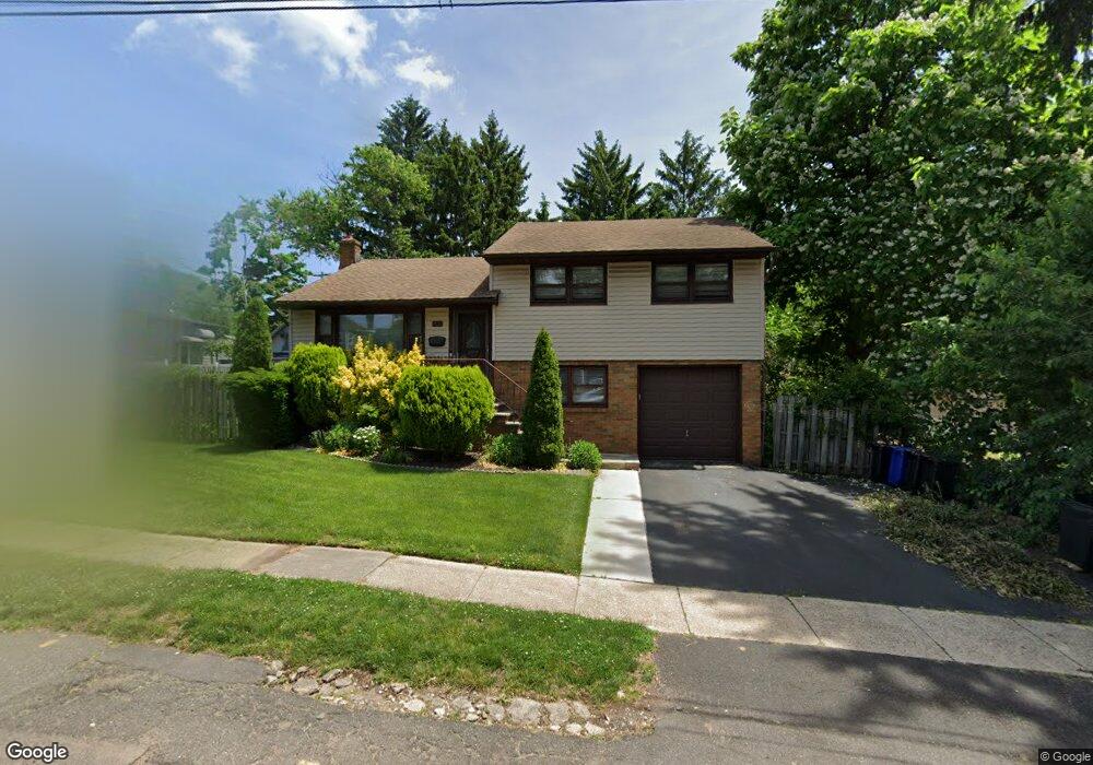
This home is located at 1087 Dawes Ave, Union, NJ 07083 and is currently estimated at $506,915. 1087 Dawes Ave is a home located in Union County with nearby schools including Connecticut Farms Elementary School, Union High School, and St Michael Parish School.
Ownership History
Date
Name
Owned For
Owner Type
Purchase Details
Closed on
Dec 1, 1999
Sold by
Bruno Thomas Michael and Bruno Diana
Bought by
Mobley Gary and Austin Jamie
Current Estimated Value
Home Financials for this Owner
Home Financials are based on the most recent Mortgage that was taken out on this home.
Original Mortgage
$155,500
Outstanding Balance
$48,679
Interest Rate
7.86%
Estimated Equity
$458,236
Purchase Details
Closed on
Apr 15, 1996
Sold by
Loboda Linda Richter and Richter Adeline
Bought by
Bruno Thomas Michael
Create a Home Valuation Report for This Property
The Home Valuation Report is an in-depth analysis detailing your home's value as well as a comparison with similar homes in the area
Home Values in the Area
Average Home Value in this Area
Purchase History
| Date | Buyer | Sale Price | Title Company |
|---|---|---|---|
| Mobley Gary | $176,500 | -- | |
| Bruno Thomas Michael | $139,000 | -- |
Source: Public Records
Mortgage History
| Date | Status | Borrower | Loan Amount |
|---|---|---|---|
| Open | Mobley Gary | $155,500 |
Source: Public Records
Tax History Compared to Growth
Tax History
| Year | Tax Paid | Tax Assessment Tax Assessment Total Assessment is a certain percentage of the fair market value that is determined by local assessors to be the total taxable value of land and additions on the property. | Land | Improvement |
|---|---|---|---|---|
| 2025 | $11,868 | $53,100 | $21,800 | $31,300 |
| 2024 | $11,506 | $53,100 | $21,800 | $31,300 |
| 2023 | $11,506 | $53,100 | $21,800 | $31,300 |
| 2022 | $11,106 | $53,100 | $21,800 | $31,300 |
| 2021 | $10,837 | $53,100 | $21,800 | $31,300 |
| 2020 | $10,621 | $53,100 | $21,800 | $31,300 |
| 2019 | $10,478 | $53,100 | $21,800 | $31,300 |
| 2018 | $10,300 | $53,100 | $21,800 | $31,300 |
| 2017 | $10,147 | $53,100 | $21,800 | $31,300 |
| 2016 | $9,341 | $50,100 | $21,800 | $28,300 |
| 2015 | $9,186 | $50,100 | $21,800 | $28,300 |
| 2014 | $8,980 | $50,100 | $21,800 | $28,300 |
Source: Public Records
Map
Nearby Homes
- 152 Glenwood Ct
- 1848 Portsmouth Way
- 1239 Victor Ave
- 1893 Arbor Ln
- 1263 Coolidge Ave
- 1287 Oxford Ln
- 1764 Colgate Place
- 1244 Grandview Ave
- 843 Boyd Ave
- 1871 Pilgrim Way
- 987 Floyd Terrace
- 2010 Gless Ave
- 112 Apple Tree Ln
- 1249 Plane St
- 926 Floyd Terrace
- 2021 Tyler St
- 1040 Cranbrook Rd
- 7 Jessica Ln
- 1535 Gregory Ave
- 1534 Julian Terrace
- 1824 Vauxhall Rd
- 1828 Vauxhall Rd
- 125 Borinsky Ln
- 1081 Dawes Ave
- 121 Borinsky Ln
- 129 Borinsky Ln
- 117 Borinsky Ln
- 1075 Dawes Ave
- 1834 Vauxhall Rd
- 1084 Dawes Ave
- 1088 Dawes Ave
- 1082 Dawes Ave
- 1082 Dawes Ave Unit 2
- 113 Borinsky Ln
- 1838 Vauxhall Rd
- 1072 Dawes Ave
- 1827 Vauxhall Rd
- 1835 Vauxhall Rd
- 1842 Vauxhall Rd
- 1823 Vauxhall Rd