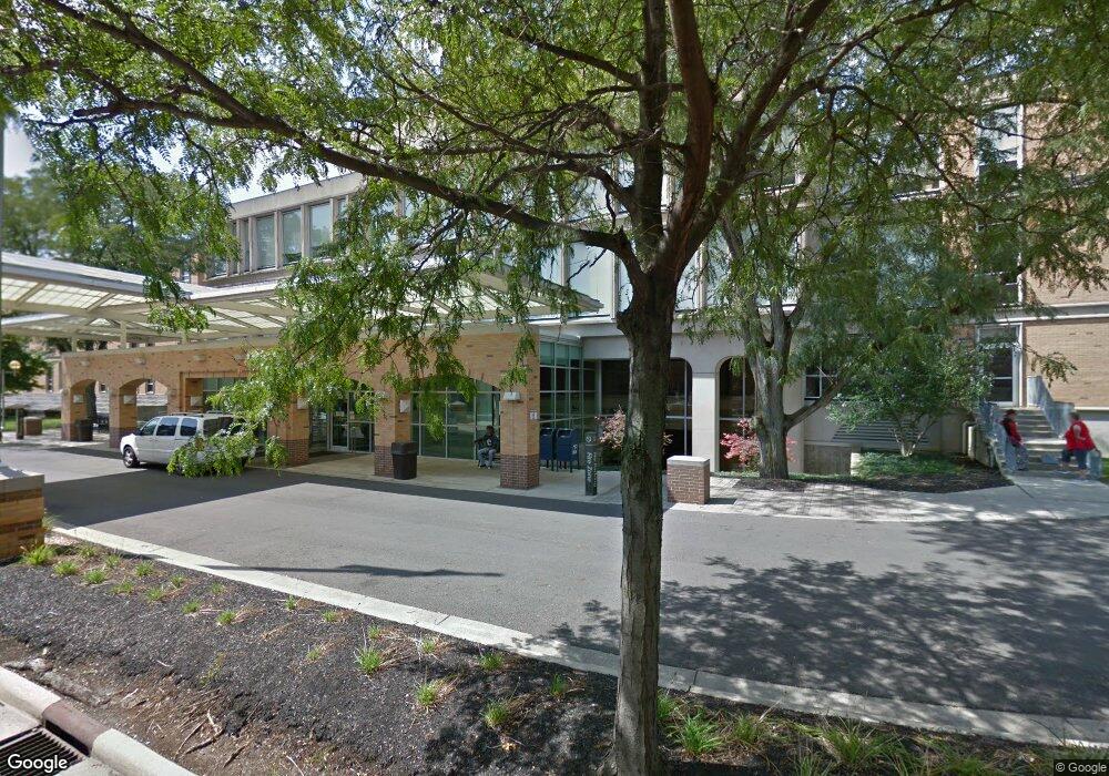
1087 Dennison Ave Unit LOBB Columbus, OH 43201
Victorian Village Neighborhood
--
Bed
--
Bath
228,724
Sq Ft
5.61
Acres
About This Home
This home is located at 1087 Dennison Ave Unit LOBB, Columbus, OH 43201. 1087 Dennison Ave Unit LOBB is a home located in Franklin County with nearby schools including Hubbard Elementary School, Dominion Middle School, and Whetstone High School.
Ownership History
Date
Name
Owned For
Owner Type
Purchase Details
Closed on
May 28, 1993
Bought by
Doctors Hospital
Create a Home Valuation Report for This Property
The Home Valuation Report is an in-depth analysis detailing your home's value as well as a comparison with similar homes in the area
Home Values in the Area
Average Home Value in this Area
Purchase History
| Date | Buyer | Sale Price | Title Company |
|---|---|---|---|
| Doctors Hospital | -- | -- |
Source: Public Records
Tax History Compared to Growth
Tax History
| Year | Tax Paid | Tax Assessment Tax Assessment Total Assessment is a certain percentage of the fair market value that is determined by local assessors to be the total taxable value of land and additions on the property. | Land | Improvement |
|---|---|---|---|---|
| 2024 | $692,515 | $9,330,270 | $854,530 | $8,475,740 |
| 2023 | $681,558 | $9,330,270 | $854,530 | $8,475,740 |
| 2022 | $603,010 | $8,040,910 | $936,150 | $7,104,760 |
| 2021 | $1,014,865 | $13,475,050 | $936,150 | $12,538,900 |
| 2020 | $1,007,906 | $13,475,050 | $936,150 | $12,538,900 |
| 2019 | $1,008,910 | $12,250,010 | $851,030 | $11,398,980 |
| 2018 | $765,539 | $12,250,010 | $851,030 | $11,398,980 |
| 2017 | $1,007,760 | $12,250,010 | $851,030 | $11,398,980 |
| 2016 | $927,057 | $10,652,750 | $851,030 | $9,801,720 |
| 2015 | $972,546 | $12,036,610 | $851,030 | $11,185,580 |
| 2014 | $972,102 | $12,036,610 | $851,030 | $11,185,580 |
| 2013 | $449,633 | $11,236,295 | $427,315 | $10,808,980 |
Source: Public Records
Map
Nearby Homes
- 1025 Hunter Ave
- 1001 Dennison Ave
- 998 Ewing Alley Unit 998
- 162 E 2nd Ave
- 1042 Neil Ave
- 30 W 4th Ave
- 18 W 4th Ave
- 986 Highland St
- 17 W 3rd Ave Unit 212
- 17 W 3rd Ave Unit 213
- 969 Hunter Ave
- 1016 Neil Ave
- 1018 Neil Ave
- 1145 N High St Unit 203
- 1145 N High St Unit 307
- 938 Hunter Ave
- 915 Dennison Ave Unit 915
- 319 W 2nd Ave Unit 319
- 63 Smith Place
- 337 Tappan St
- 111 W 3rd Ave
- 121 Aston Row Ln
- 100 W 3rd Ave Unit 114
- 100 W 3rd Ave
- 100 W 3rd Ave Unit 100
- 119 Aston Row Ln
- 201 W 3rd Ave
- 117 Aston Row Ln
- 202 W 3rd Ave
- 194 W 3rd Ave
- 128 W Starr Ave Unit 1
- 115 Aston Row Ln
- 1050 Hunter Ave
- 113 Aston Row Ln
- 126 W Starr Ave
- 122 W Starr Ave Unit 3
- 126 W Starr Ave Unit 2
- 204 W 3rd Ave
- 187 W 3rd Ave Unit 189
- 111 Aston Row Ln