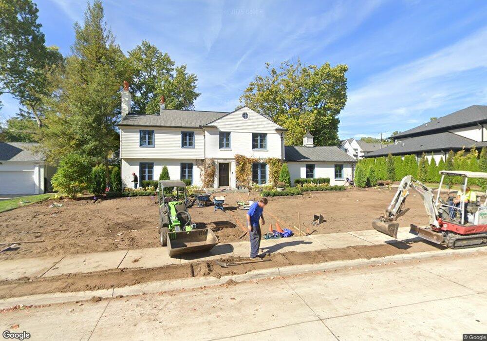
1087 N Glenhurst Dr Birmingham, MI 48009
Estimated Value: $1,289,420 - $1,690,000
4
Beds
4
Baths
3,273
Sq Ft
$464/Sq Ft
Est. Value
About This Home
This home is located at 1087 N Glenhurst Dr, Birmingham, MI 48009 and is currently estimated at $1,518,355, approximately $463 per square foot. 1087 N Glenhurst Dr is a home located in Oakland County with nearby schools including Quarton Elementary, Derby Middle School, and Ernest W. Seaholm High School.
Ownership History
Date
Name
Owned For
Owner Type
Purchase Details
Closed on
May 14, 1999
Sold by
Mosteller Judy
Bought by
Claar Richard
Current Estimated Value
Purchase Details
Closed on
Jul 16, 1996
Sold by
Mosteller Judy Sandra
Bought by
Judy S Mosteller Tr
Create a Home Valuation Report for This Property
The Home Valuation Report is an in-depth analysis detailing your home's value as well as a comparison with similar homes in the area
Home Values in the Area
Average Home Value in this Area
Purchase History
| Date | Buyer | Sale Price | Title Company |
|---|---|---|---|
| Claar Richard | -- | -- | |
| Judy S Mosteller Tr | -- | -- |
Source: Public Records
Tax History Compared to Growth
Tax History
| Year | Tax Paid | Tax Assessment Tax Assessment Total Assessment is a certain percentage of the fair market value that is determined by local assessors to be the total taxable value of land and additions on the property. | Land | Improvement |
|---|---|---|---|---|
| 2024 | $13,039 | $526,450 | $0 | $0 |
| 2023 | $12,495 | $495,790 | $0 | $0 |
| 2022 | $13,397 | $526,650 | $0 | $0 |
| 2021 | $13,515 | $528,570 | $0 | $0 |
| 2020 | $12,042 | $509,350 | $0 | $0 |
| 2019 | $13,627 | $502,770 | $0 | $0 |
| 2018 | $13,522 | $496,810 | $0 | $0 |
| 2017 | $13,499 | $480,300 | $0 | $0 |
| 2016 | $13,524 | $475,060 | $0 | $0 |
| 2015 | -- | $423,720 | $0 | $0 |
| 2014 | -- | $351,590 | $0 | $0 |
| 2011 | -- | $287,640 | $0 | $0 |
Source: Public Records
Map
Nearby Homes
- 956 Westwood Dr
- 1120 Lyonhurst St
- 1260 Lyonhurst St
- 1019 N Cranbrook Rd
- 1882 Melbourne St
- 1056 Pilgrim Ave
- 345 Kimberly St
- 586 Fairfax St
- 1834 Fairview St
- 2579 Amberly Rd
- 1537 Ashford Ln
- 120 Westchester Way
- 375 Dunston Rd
- 1295 Lakeside Dr
- 1030 Lakeside Dr
- 1551 Lakeside Dr
- 592 Lakeside Dr
- 270 Martell Dr
- 222 Arlington St
- 394 S Glenhurst Dr
- 1065 N Glenhurst Dr
- 1099 N Glenhurst Dr
- 1064 Westwood Dr
- 1036 Westwood Dr
- 1090 Westwood Dr
- 1076 N Glenhurst Dr
- 1060 N Glenhurst Dr
- 1043 N Glenhurst Dr
- 1090 N Glenhurst Dr
- 1000 Westwood Dr
- 1135 N Glenhurst Dr
- 911 Brookwood St Unit Bldg-Unit
- 1100 Westwood Dr
- 1025 N Glenhurst Dr Unit Bldg-Unit
- 1025 N Glenhurst Dr
- 1065 Westwood Dr
- 1043 Westwood Dr
- 1087 Westwood Dr
- 1044 N Glenhurst Dr
- 1973 Raynale St