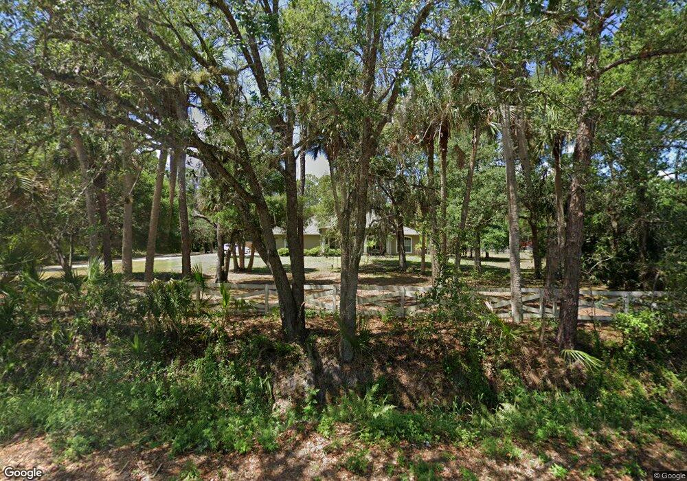
Estimated Value: $500,591 - $636,000
4
Beds
3
Baths
2,218
Sq Ft
$258/Sq Ft
Est. Value
About This Home
This home is located at 1087 N Range Rd, Cocoa, FL 32926 and is currently estimated at $571,398, approximately $257 per square foot. 1087 N Range Rd is a home located in Brevard County with nearby schools including Saturn Elementary School, Cocoa High School, and Space Coast Christian Academy.
Ownership History
Date
Name
Owned For
Owner Type
Purchase Details
Closed on
Jul 17, 2013
Sold by
Edwards Donald and Edwards Janet
Bought by
Schnabel Dana Lyn and Schnabel Davis Alan
Current Estimated Value
Purchase Details
Closed on
Aug 12, 2011
Sold by
Lyon Waldo R and Pearce Karen
Bought by
Edwards Donald and Edwards Janet
Home Financials for this Owner
Home Financials are based on the most recent Mortgage that was taken out on this home.
Original Mortgage
$22,000
Interest Rate
4.53%
Purchase Details
Closed on
Oct 4, 1996
Sold by
C & R Joint Ventures Inc
Bought by
Kleinhenz Floyd D and Kleinhenz Leslie L
Home Financials for this Owner
Home Financials are based on the most recent Mortgage that was taken out on this home.
Original Mortgage
$15,975
Interest Rate
8.05%
Purchase Details
Closed on
Oct 2, 1996
Sold by
C & R Joint Ventures Inc
Bought by
Lyon Waldo R
Home Financials for this Owner
Home Financials are based on the most recent Mortgage that was taken out on this home.
Original Mortgage
$15,975
Interest Rate
8.05%
Create a Home Valuation Report for This Property
The Home Valuation Report is an in-depth analysis detailing your home's value as well as a comparison with similar homes in the area
Home Values in the Area
Average Home Value in this Area
Purchase History
| Date | Buyer | Sale Price | Title Company |
|---|---|---|---|
| Schnabel Dana Lyn | $200,000 | Fidelity National Title Of F | |
| Edwards Donald | $195,000 | Attorney | |
| Kleinhenz Floyd D | $17,800 | -- | |
| Lyon Waldo R | $17,800 | -- |
Source: Public Records
Mortgage History
| Date | Status | Borrower | Loan Amount |
|---|---|---|---|
| Previous Owner | Edwards Donald | $22,000 | |
| Previous Owner | Lyon Waldo R | $15,975 |
Source: Public Records
Tax History Compared to Growth
Tax History
| Year | Tax Paid | Tax Assessment Tax Assessment Total Assessment is a certain percentage of the fair market value that is determined by local assessors to be the total taxable value of land and additions on the property. | Land | Improvement |
|---|---|---|---|---|
| 2025 | $3,907 | $239,680 | -- | -- |
| 2024 | $3,821 | $232,930 | -- | -- |
| 2023 | $3,821 | $226,150 | $0 | $0 |
| 2022 | $3,486 | $219,570 | $0 | $0 |
| 2021 | $3,495 | $213,180 | $0 | $0 |
| 2020 | $3,397 | $210,240 | $0 | $0 |
| 2019 | $3,354 | $205,520 | $0 | $0 |
| 2018 | $3,156 | $201,690 | $0 | $0 |
| 2017 | $2,580 | $166,100 | $0 | $0 |
| 2016 | $2,586 | $162,690 | $36,000 | $126,690 |
| 2015 | $2,623 | $161,560 | $36,000 | $125,560 |
| 2014 | $2,569 | $160,280 | $36,000 | $124,280 |
Source: Public Records
Map
Nearby Homes
- 0000 N Range Rd
- 2559 Hooper Rd
- 1301 N Range Rd
- 2425 Delys St
- 717 Lunar Lake Cir
- 703 Venus Dr
- 2515 Fairfield Dr
- 1353 S Stetson Dr
- 2029 Ivy Dr
- 2500 Fairfield Dr
- 764 Lunar Lake Cir
- 766 Lunar Lake Cir
- 1326 Stetson Ct
- 2508 Palmetto Dr
- 2511 Hathaway Dr
- 2442 Dianne Dr
- 0000 Null Unknown
- 2472 Victor Rd
- 1810 Dixon Blvd
- 2409 Granger Rd
- 2523 Hooper Rd
- 0000 Range Rd
- 1059 N Range Rd
- 1073 N Range Rd
- 2476 Kathi Kim St
- Xxx N Range Rd
- 1234 N Range Rd
- 1047 N Range Rd
- 2470 Kathi Kim St
- 2468 Kathi Kim St
- 1043 N Range Rd
- 2460 Kathi Kim St
- 1045 N Range Rd
- 2475 Kathi Kim St
- 2454 Kathi Kim St
- 000 Range Rd
- 2452 Kathi Kim St
- 2467 Kathi Kim St
- 2461 Kathi Kim St
- 1031 N Range Rd
