Estimated Value: $430,127
4
Beds
3
Baths
2,016
Sq Ft
$213/Sq Ft
Est. Value
About This Home
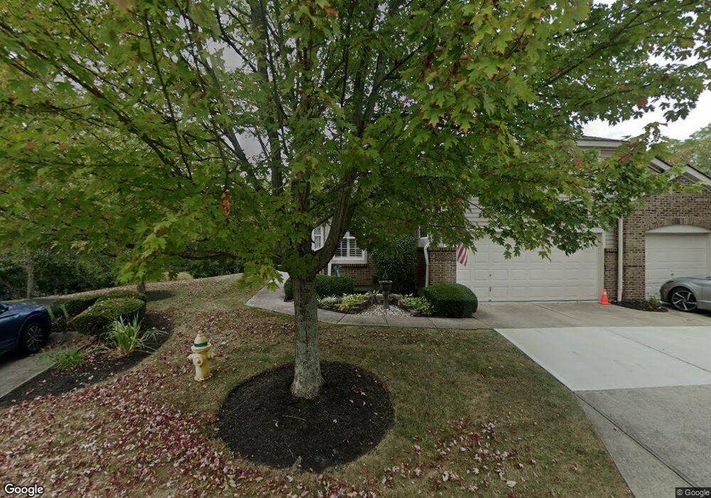
This home is located at 10870 St Andrews Dr, Union, KY 41091 and is currently estimated at $430,127, approximately $213 per square foot. 10870 St Andrews Dr is a home located in Boone County with nearby schools including New Haven Elementary School, Gray Middle School, and Larry A. Ryle High School.
Ownership History
Date
Name
Owned For
Owner Type
Purchase Details
Closed on
Jan 30, 2008
Sold by
Neagle Claude Andrew and Neagle Margaret Ann
Bought by
Neagle Margaret Ann
Current Estimated Value
Purchase Details
Closed on
Jun 23, 2005
Sold by
Spicer Kenneth W and Spicer Sylvia J
Bought by
Neagle Claude A and Neagle Margaret A
Home Financials for this Owner
Home Financials are based on the most recent Mortgage that was taken out on this home.
Original Mortgage
$50,000
Interest Rate
5.7%
Mortgage Type
New Conventional
Purchase Details
Closed on
Nov 9, 2000
Sold by
Fischer Attached Homes L
Bought by
Spicer Kenneth W and Spicer Sylvia J
Home Financials for this Owner
Home Financials are based on the most recent Mortgage that was taken out on this home.
Original Mortgage
$100,000
Interest Rate
7.93%
Mortgage Type
New Conventional
Create a Home Valuation Report for This Property
The Home Valuation Report is an in-depth analysis detailing your home's value as well as a comparison with similar homes in the area
Home Values in the Area
Average Home Value in this Area
Purchase History
| Date | Buyer | Sale Price | Title Company |
|---|---|---|---|
| Neagle Margaret Ann | -- | None Available | |
| Neagle Claude A | $218,000 | None Available | |
| Spicer Kenneth W | $213,570 | -- |
Source: Public Records
Mortgage History
| Date | Status | Borrower | Loan Amount |
|---|---|---|---|
| Previous Owner | Neagle Claude A | $50,000 | |
| Previous Owner | Spicer Kenneth W | $100,000 |
Source: Public Records
Tax History Compared to Growth
Tax History
| Year | Tax Paid | Tax Assessment Tax Assessment Total Assessment is a certain percentage of the fair market value that is determined by local assessors to be the total taxable value of land and additions on the property. | Land | Improvement |
|---|---|---|---|---|
| 2024 | $1,961 | $218,000 | $0 | $218,000 |
| 2023 | $1,953 | $218,000 | $0 | $218,000 |
| 2022 | $1,993 | $218,000 | $0 | $218,000 |
| 2021 | $2,072 | $218,000 | $0 | $218,000 |
| 2020 | $2,046 | $218,000 | $0 | $218,000 |
| 2019 | $2,070 | $218,000 | $0 | $218,000 |
| 2018 | $2,133 | $218,000 | $0 | $218,000 |
| 2017 | $2,058 | $218,000 | $0 | $218,000 |
| 2015 | $2,041 | $218,000 | $0 | $218,000 |
| 2013 | -- | $218,000 | $0 | $218,000 |
Source: Public Records
Map
Nearby Homes
- 10880 Saint Andrews Dr
- 985 Oakmont Ct
- 10807 Doral Ct
- 10730 Stone St
- 10819 Sawgrass Ct
- 10713 Stone St
- 10869 Arcaro Ln
- 6800 Green Isle Ln
- 815 Devin Ct
- 1042 Spectacular Bid Dr
- 1018 Whirlaway Dr
- 1052 Aristides Dr
- 10723 Saint Leger Cir
- 1655 Frogtown Rd
- 1049 Swale Ct
- 10567 Secretariat Run
- 10605 Pimlico Park
- 952 Dustwhirl Dr
- 10587 Pimlico Park
- 10007 Glensprings Place
- 10870 Saint Andrews Dr
- 10872 Saint Andrews Dr
- 10872 Saint Andrews Dr Unit 2
- 10874 Saint Andrews Dr
- 10876 Saint Andrews Dr
- 10878 Saint Andrews Dr
- 10866 Saint Andrews Dr
- 10866 St Andrews Dr
- 10880 Saint Andrews Dr Unit 6
- 10873 Saint Andrews Dr
- 10873 St Andrews Dr
- 10864 Saint Andrews Dr
- 10875 Saint Andrews Dr
- 10875 Saint Andrews Dr Unit 5
- 10862 Saint Andrews Dr
- 10862 St Andrews
- 10877 Saint Andrews Dr
- 10877 Saint Andrews Dr Unit 4
- 10879 St Andrews Dr
- 10879 Saint Andrews Dr