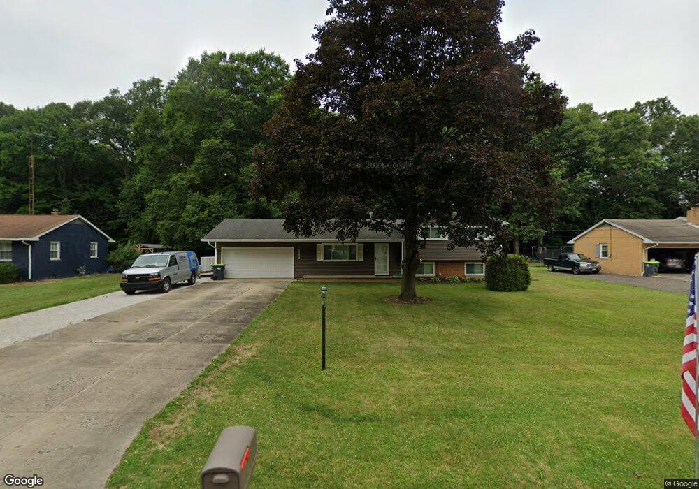
10871 Dot Ave NE Alliance, OH 44601
Estimated Value: $209,251 - $255,000
3
Beds
1
Bath
1,196
Sq Ft
$195/Sq Ft
Est. Value
About This Home
This home is located at 10871 Dot Ave NE, Alliance, OH 44601 and is currently estimated at $232,750, approximately $194 per square foot. 10871 Dot Ave NE is a home located in Stark County with nearby schools including Marlington High School and Regina Coeli/St Joseph School.
Ownership History
Date
Name
Owned For
Owner Type
Purchase Details
Closed on
Sep 15, 2016
Sold by
Baier Karen M and Smith Karen M
Bought by
Smith Roland C
Current Estimated Value
Purchase Details
Closed on
Mar 5, 2001
Sold by
Cribbs Earl V and Cribbs Patricia J
Bought by
Smith Roland C and Baier Karen M
Home Financials for this Owner
Home Financials are based on the most recent Mortgage that was taken out on this home.
Original Mortgage
$93,000
Interest Rate
7.06%
Mortgage Type
Purchase Money Mortgage
Create a Home Valuation Report for This Property
The Home Valuation Report is an in-depth analysis detailing your home's value as well as a comparison with similar homes in the area
Home Values in the Area
Average Home Value in this Area
Purchase History
| Date | Buyer | Sale Price | Title Company |
|---|---|---|---|
| Smith Roland C | -- | None Available | |
| Smith Roland C | $123,000 | -- |
Source: Public Records
Mortgage History
| Date | Status | Borrower | Loan Amount |
|---|---|---|---|
| Closed | Smith Roland C | $93,000 |
Source: Public Records
Tax History Compared to Growth
Tax History
| Year | Tax Paid | Tax Assessment Tax Assessment Total Assessment is a certain percentage of the fair market value that is determined by local assessors to be the total taxable value of land and additions on the property. | Land | Improvement |
|---|---|---|---|---|
| 2022 | $1,788 | $50,580 | $11,620 | $38,960 |
| 2021 | $1,793 | $50,580 | $11,620 | $38,960 |
| 2020 | $1,798 | $45,190 | $10,010 | $35,180 |
| 2019 | $1,786 | $45,190 | $10,010 | $35,180 |
| 2018 | $1,788 | $45,190 | $10,010 | $35,180 |
| 2017 | $1,680 | $39,730 | $9,520 | $30,210 |
| 2016 | $1,680 | $39,730 | $9,520 | $30,210 |
| 2015 | $1,599 | $39,730 | $9,520 | $30,210 |
| 2014 | $1,461 | $33,150 | $7,950 | $25,200 |
| 2013 | $727 | $33,150 | $7,950 | $25,200 |
Source: Public Records
Map
Nearby Homes
- 10666 Wilma Ave NE
- 13334 Cindy St NE
- 0 Meadow St NE
- 12355 Edison St NE
- 11960 Freshley Ave NE
- 11480 Aebi Ave NE
- 13109 Edison St NE
- 12252 Snode St NE
- 0 W Main St Unit 5090123
- 12415 Snode St NE
- 1430 Westwood Ave
- 2081 Marwood Cir
- 000 Klinger Ave
- 0 Reeder Ave NE
- 2377 Ansley St Unit 2377
- 432 Johnson Ave
- 14422 Sturbridge Rd NE
- 0 Homestead Ave NE
- 000 Meadowbrook Ave
- 0 Meadowbrook Ave
- 10891 Dot Ave NE
- 10851 Dot Ave NE
- 10905 Dot Ave NE
- 10831 Dot Ave NE
- 10870 Dot Ave NE
- 10890 Dot Ave NE
- 10811 Dot Ave NE
- 10830 Dot Ave NE
- 10920 Dot Ave NE
- 10935 Dot Ave NE
- 10791 Dot Ave NE
- 10871 Barcus Ave NE
- 10891 Barcus Ave NE
- 10851 Barcus Ave NE
- 10905 Barcus Ave NE
- 10936 Dot Ave NE
- 10831 Barcus Ave NE
- 10790 Dot Ave NE
- 10771 Dot Ave NE
- 10921 Barcus Ave NE