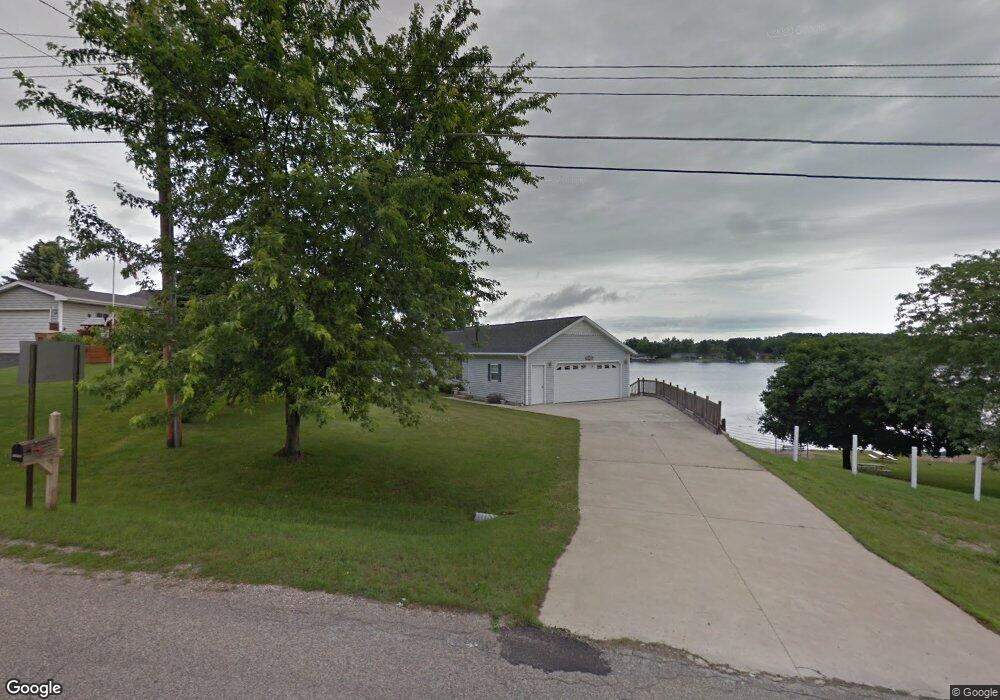
10875 Baker Rd Jerome, MI 49249
Estimated Value: $387,000 - $568,000
3
Beds
2
Baths
1,282
Sq Ft
$376/Sq Ft
Est. Value
About This Home
This home is located at 10875 Baker Rd, Jerome, MI 49249 and is currently estimated at $482,076, approximately $376 per square foot. 10875 Baker Rd is a home located in Hillsdale County with nearby schools including Addison Elementary School, Addison Middle School, and Addison High School.
Ownership History
Date
Name
Owned For
Owner Type
Purchase Details
Closed on
Jun 26, 2002
Sold by
Tohmpson Christopher D and Tohmpson Jennifer
Bought by
Burkhart Timothy J and Trst Marisa L
Current Estimated Value
Purchase Details
Closed on
Feb 20, 1998
Sold by
Thompson Christopher and Thompson Jennife
Purchase Details
Closed on
Aug 13, 1997
Sold by
Honold David L
Bought by
Thompson Christopher and Thompson Jennife
Purchase Details
Closed on
Mar 3, 1995
Sold by
Feerer Judith J
Bought by
Honold David L
Purchase Details
Closed on
Jul 1, 1990
Bought by
Ratay
Purchase Details
Closed on
Apr 22, 1976
Bought by
Ratay
Create a Home Valuation Report for This Property
The Home Valuation Report is an in-depth analysis detailing your home's value as well as a comparison with similar homes in the area
Purchase History
| Date | Buyer | Sale Price | Title Company |
|---|---|---|---|
| Burkhart Timothy J | $86,500 | -- | |
| -- | -- | -- | |
| Thompson Christopher | $49,900 | -- | |
| Honold David L | $38,000 | -- | |
| Ratay | -- | -- | |
| Ratay | $7,000 | -- |
Source: Public Records
Tax History
| Year | Tax Paid | Tax Assessment Tax Assessment Total Assessment is a certain percentage of the fair market value that is determined by local assessors to be the total taxable value of land and additions on the property. | Land | Improvement |
|---|---|---|---|---|
| 2025 | $1,448 | $250,510 | $0 | $0 |
| 2024 | $14 | $219,460 | $0 | $0 |
| 2023 | $5,340 | $192,000 | $0 | $0 |
| 2022 | $5,276 | $168,230 | $0 | $0 |
| 2021 | $5,106 | $161,320 | $0 | $0 |
| 2020 | $5,065 | $147,910 | $0 | $0 |
| 2019 | $5,017 | $148,240 | $0 | $0 |
| 2018 | $4,830 | $129,520 | $0 | $0 |
| 2017 | $4,695 | $134,260 | $0 | $0 |
| 2016 | $4,670 | $111,630 | $0 | $0 |
| 2015 | $1,132 | $111,630 | $0 | $0 |
| 2013 | $1,150 | $104,950 | $0 | $0 |
| 2012 | $1,216 | $111,020 | $0 | $0 |
Source: Public Records
Map
Nearby Homes
- 11348 Oakwood Dr
- 10362 Glencoe Rd
- 10291 Glencoe Rd
- 11500 Rutan Cir
- 10380 Heatherlawn Ct
- 11531 Rutan Cir
- 11620 Greenlawn Dr
- 10140 Fairway Dr
- 11860 N Lake Side Dr
- 11246 Lemott Cir
- 11248 Lemott Cir
- 11770 Penlawn Dr
- 11062 Greenview Ct
- 11968 Greenbriar Dr
- 11838 Greenbriar Dr
- 10841 N Waldron Rd
- 11791 Bradley Dr
- Lots 274-276 Southlawn Cir
- 10011 Southlawn Cir
- 9951 Southlawn Cir
- 10885 Baker Rd
- 10895 Baker Rd
- 10810 Baker Rd
- 0 Montview Unit 10781,Lot 51 Lakevie
- 10849 Baker Rd
- 10911 Baker Rd
- 10800 Baker Rd
- 10839 Baker Rd
- 10810 Montview Dr
- 10829 Baker Rd
- 10792 Baker Rd
- 10921 Baker Rd
- 10788 Baker Rd
- 10819 Baker Rd
- 12360 Chicago Rd
- 10860 Baker Rd
- 10781 Montview Unit Lot 51 Lakeview
- 10781 Montview
- 10925 Baker Rd
- 10941 Tacoma Dr
Your Personal Tour Guide
Ask me questions while you tour the home.