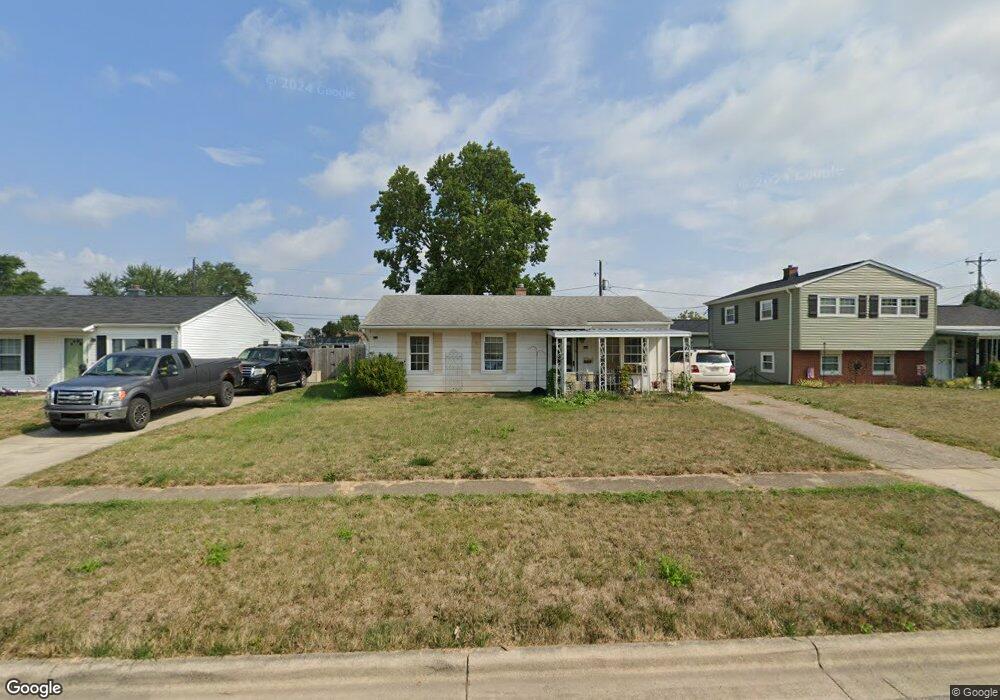
1088 Langtry Ave Columbus, OH 43207
Obetz-Lockbourne NeighborhoodEstimated Value: $193,946 - $224,000
3
Beds
1
Bath
925
Sq Ft
$231/Sq Ft
Est. Value
About This Home
This home is located at 1088 Langtry Ave, Columbus, OH 43207 and is currently estimated at $213,737, approximately $231 per square foot. 1088 Langtry Ave is a home located in Franklin County with nearby schools including Hamilton Elementary School, Hamilton Intermediate School, and Hamilton Middle School.
Ownership History
Date
Name
Owned For
Owner Type
Purchase Details
Closed on
Aug 12, 2020
Sold by
Wilson Beverly M
Bought by
Wilson John M and Wilson Ashley C
Current Estimated Value
Purchase Details
Closed on
Aug 10, 2010
Sold by
Hogan Michael E and Hogan Patricia G
Bought by
Wilson Beverly M
Home Financials for this Owner
Home Financials are based on the most recent Mortgage that was taken out on this home.
Original Mortgage
$42,900
Interest Rate
4.08%
Mortgage Type
New Conventional
Purchase Details
Closed on
Aug 5, 1991
Bought by
Hogan Michael E
Purchase Details
Closed on
Jun 25, 1990
Purchase Details
Closed on
Apr 21, 1989
Create a Home Valuation Report for This Property
The Home Valuation Report is an in-depth analysis detailing your home's value as well as a comparison with similar homes in the area
Home Values in the Area
Average Home Value in this Area
Purchase History
| Date | Buyer | Sale Price | Title Company |
|---|---|---|---|
| Wilson John M | -- | None Available | |
| Wilson Beverly M | $53,900 | Title First | |
| Hogan Michael E | $56,000 | -- | |
| -- | $42,600 | -- | |
| -- | $37,900 | -- |
Source: Public Records
Mortgage History
| Date | Status | Borrower | Loan Amount |
|---|---|---|---|
| Closed | Wilson Beverly M | $42,900 |
Source: Public Records
Tax History
| Year | Tax Paid | Tax Assessment Tax Assessment Total Assessment is a certain percentage of the fair market value that is determined by local assessors to be the total taxable value of land and additions on the property. | Land | Improvement |
|---|---|---|---|---|
| 2025 | $2,324 | $50,860 | $16,140 | $34,720 |
| 2024 | $2,324 | $50,860 | $16,140 | $34,720 |
| 2023 | $2,312 | $50,855 | $16,135 | $34,720 |
| 2022 | $1,376 | $25,380 | $5,670 | $19,710 |
| 2021 | $1,395 | $25,380 | $5,670 | $19,710 |
| 2020 | $1,455 | $25,380 | $5,670 | $19,710 |
| 2019 | $1,336 | $21,150 | $4,730 | $16,420 |
| 2018 | $1,288 | $21,150 | $4,730 | $16,420 |
| 2017 | $1,261 | $21,150 | $4,730 | $16,420 |
| 2016 | $1,327 | $20,510 | $5,530 | $14,980 |
| 2015 | $1,258 | $20,510 | $5,530 | $14,980 |
| 2014 | $1,252 | $20,510 | $5,530 | $14,980 |
| 2013 | $669 | $22,750 | $6,125 | $16,625 |
Source: Public Records
Map
Nearby Homes
- 4926 Meadowbrook Dr
- 5076 Ranger Dr Unit Lot 100
- 1291 Webb Dr Unit Lot 90
- 1307 Webb Dr Unit Lot 92
- 1315 Webb Dr Unit Lot 93
- 5220 Edgeview Rd
- 863 Cherrydale Ave
- 908 Tecumseh Ave
- 1132 Ayrshire Dr
- 4410 Holstein Dr
- 4436 Wesley Trail
- 1962 Reese Ave
- 1987 Reese Ave
- 2027 Reese Ave
- 4455 Catamaran Dr
- 4412 Catamaran Dr
- 4344 Brett Ln
- 4801 Obetz Reese Rd
- 4356 Monterey Ct
- 1187 Rendezvous Ln
- 1080 Langtry Ave
- 1096 Langtry Ave
- 1072 Langtry Ave
- 1091 Gilcrest Ave
- 1104 Langtry Ave
- 1083 Gilcrest Ave
- 1099 Gilcrest Ave
- 1075 Gilcrest Ave
- 1107 Gilcrest Ave
- 1064 Langtry Ave
- 1091 Langtry Ave
- 1099 Langtry Ave
- 1083 Langtry Ave
- 1112 Langtry Ave
- 5005 Sutherland Dr
- 1107 Langtry Ave
- 1067 Gilcrest Ave
- 1075 Langtry Ave
- 1056 Langtry Ave
- 1119 Gilcrest Ave
Your Personal Tour Guide
Ask me questions while you tour the home.