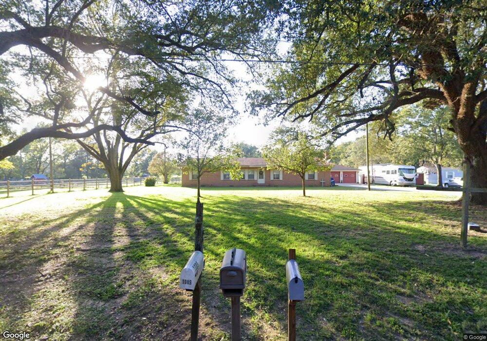
1088 Lone Star Rd Lufkin, TX 75901
Estimated Value: $212,000 - $257,000
--
Bed
1
Bath
1,820
Sq Ft
$128/Sq Ft
Est. Value
About This Home
This home is located at 1088 Lone Star Rd, Lufkin, TX 75901 and is currently estimated at $232,056, approximately $127 per square foot. 1088 Lone Star Rd is a home located in Angelina County with nearby schools including Herty Primary School, Coston Elementary School, and Lufkin Middle School.
Ownership History
Date
Name
Owned For
Owner Type
Purchase Details
Closed on
Nov 30, 2021
Sold by
Craig Teafatiller Randal
Bought by
Brassette Mark and Brassette Lesa
Current Estimated Value
Purchase Details
Closed on
Apr 24, 2020
Sold by
Byrd Teafatiller Patti Lou
Bought by
Teafatiller Randal Craig and Teafatiller Patti Lou
Home Financials for this Owner
Home Financials are based on the most recent Mortgage that was taken out on this home.
Original Mortgage
$136,000
Interest Rate
3.6%
Mortgage Type
Stand Alone First
Purchase Details
Closed on
Sep 11, 2009
Sold by
Byrd Royce E and Byrd Carrie Mona
Bought by
Capps Mike and Capps Barbara
Create a Home Valuation Report for This Property
The Home Valuation Report is an in-depth analysis detailing your home's value as well as a comparison with similar homes in the area
Home Values in the Area
Average Home Value in this Area
Purchase History
| Date | Buyer | Sale Price | Title Company |
|---|---|---|---|
| Brassette Mark | -- | Security Guaranty Abstract | |
| Teafatiller Randal Craig | -- | Security & Guaranty Abstract | |
| Capps Mike | -- | None Available |
Source: Public Records
Mortgage History
| Date | Status | Borrower | Loan Amount |
|---|---|---|---|
| Previous Owner | Teafatiller Randal Craig | $136,000 |
Source: Public Records
Tax History Compared to Growth
Tax History
| Year | Tax Paid | Tax Assessment Tax Assessment Total Assessment is a certain percentage of the fair market value that is determined by local assessors to be the total taxable value of land and additions on the property. | Land | Improvement |
|---|---|---|---|---|
| 2025 | $2,848 | $180,080 | $27,260 | $152,820 |
| 2024 | $2,810 | $177,690 | $27,260 | $150,430 |
| 2023 | $2,660 | $176,250 | $27,260 | $148,990 |
| 2022 | $3,054 | $174,200 | $27,260 | $146,940 |
| 2021 | $3,205 | $165,900 | $31,520 | $134,380 |
| 2020 | $2,925 | $151,840 | $37,020 | $114,820 |
| 2019 | $3,143 | $151,990 | $37,020 | $114,970 |
| 2018 | $891 | $139,070 | $34,720 | $104,350 |
| 2017 | $891 | $134,520 | $34,720 | $99,800 |
| 2016 | $2,426 | $130,870 | $34,720 | $96,150 |
| 2015 | $975 | $130,870 | $34,720 | $96,150 |
| 2014 | $975 | $131,490 | $34,720 | $96,770 |
Source: Public Records
Map
Nearby Homes
- 3108 E Lufkin Ave
- 108 Home Ave
- 410 S Medford Dr
- LOT 6-11,12.1,A McHale St
- 206 Shady Pine St
- 3749 Fm 841
- 132 Preston St
- 137 Woods Rd
- 165 Preston St
- 4515 Farm-To-market 841
- 0 Farm-To-market 841
- 4311 Farm-To-market 841
- ID 13148 Farm-To-market 841
- 3012 Fm 325
- 2401 Paul Ave
- 171 Albritton Ln
- Lot 11 Shady Elm
- Lot 12 Shady Elm
- 2114 E Lufkin Ave
- 4344 N Highway 69
- 1088 Lone Star Rd
- 1132 Lone Star Rd
- 1139 Lone Star Rd
- 6656 Us Hwy 103e
- 7585 Us Hwy 59n
- 7499 Us Hwy 59n
- 00 Loop 287 & S Medford
- 1202-04 Main St
- 0 Loop 287e
- 111 Austin Ln
- 4730 Hwy 103e
- 11774 Us Hwy 69s
- 0 Loop 287 & Hwy 59 N
- 0 Fielders Cemetary Rd
- 1185 Lone Star Rd
- 1221 Lone Star Rd
- 1210 Lone Star Rd
- 108 Milner St
- 106 Milner St
- 1271 Lone Star Rd