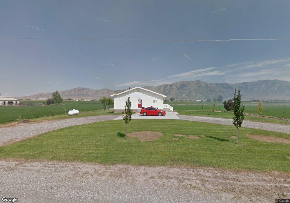
10880 N 5600 W Tremonton, UT 84337
Estimated Value: $448,000 - $614,333
--
Bed
--
Bath
1,122
Sq Ft
$469/Sq Ft
Est. Value
About This Home
This home is located at 10880 N 5600 W, Tremonton, UT 84337 and is currently estimated at $526,583, approximately $469 per square foot. 10880 N 5600 W is a home with nearby schools including McKinley School, Bear River Middle School, and Alice C. Harris Intermediate School.
Ownership History
Date
Name
Owned For
Owner Type
Purchase Details
Closed on
Mar 23, 2022
Sold by
Spenst Virginia M
Bought by
J & M Builders Inc
Current Estimated Value
Purchase Details
Closed on
Feb 3, 2010
Sold by
Miles Dee E and Miles Alyssa A
Bought by
Big E Enterprises Llc
Home Financials for this Owner
Home Financials are based on the most recent Mortgage that was taken out on this home.
Original Mortgage
$25,000
Interest Rate
5.03%
Mortgage Type
Unknown
Create a Home Valuation Report for This Property
The Home Valuation Report is an in-depth analysis detailing your home's value as well as a comparison with similar homes in the area
Home Values in the Area
Average Home Value in this Area
Purchase History
| Date | Buyer | Sale Price | Title Company |
|---|---|---|---|
| J & M Builders Inc | -- | None Listed On Document | |
| Jm Builders Inc | -- | None Listed On Document | |
| Big G Enterprises Llc | -- | None Listed On Document | |
| Big G Enterprises Llc | -- | None Listed On Document | |
| Big E Enterprises Llc | -- | -- |
Source: Public Records
Mortgage History
| Date | Status | Borrower | Loan Amount |
|---|---|---|---|
| Previous Owner | Big E Enterprises Llc | $25,000 |
Source: Public Records
Tax History Compared to Growth
Tax History
| Year | Tax Paid | Tax Assessment Tax Assessment Total Assessment is a certain percentage of the fair market value that is determined by local assessors to be the total taxable value of land and additions on the property. | Land | Improvement |
|---|---|---|---|---|
| 2025 | $3,117 | $610,613 | $228,600 | $382,013 |
| 2024 | $3,117 | $617,587 | $228,600 | $388,987 |
| 2023 | $2,083 | $422,807 | $191,160 | $231,647 |
| 2022 | $1,922 | $362,055 | $86,160 | $275,895 |
| 2021 | $1,705 | $253,894 | $86,160 | $167,734 |
| 2020 | $1,632 | $253,894 | $86,160 | $167,734 |
| 2019 | $1,590 | $112,320 | $56,160 | $56,160 |
| 2018 | $1,201 | $108,920 | $54,000 | $54,920 |
| 2017 | $1,245 | $167,355 | $54,000 | $99,855 |
| 2016 | $1,206 | $106,305 | $54,000 | $52,305 |
| 2015 | $1,138 | $101,550 | $54,000 | $47,550 |
| 2014 | $1,138 | $99,286 | $54,000 | $45,286 |
| 2013 | -- | $99,286 | $13,338 | $85,948 |
Source: Public Records
Map
Nearby Homes
- 518 E 40 S
- 137 N 870 W Unit 28
- 839 E 180 N Unit 30
- 1286 E 240 N Unit 15
- Auburn Plan at River's Edge - Tremonton
- Aberdeen Plan at River's Edge - Tremonton
- Glendale Plan at River's Edge - Tremonton
- Lyndhurst Plan at River's Edge - Tremonton
- Sumac Plan at River's Edge - Tremonton
- Redwood Plan at River's Edge - Tremonton
- Summerlyn Plan at River's Edge - Tremonton
- Fairview Plan at River's Edge - Tremonton
- 635 E 240 N Unit 9
- 635 E 240 N
- 25 W 400 S
- 236 S Tremont St
- 408 N 775 E
- 311 S 100 W
- 795 S 150 W
- 144 S 100 W
- 10930 N 5600 W
- 10815 N 5600 W
- 11000 N 5600 W
- 1052 E 250 S
- 1072 E 250 S Unit 37
- 1092 E 250 S
- 1092 E 250 S Unit 36
- 264 S 1150 E
- 1112 E 250 S
- 1055 E 250 S
- 1075 E 250 S Unit 40
- 1156 E 250 S
- 1095 E 250 S
- 10875 N 5400 W
- 1135 E 250 S Unit 43
- 1115 E 250 S
- 1170 E 250 S
- 10815 N 5400 W
- 10815 N 5400 W
- 239 S 1150 E