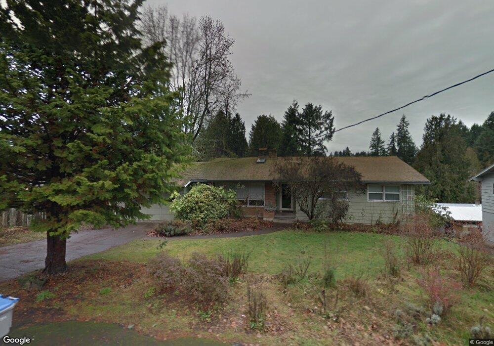
10885 SW Derry Dell Ct Portland, OR 97223
Derry Dell NeighborhoodEstimated Value: $665,422 - $718,000
4
Beds
3
Baths
2,954
Sq Ft
$231/Sq Ft
Est. Value
About This Home
This home is located at 10885 SW Derry Dell Ct, Portland, OR 97223 and is currently estimated at $682,606, approximately $231 per square foot. 10885 SW Derry Dell Ct is a home located in Washington County with nearby schools including Charles F. Tigard Elementary School, Thomas R. Fowler Middle School, and Tigard High School.
Ownership History
Date
Name
Owned For
Owner Type
Purchase Details
Closed on
Aug 30, 2004
Sold by
Kool Scott D and Kool Celia C
Bought by
Copelan Jeffrey R and Copeland Maria A
Current Estimated Value
Home Financials for this Owner
Home Financials are based on the most recent Mortgage that was taken out on this home.
Original Mortgage
$155,000
Outstanding Balance
$77,711
Interest Rate
6.06%
Mortgage Type
Unknown
Estimated Equity
$604,895
Purchase Details
Closed on
Sep 23, 1998
Sold by
Bladen David E and Bladen Jean M
Bought by
Kool Scott D and Kool Celia C
Home Financials for this Owner
Home Financials are based on the most recent Mortgage that was taken out on this home.
Original Mortgage
$149,200
Interest Rate
6.88%
Create a Home Valuation Report for This Property
The Home Valuation Report is an in-depth analysis detailing your home's value as well as a comparison with similar homes in the area
Home Values in the Area
Average Home Value in this Area
Purchase History
| Date | Buyer | Sale Price | Title Company |
|---|---|---|---|
| Copelan Jeffrey R | $265,000 | Chicago Title Insurance Comp | |
| Kool Scott D | $186,500 | Transnation Title Insurance |
Source: Public Records
Mortgage History
| Date | Status | Borrower | Loan Amount |
|---|---|---|---|
| Open | Copelan Jeffrey R | $155,000 | |
| Previous Owner | Kool Scott D | $149,200 |
Source: Public Records
Tax History Compared to Growth
Tax History
| Year | Tax Paid | Tax Assessment Tax Assessment Total Assessment is a certain percentage of the fair market value that is determined by local assessors to be the total taxable value of land and additions on the property. | Land | Improvement |
|---|---|---|---|---|
| 2025 | $5,483 | $321,580 | -- | -- |
| 2024 | $5,336 | $312,220 | -- | -- |
| 2023 | $5,336 | $303,130 | $0 | $0 |
| 2022 | $5,182 | $303,130 | $0 | $0 |
| 2021 | $5,052 | $285,740 | $0 | $0 |
| 2020 | $4,901 | $277,420 | $0 | $0 |
| 2019 | $4,688 | $269,340 | $0 | $0 |
| 2018 | $4,498 | $261,500 | $0 | $0 |
| 2017 | $4,336 | $253,890 | $0 | $0 |
| 2016 | $4,140 | $246,500 | $0 | $0 |
| 2015 | $3,980 | $239,330 | $0 | $0 |
| 2014 | $3,862 | $232,360 | $0 | $0 |
Source: Public Records
Map
Nearby Homes
- 10985 SW Mira Ct
- 11010 SW Fonner St
- 13465 SW 107th Ave
- 10635 SW Watkins Place
- 12557 SW 115th Ave
- 13154 SW 121st Ave
- 12393 SW 114th Terrace
- 12230 SW 106th Dr
- 10097 SW Woodard Ln
- 12175 SW Alberta St
- 11735 SW Gaarde St
- 10060 SW Molly Ct
- 13890 SW 118th Ct
- 12174 SW Quail Creek Ln
- 12249 SW Hollow Ln
- 13235 SW Ash Dr
- 12370 SW 121st Ave
- 14180 SW 103rd Ave
- 0 SW Walnut St
- 12200 SW Walnut St
- 10865 SW Derry Dell Ct
- 11150 SW Eden Ct
- 10925 SW Derry Dell Ct
- 11145 SW Eden Ct
- 11160 SW Eden Ct
- 11015 SW Park St
- 11027 SW 110th Ave
- 10845 SW Derry Dell Ct
- 10880 SW Derry Dell Ct
- 10895 SW Park St
- 10820 SW Derry Dell Ct
- 11155 SW Eden Ct
- 11025 SW Park St
- 10865 SW Park St
- 10825 SW Derry Dell Ct
- 10920 SW Park St
- 10790 SW Derry Dell Ct
- 13295 SW 110th Ave
- 11175 SW Eden Ct
- 11180 SW Eden Ct