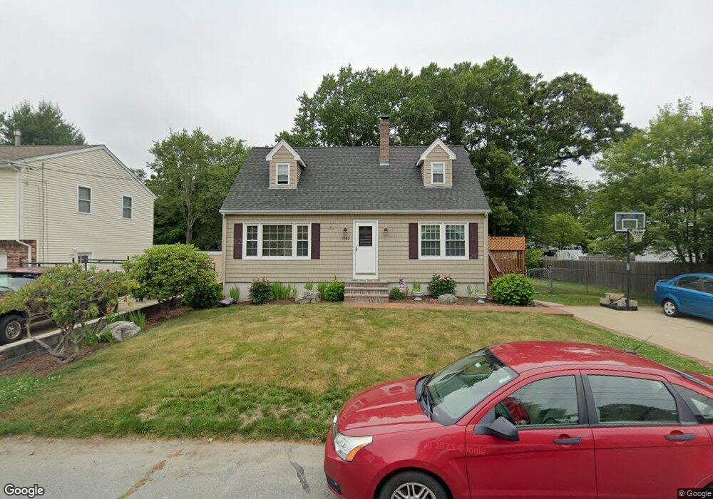
1089 Cherokee St New Bedford, MA 02745
Estimated Value: $481,005 - $535,000
3
Beds
3
Baths
1,346
Sq Ft
$377/Sq Ft
Est. Value
About This Home
This home is located at 1089 Cherokee St, New Bedford, MA 02745 and is currently estimated at $507,251, approximately $376 per square foot. 1089 Cherokee St is a home located in Bristol County with nearby schools including Casimir Pulaski Elementary School, Normandin Middle School, and New Bedford High School.
Ownership History
Date
Name
Owned For
Owner Type
Purchase Details
Closed on
Apr 27, 2001
Sold by
Simao Alfredo V and Simao Linda M
Bought by
Carusi Thomas P and Carusi Rebecca A
Current Estimated Value
Purchase Details
Closed on
Jul 20, 1998
Sold by
Ponte David J
Bought by
Simao Alfredo V and Simao Linda M
Create a Home Valuation Report for This Property
The Home Valuation Report is an in-depth analysis detailing your home's value as well as a comparison with similar homes in the area
Home Values in the Area
Average Home Value in this Area
Purchase History
| Date | Buyer | Sale Price | Title Company |
|---|---|---|---|
| Carusi Thomas P | $169,900 | -- | |
| Carusi Thomas P | $169,900 | -- | |
| Simao Alfredo V | $127,000 | -- | |
| Simao Alfredo V | $127,000 | -- |
Source: Public Records
Mortgage History
| Date | Status | Borrower | Loan Amount |
|---|---|---|---|
| Open | Simao Alfredo V | $147,000 | |
| Closed | Simao Alfredo V | $165,000 |
Source: Public Records
Tax History Compared to Growth
Tax History
| Year | Tax Paid | Tax Assessment Tax Assessment Total Assessment is a certain percentage of the fair market value that is determined by local assessors to be the total taxable value of land and additions on the property. | Land | Improvement |
|---|---|---|---|---|
| 2025 | $4,747 | $419,700 | $125,400 | $294,300 |
| 2024 | $4,853 | $404,400 | $136,300 | $268,100 |
| 2023 | $5,219 | $365,200 | $109,700 | $255,500 |
| 2022 | $4,583 | $294,900 | $101,900 | $193,000 |
| 2021 | $4,484 | $287,600 | $101,900 | $185,700 |
| 2020 | $4,504 | $278,700 | $101,900 | $176,800 |
| 2019 | $4,351 | $264,200 | $97,900 | $166,300 |
| 2018 | $4,114 | $247,400 | $97,900 | $149,500 |
| 2017 | $3,877 | $232,300 | $96,000 | $136,300 |
| 2016 | $3,733 | $226,400 | $94,000 | $132,400 |
| 2015 | $3,483 | $221,400 | $90,100 | $131,300 |
| 2014 | $3,282 | $216,500 | $88,100 | $128,400 |
Source: Public Records
Map
Nearby Homes
- 1069 Cherokee St
- 16 Swallow St
- 13 Luscomb Ln
- 64 Blaze Rd
- 26 Blueberry Dr
- 34 Poplar Rd
- 1573 Braley Rd Unit 39
- 210 Heritage Dr
- 1063 Westgate St
- 1599 Braley Rd Unit 68
- 145 Heritage Dr
- 4597 Acushnet Ave
- SS Charbonneau Ln
- 2 Woodland Rd
- 62 Longview Rd
- 595 Quanapoag Rd
- 8 Holly Tree Ln
- 700 Pine Hill Dr
- 888 Hillcrest Rd
- 1269 Bartlett St
- 1079 Cherokee St
- 1097 Cherokee St
- 1078 Sassaquin Ave
- 1092 Cherokee St
- 1082 Cherokee St
- 1109 Cherokee St
- 1098 Cherokee St
- 1072 Cherokee St
- 1059 Cherokee St
- 1070 Sassaquin Ave
- 1122 Sassaquin Ave Unit 1124
- 1112 Cherokee St Unit 1114
- 1060 Cherokee St
- 1085 Pequot St
- 1089 Sassaquin Ave
- 1095 Pequot St
- 1101 Pequot St
- 1079 Sassaquin Ave
- 1128 Sassaquin Ave
- 1111 Sassaquin Ave