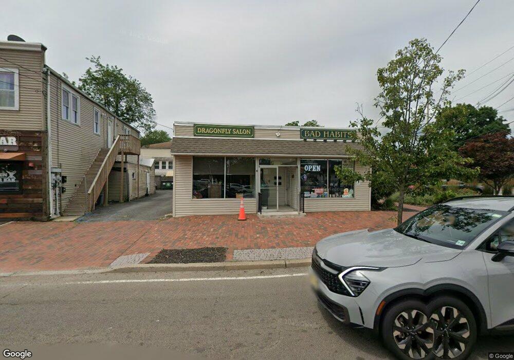
1089 Ringwood Ave Unit B Haskell, NJ 07420
Estimated Value: $276,937
--
Bed
--
Bath
600
Sq Ft
$462/Sq Ft
Est. Value
About This Home
This home is located at 1089 Ringwood Ave Unit B, Haskell, NJ 07420 and is currently estimated at $276,937, approximately $461 per square foot. 1089 Ringwood Ave Unit B is a home located in Passaic County with nearby schools including Lakeland Reg High School and St Marys School.
Ownership History
Date
Name
Owned For
Owner Type
Purchase Details
Closed on
Apr 14, 2023
Sold by
Johnson David and Johnson Mary
Bought by
1089 Ringwood Ave Llc
Current Estimated Value
Purchase Details
Closed on
May 25, 1999
Sold by
Roberto Theodore and Roberto Marie
Bought by
Johnson David and Johnson Mary
Home Financials for this Owner
Home Financials are based on the most recent Mortgage that was taken out on this home.
Original Mortgage
$46,800
Interest Rate
8%
Mortgage Type
Seller Take Back
Create a Home Valuation Report for This Property
The Home Valuation Report is an in-depth analysis detailing your home's value as well as a comparison with similar homes in the area
Home Values in the Area
Average Home Value in this Area
Purchase History
| Date | Buyer | Sale Price | Title Company |
|---|---|---|---|
| 1089 Ringwood Ave Llc | $230,000 | Sage Title & Settlement Servic | |
| 1089 Ringwood Ave Llc | $230,000 | Sage Title & Settlement Servic | |
| Johnson David | $52,000 | Fidelity National Title Ins |
Source: Public Records
Mortgage History
| Date | Status | Borrower | Loan Amount |
|---|---|---|---|
| Previous Owner | Johnson David | $46,800 |
Source: Public Records
Tax History Compared to Growth
Tax History
| Year | Tax Paid | Tax Assessment Tax Assessment Total Assessment is a certain percentage of the fair market value that is determined by local assessors to be the total taxable value of land and additions on the property. | Land | Improvement |
|---|---|---|---|---|
| 2025 | $7,418 | $135,000 | $123,300 | $11,700 |
| 2024 | $7,270 | $172,000 | $154,100 | $17,900 |
| 2022 | $7,117 | $172,000 | $154,100 | $17,900 |
| 2021 | $6,963 | $172,000 | $154,100 | $17,900 |
| 2020 | $6,885 | $172,000 | $154,100 | $17,900 |
| 2019 | $6,720 | $172,000 | $154,100 | $17,900 |
| 2018 | $6,588 | $172,000 | $154,100 | $17,900 |
| 2017 | $6,433 | $172,000 | $154,100 | $17,900 |
| 2016 | $6,275 | $172,000 | $154,100 | $17,900 |
| 2015 | $6,185 | $167,000 | $154,100 | $12,900 |
| 2014 | $5,887 | $167,000 | $154,100 | $12,900 |
Source: Public Records
Map
Nearby Homes
- 1 Gorge Dr
- 3 Elm St
- 19 Skyland Ave
- 1025 Ringwood Ave
- 19 Elm St
- 6 Elston Ct
- 28 Elston Ct
- 43 Elston Ct Unit 301
- 24 Roseland Ave
- 19 Dogwood Ln Unit 19
- 19 Dogwood Ln Unit U9F
- 12 Franklin Place
- 21 Bartholdi Ave
- 5 Storms Place
- 35 Smith Ave
- 17 Locust St
- 9116 Warrens Way Unit 116
- 9116 Warrens Way
- 45 Buena Vista Way E
- 9312 Warrens Way
- 1089 Ringwood Ave
- 1097 Ringwood Ave
- 5 Brook St
- 1099 Ringwood Ave
- 1099 Ringwood Ave Unit B
- 1101 Ringwood Ave
- 1101 Ringwood Ave Unit 1101A
- 1101 Ringwood Ave Unit 1099a
- 1101 Ringwood Ave Unit A
- 7 Brook St Unit 6
- 7 Brook St Unit 5
- 7 Brook St Unit 4
- 7 Brook St Unit 3
- 7 Brook St Unit 2
- 7 Brook St Unit 1
- 7 Brook St Unit 4
- 7 Brook St
- 7 Brook St Unit 5
- 7 Brook St
- 1103 Ringwood Ave