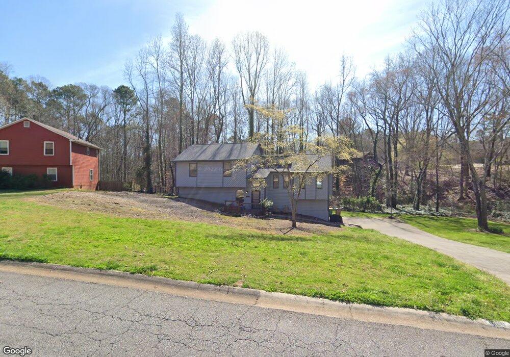
1089 Rolling Green Dr Unit 2 Acworth, GA 30102
Oak Grove NeighborhoodEstimated Value: $380,404 - $406,000
3
Beds
3
Baths
2,408
Sq Ft
$163/Sq Ft
Est. Value
About This Home
This home is located at 1089 Rolling Green Dr Unit 2, Acworth, GA 30102 and is currently estimated at $393,202, approximately $163 per square foot. 1089 Rolling Green Dr Unit 2 is a home located in Cherokee County with nearby schools including Carmel Elementary School, Woodstock Middle School, and Woodstock High School.
Ownership History
Date
Name
Owned For
Owner Type
Purchase Details
Closed on
Dec 15, 2010
Sold by
Fain Richard L
Bought by
Fain Christy D
Current Estimated Value
Purchase Details
Closed on
Feb 23, 2007
Sold by
Macduff Beryl
Bought by
Fain Richard L and Fain Christy D
Home Financials for this Owner
Home Financials are based on the most recent Mortgage that was taken out on this home.
Original Mortgage
$163,000
Interest Rate
6.19%
Mortgage Type
New Conventional
Purchase Details
Closed on
Apr 30, 1998
Sold by
Wheeler John C
Bought by
Macduff Edward and Macduff Beryl
Home Financials for this Owner
Home Financials are based on the most recent Mortgage that was taken out on this home.
Original Mortgage
$35,000
Interest Rate
7.03%
Mortgage Type
New Conventional
Create a Home Valuation Report for This Property
The Home Valuation Report is an in-depth analysis detailing your home's value as well as a comparison with similar homes in the area
Home Values in the Area
Average Home Value in this Area
Purchase History
| Date | Buyer | Sale Price | Title Company |
|---|---|---|---|
| Fain Christy D | -- | -- | |
| Fain Richard L | $163,000 | -- | |
| Macduff Edward | $115,000 | -- |
Source: Public Records
Mortgage History
| Date | Status | Borrower | Loan Amount |
|---|---|---|---|
| Previous Owner | Fain Richard L | $163,000 | |
| Previous Owner | Macduff Edward | $35,000 |
Source: Public Records
Tax History Compared to Growth
Tax History
| Year | Tax Paid | Tax Assessment Tax Assessment Total Assessment is a certain percentage of the fair market value that is determined by local assessors to be the total taxable value of land and additions on the property. | Land | Improvement |
|---|---|---|---|---|
| 2025 | $3,263 | $141,976 | $32,000 | $109,976 |
| 2024 | $3,125 | $135,656 | $26,000 | $109,656 |
| 2023 | $2,782 | $140,016 | $26,000 | $114,016 |
| 2022 | $2,784 | $117,856 | $22,000 | $95,856 |
| 2021 | $2,373 | $90,136 | $18,000 | $72,136 |
| 2020 | $2,088 | $77,736 | $14,000 | $63,736 |
| 2019 | $1,920 | $70,520 | $14,000 | $56,520 |
| 2018 | $1,751 | $63,520 | $11,200 | $52,320 |
| 2017 | $1,718 | $154,700 | $11,200 | $50,680 |
| 2016 | $1,672 | $149,400 | $11,200 | $48,560 |
| 2015 | $1,596 | $141,500 | $11,200 | $45,400 |
| 2014 | $1,477 | $131,100 | $10,400 | $42,040 |
Source: Public Records
Map
Nearby Homes
- 1172 Ridgeside Dr NW
- 1071 Ferry Creek Way
- 4949 Woodland Way NW
- 1033 Justice Ln NW
- 1220 Wade Green Cir NW Unit 1
- 806 Moonlit Ln NW
- 4815 Wade Green Rd NW Unit 1
- 4815 Wade Green Rd NW
- 5464 Wade Green Rd
- 367 Lake Forest Dr
- 1361 Summit Ln NW
- 4955 Day Lily Way NW
- 5119 Verbena Dr NW
- 243 Odell St
- 611 Ashley Forest Dr NW
- 5357 Wade Green Rd
- 805 Silver Mound Cir NW
- 4809 Burlington Ct NW
- 1081 Rolling Green Dr
- 1094 Rolling Green Dr
- 5166 Willow Tarn
- 1076 Rolling Green Dr
- 5162 Willow Tarn
- 1073 Rolling Green Dr
- 1128 Rolling Green Dr
- 5154 Willow Tarn
- 1064 Rolling Green Dr Unit 2
- 5183 Willow Tarn
- 5175 Willow Tarn
- 5191 Willow Tarn
- 5167 Willow Tarn
- 1061 Rolling Green Dr
- 5245 Ferry Creek Ln Unit 2
- 5249 Ferry Creek Ln
- 1123 Rolling Green Dr
- 1104 Ferry Creek Way
- 5146 Willow Tarn
- 1136 Rolling Green Dr